Country:
 Hong Kong (China)
Region:
City:
Latitude and Longitude:
Time Zone:
Postal Code:
IP information under different IP Channel
ip-api
Country
Region
City
ASN
Time Zone
ISP
Blacklist
Proxy
Latitude
Longitude
Postal
Route
IPinfo
Country
Region
City
ASN
Time Zone
ISP
Blacklist
Proxy
Latitude
Longitude
Postal
Route
MaxMind
Country
Region
City
ASN
Time Zone
ISP
Blacklist
Proxy
Latitude
Longitude
Postal
Route
Luminati
Country
HKASN
Time Zone
Asia/Hong_Kong
ISP
HK Kwaifong Group Limited
Latitude
Longitude
Postal
db-ip
Country
Region
City
ASN
Time Zone
ISP
Blacklist
Proxy
Latitude
Longitude
Postal
Route
ipdata
Country
Region
City
ASN
Time Zone
ISP
Blacklist
Proxy
Latitude
Longitude
Postal
Route
Popular places and events near this IP address

Tsuen Wan District
District in Hong Kong, New Territories
Distance: Approx. 454 meters
Latitude and longitude: 22.36281,114.12907
Tsuen Wan District is one of the 18 districts of Hong Kong. It is located in the New Territories and is served by the Tsuen Wan line of the MTR metro system. Its area is 60.7 km2.

Kwai Chung
Urban area in the New Territories of Hong Kong
Distance: Approx. 515 meters
Latitude and longitude: 22.36666667,114.125
Kwai Chung is an urban area within Tsuen Wan New Town in the New Territories of Hong Kong. Together with Tsing Yi Island, it is part of the Kwai Tsing District of Hong Kong. It is also part of Tsuen Wan New Town.

Kwai Hing station
MTR station in the New Territories, Hong Kong
Distance: Approx. 419 meters
Latitude and longitude: 22.3632,114.1312
Kwai Hing (Chinese: 葵興) is an elevated railway station on the Tsuen Wan line of Hong Kong MTR system. It is named after the nearest public housing estate, and is between Kwai Fong and Tai Wo Hau stations. Opened on 10 May 1982, it forced most direct bus services into Kowloon to be cancelled.

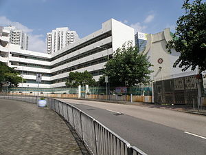
Sheng Kung Hui Lam Woo Memorial Secondary School
Secondary school in Hong Kong
Distance: Approx. 211 meters
Latitude and longitude: 22.36494444,114.130425
Sheng Kung Hui Lam Woo Memorial Secondary School (LWMSS, Traditional Chinese: 聖公會林護紀念中學) is an Anglican secondary school located at Kwai Shing Circuit, Kwai Chung, the New Territories, Hong Kong. The school was founded in 1970 by Hong Kong Sheng Kung Hui (Anglican Church in Hong Kong) and was named after Mr. Lam Woo for his donations to promote education.
Daughters of Mary Help of Christians Siu Ming Catholic Secondary School
Public school
Distance: Approx. 213 meters
Latitude and longitude: 22.36534722,114.12865278
Daughters of Mary Help of Christians Siu Ming Catholic Secondary School (天主教母佑會蕭明中學), founded in 1973, is a girls' secondary school in Kwai Chung, Hong Kong. It is administered under the Grant Code and using English as a medium of instruction, or being an "EMI school".

CCC Chuen Yuen College
Secondary school in Kwai Chung, New Territories
Distance: Approx. 272 meters
Latitude and longitude: 22.3685,114.1281
CCC Chuen Yuen College (Chinese: 中華基督教會全完中學) is a Chinese Christian secondary school in Hong Kong. Established in 1969 and located in the Kwai Chung district of the New Territories, the school consists of a 50,000-square-foot (4,600 m2), six-storey school building and a new wing which was opened in 2004. Facilities of the school include of 24 conventional class rooms, eleven special purpose rooms, an assembly hall that seats a thousand people, and a basketball court.
Tung Wah Group of Hospitals Chen Zao Men College
Secondary, co-educational school in Hong Kong
Distance: Approx. 280 meters
Latitude and longitude: 22.36439722,114.12918056
Tung Wah Group of Hospitals Chen Zao Men College (CZM, Traditional Chinese: 東華三院陳兆民中學) is a secondary school located at Kwai Chung, New Territories, Hong Kong. Initiated in 1969 by the board of directors of Tung Wah Group of Hospitals, Tung Wah Group of Hospitals Chen Zao Men College was named after Mr Chen Zao Men (陳兆民先生).
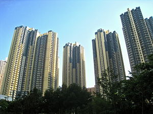
Kwai Chung Estate
Public housing estate in Kwai Chung, Hong Kong
Distance: Approx. 285 meters
Latitude and longitude: 22.3673779,114.1273056
Kwai Chung Estate (Chinese: 葵涌邨) is a public housing estate in Kwai Chung, New Territories, Hong Kong. It is the largest public housing estate in Kwai Tsing District and consists of sixteen residential buildings completed between 1997 and 2008.

Kwai Hing
Distance: Approx. 430 meters
Latitude and longitude: 22.36314,114.13134
Kwai Hing is an area of Kwai Chung Town, Hong Kong. The mainly residential area extends to North Kwai Chung in the north and east, Kwai Fong in the south, and Kwai Chung Estate to the west. It is part of the reclamation of Gin Drinkers Bay in 1960s.

Kwai Hing Estate
Public housing estate in Kwai Chung, Hong Kong
Distance: Approx. 246 meters
Latitude and longitude: 22.365822,114.132148
Kwai Hing Estate (Chinese: 葵興邨) is a public housing estate in Kwai Hing, Kwai Chung, New Territories, Hong Kong. It was built in the valley of Gin Drinkers Bay, later the town centre of Kwai Chung. Kwai Hing station is named after the name of the estate.

Kwai Shing East Estate
Public housing estate in Kwai Chung, Hong Kong
Distance: Approx. 418 meters
Latitude and longitude: 22.364545,114.126757
Kwai Shing East Estate (Chinese: 葵盛東邨) is a public housing estate in Kwai Shing, Kwai Chung, New Territories, Hong Kong located at the east of Kwai Shing West Estate and near MTR Kwai Hing station. It consists of ten residential blocks completed between 1990 and 2003.
Buddhist Sin Tak College
Secondary school in Kwai Chung, Hong Kong
Distance: Approx. 468 meters
Latitude and longitude: 22.3626,114.1299
Buddhist Sin Tak College (Chinese: 佛教善德英文中學) is a secondary school in Kwai Chung, New Territories, Hong Kong. It uses the English and Chinese languages as the media of instruction.
Weather in this IP's area
clear sky
29 Celsius
34 Celsius
28 Celsius
30 Celsius
1015 hPa
77 %
1015 hPa
1010 hPa
10000 meters
0.89 m/s
4.47 m/s
60 degree
10 %
06:21:18
17:55:15