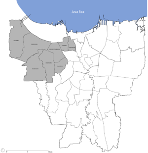
Country:
Region:
City:
Latitude and Longitude:
Time Zone:
Postal Code:
IP information under different IP Channel
ip-api
Country
Region
City
ASN
Time Zone
ISP
Blacklist
Proxy
Latitude
Longitude
Postal
Route
Luminati
Country
ASN
Time Zone
Asia/Jakarta
ISP
Global Inti Corporatama PT.
Latitude
Longitude
Postal
IPinfo
Country
Region
City
ASN
Time Zone
ISP
Blacklist
Proxy
Latitude
Longitude
Postal
Route
db-ip
Country
Region
City
ASN
Time Zone
ISP
Blacklist
Proxy
Latitude
Longitude
Postal
Route
ipdata
Country
Region
City
ASN
Time Zone
ISP
Blacklist
Proxy
Latitude
Longitude
Postal
Route
Popular places and events near this IP address

Taman Sari, Jakarta
District in West Jakarta, Indonesia
Distance: Approx. 1495 meters
Latitude and longitude: -6.1485,106.8208
Taman Sari is a district (kecamatan) of West Jakarta Administrative City, Indonesia. It is the smallest district of West Jakarta (4.37 km2). It is bounded by Central Jakarta to the south and to the east, and by Pademangan in North Jakarta to the north.
Jakarta Fair
Annual trade fair in Indonesia
Distance: Approx. 1301 meters
Latitude and longitude: -6.14638716,106.84573046
Jakarta Fair (Indonesian: Pekan Raya Jakarta or PRJ, lit. 'Jakarta Grand Week') is a fair held annually in Jakarta International Expo Kemayoran, Jakarta, Indonesia, in June and July. It features exhibitions, trade promotions, shopping, music performances, various shows, amusement rides and a food festival. Jakarta Fair is part of a series of events to held to celebrate the capital's anniversary, which falls on June 22.
Karang Anyar
Administrative village in DKI Jakarta, Indonesia
Distance: Approx. 1059 meters
Latitude and longitude: -6.1539,106.8292
Karang Anyar is an administrative village in the Sawah Besar district of Jakarta in Indonesia. It has postal code of 10740.

Kampung Bandan railway station
Railway station in Indonesia
Distance: Approx. 1557 meters
Latitude and longitude: -6.1328,106.8285
Kampung Bandan Station (KPB) is a railway station located in North Jakarta. This station is located close to WTC Mangga Dua. This station has elevated and ground-level tracks.

Jayakarta railway station
Railway station in Indonesia
Distance: Approx. 1298 meters
Latitude and longitude: -6.141285,106.823133
Jayakarta Station (JAY) is a railway station serving by KRL Commuterline system. It is located at Jl. Pangeran Jayakarta.

Mangga Besar railway station
Railway station in Indonesia
Distance: Approx. 892 meters
Latitude and longitude: -6.1496813,106.8270263
Mangga Besar Station (MGB) is a railway station serving by KRL Commuterline system. It's located at Jl. Mangga Besar Raya.

Mangga Dua, Jakarta
Place in Indonesia
Distance: Approx. 999 meters
Latitude and longitude: -6.13688,106.8322
Mangga Dua is a shopping district at Pademangan subdistrict of North Jakarta, in Indonesia. The area is bordered by Jalan Gajah Mada in the west and Jalan Gunung Sahari in the east, while in the middle is Jalan Pangeran Jayakarta and Jalan Mangga Dua Raya. Mangga Dua is part of Jakarta's long history starting from Sunda Kelapa port and Glodok, which is biggest China town in Indonesia.
Mangga Besar, Jakarta
Administrative village in Jakarta, Indonesia
Distance: Approx. 1708 meters
Latitude and longitude: -6.145353,106.818575
Mangga Besar is an administrative village of Taman Sari, West Jakarta, Indonesia.This village is adjacent to Pinangsia Road (Glodok) in the north, Ciliwung River to the west, Tangki to the east and Mangga Besar Road in the south. The neighborhood is a popular nightlife destination in Jakarta.
Jakarta International Expo
International expo based in Jakarta, Indonesia
Distance: Approx. 1298 meters
Latitude and longitude: -6.146701,106.845681
Jakarta International Expo, or JIExpo, is a convention, exhibition and entertainment complex located at Pademangan in North Jakarta, Indonesia. Opened in 2010, it was developed by the Central Cipta Murdaya group. Built in the area of the former Kemayoran Airport.
Menara Jakarta at Kemayoran
Hotel, Commercial offices, Residential in Jakarta, Indonesia
Distance: Approx. 1384 meters
Latitude and longitude: -6.148136,106.846252
Menara Jakarta is an under construction mixed development complex at Kemayoran, Jakarta, Indonesia. Located in front of JIEXPO, it consists of six towers, 1 Conho (Condo & Hotel), 1 Condo Tower, 1 Office Tower, and 3 Suite Tower. The complex will also have a mall.

Rajawali railway station
Railway station in Indonesia
Distance: Approx. 306 meters
Latitude and longitude: -6.14505,106.836698
Rajawali Station (RJW) is a class III railway station located on North Gunung Sahari, Sawah Besar, Central Jakarta. The station, which is located at an altitude of +4 m (13 ft), is included in the Operation Area I Jakarta. This station has four tracks and only serves the KRL Commuterline.

Lautze Mosque
Mosque in Sawah Besar, Jakarta, Indonesia
Distance: Approx. 1545 meters
Latitude and longitude: -6.15894444,106.82991667
The Lautze Mosque (Indonesian: Masjid Lautze) is a mosque in Sawah Besar, Jakarta, Indonesia.
Weather in this IP's area
haze
28 Celsius
34 Celsius
27 Celsius
30 Celsius
1010 hPa
85 %
1010 hPa
1009 hPa
1800 meters
1.54 m/s
250 degree
20 %
05:25:39
17:49:29
