202.72.107.42 - IP Lookup: Free IP Address Lookup, Postal Code Lookup, IP Location Lookup, IP ASN, Public IP
Country:
Region:
City:
Location:
Time Zone:
Postal Code:
IP information under different IP Channel
ip-api
Country
Region
City
ASN
Time Zone
ISP
Blacklist
Proxy
Latitude
Longitude
Postal
Route
Luminati
Country
Region
nsw
City
mollymook
ASN
Time Zone
Australia/Sydney
ISP
INTELSAT-1
Latitude
Longitude
Postal
IPinfo
Country
Region
City
ASN
Time Zone
ISP
Blacklist
Proxy
Latitude
Longitude
Postal
Route
IP2Location
202.72.107.42Country
Region
western australia
City
shenton park
Time Zone
Australia/Perth
ISP
Language
User-Agent
Latitude
Longitude
Postal
db-ip
Country
Region
City
ASN
Time Zone
ISP
Blacklist
Proxy
Latitude
Longitude
Postal
Route
ipdata
Country
Region
City
ASN
Time Zone
ISP
Blacklist
Proxy
Latitude
Longitude
Postal
Route
Popular places and events near this IP address

Shenton College
School in Shenton Park, Western Australia
Distance: Approx. 607 meters
Latitude and longitude: -31.95861111,115.80361111
Shenton College is a public co-educational senior high school, located in Shenton Park, an inner western suburb of Perth, Western Australia. Like many WA high schools, it is a partially selective school with out-of-area students accepted on a number of criteria. It is one of the largest schools in Western Australia, with 2,839 enrolled students as of 10 May 2024.

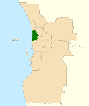
Division of Curtin
Australian federal electoral division
Distance: Approx. 184 meters
Latitude and longitude: -31.957,115.796
The Division of Curtin is an Australian electoral division in Western Australia.

Karrakatta railway station
Railway station in Perth, Western Australia
Distance: Approx. 1146 meters
Latitude and longitude: -31.968547,115.796006
Karrakatta railway station is a railway station on the Transperth network in Western Australia. It is located on the Airport line and Fremantle line, 7.4 kilometres (4.6 mi) from Perth station serving the suburb of Karrakatta.

Shenton Park railway station
Railway station in Perth, Western Australia
Distance: Approx. 793 meters
Latitude and longitude: -31.959608,115.805458
Shenton Park railway station (officially Shenton Park Station) is a commuter railway station in Shenton Park, a suburb of Perth, Western Australia. The station is on the Fremantle and Airport lines, which are part of the Transperth public transport network. It has an island platform, accessed by a pedestrian underpass.

Karrakatta, Western Australia
Suburb of Perth, Western Australia
Distance: Approx. 1138 meters
Latitude and longitude: -31.968,115.801
Karrakatta is a suburb of Perth, Western Australia, located within the City of Nedlands and 7 km west of the central business district. Its postcode is 6010. Karrakatta is composed of two distinct areas, due to the Fremantle railway line passing through the suburb.
Shenton Park, Western Australia
Suburb of Perth, Western Australia
Distance: Approx. 835 meters
Latitude and longitude: -31.959,115.806
Shenton Park is a suburb of Perth, Western Australia, located within the City of Nedlands and City of Subiaco and 4 km (2.5 mi) west of the central business district. Its postcode is 6008. The suburb is named after the park that it contains, Shenton Park, which was named after George Shenton who originally owned the land that is now the suburb of Shenton Park.
Mount Claremont, Western Australia
Suburb of Perth, Western Australia
Distance: Approx. 1313 meters
Latitude and longitude: -31.962,115.784
Mount Claremont, known previously as Graylands, is a suburb of Perth, Western Australia, located within the Town of Cambridge and the City of Nedlands. Graylands underwent significant changes in the 1950s, with the post war downgrading of military and migrant facilities in the area.

Karrakatta Cemetery
Cemetery in Perth, Western Australia
Distance: Approx. 1316 meters
Latitude and longitude: -31.97,115.7992
Karrakatta Cemetery is a metropolitan cemetery in the suburb of Karrakatta in Perth, Western Australia. Karrakatta Cemetery first opened for burials in 1899, the first being that of wheelwright Robert Creighton. Managed by the Metropolitan Cemeteries Board, the cemetery attracts more than one million visitors each year.

John XXIII College, Perth
School in Mount Claremont, Western Australia, Australia
Distance: Approx. 1222 meters
Latitude and longitude: -31.9604,115.7845
John XXIII College is a Roman Catholic co-educational primary and secondary day school located in Mount Claremont, a western suburb of Perth, Western Australia. The school provides education from kindergarten to Year 12 students and operates under the authority of the Catholic Archbishop of Perth. The college is the result of the merger in 1977 of the Jesuit Saint Louis boys school spread over different campuses (first opened in 1938) and Loreto Convent girls school (first opened in 1897).

Graylands Hospital
Hospital in Western Australia, Australia
Distance: Approx. 710 meters
Latitude and longitude: -31.962062,115.791129
Graylands Hospital is Western Australia's largest mental health inpatient facility, and the only public stand-alone psychiatric teaching hospital. It is located on a 10-hectare (25-acre) site in Mount Claremont, in a suburb formerly known as Graylands, after which the hospital was named. The suburb was named after Maria Gray, who inherited the land from her brother-in-law James Harding before 1896.

Irwin Barracks
Australian Army military base in Western Australia
Distance: Approx. 765 meters
Latitude and longitude: -31.965167,115.797018
Irwin Barracks is an Australian Army military base located in Karrakatta, a suburb of Perth, Western Australia. It occupies a 62-hectare (150-acre) site on the western side of the Fremantle railway line. It was previously known as Karrakatta Camp and Irwin Training Centre.
UWA Sports Park
Distance: Approx. 1317 meters
Latitude and longitude: -31.951686,115.785644
UWA Sports Park is a multi-purpose sporting and recreation reserve in Mount Claremont, Western Australia. It is located on 56 hectares of land approximately 10 km west of Perth and is owned by the University of Western Australia. The park provides sporting facilities for Australian rules football, Rugby union, soccer, and field hockey as well as baseball, softball and tennis.
Weather in this IP's area
clear sky
19 Celsius
19 Celsius
18 Celsius
20 Celsius
1020 hPa
77 %
1020 hPa
1018 hPa
10000 meters
5.66 m/s
200 degree
