202.7.237.98 - IP Lookup: Free IP Address Lookup, Postal Code Lookup, IP Location Lookup, IP ASN, Public IP
Country:
Region:
City:
Location:
Time Zone:
Postal Code:
IP information under different IP Channel
ip-api
Country
Region
City
ASN
Time Zone
ISP
Blacklist
Proxy
Latitude
Longitude
Postal
Route
Luminati
Country
Region
nsw
City
sydney
ASN
Time Zone
Australia/Sydney
ISP
Southern Phone Company Ltd
Latitude
Longitude
Postal
IPinfo
Country
Region
City
ASN
Time Zone
ISP
Blacklist
Proxy
Latitude
Longitude
Postal
Route
IP2Location
202.7.237.98Country
Region
new south wales
City
callaghan
Time Zone
Australia/Sydney
ISP
Language
User-Agent
Latitude
Longitude
Postal
db-ip
Country
Region
City
ASN
Time Zone
ISP
Blacklist
Proxy
Latitude
Longitude
Postal
Route
ipdata
Country
Region
City
ASN
Time Zone
ISP
Blacklist
Proxy
Latitude
Longitude
Postal
Route
Popular places and events near this IP address
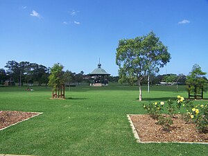
University of Newcastle (Australia)
University in Newcastle, Australia
Distance: Approx. 121 meters
Latitude and longitude: -32.89277778,151.70444444
The University of Newcastle is a public university in Newcastle, New South Wales, Australia. Established in 1965, it has a primary campus in the Newcastle suburb of Callaghan. The university also operates campuses in Central Coast, Singapore, Newcastle City in the Hunter as well as Sydney.
2HD
Radio station in Newcastle, Australia
Distance: Approx. 1779 meters
Latitude and longitude: -32.88786,151.723616
2HD is an Australian radio station in New South Wales. Owned and operated as part of the Super Radio Network of stations, it currently broadcasts a news talk and classic hits format to Newcastle, New South Wales and the Hunter Valley.
The Gardens Greyhound and Sporting Complex
Distance: Approx. 2128 meters
Latitude and longitude: -32.89333333,151.6825
Ladbrokes Gardens is an Australian stadium located in Newcastle, New South Wales. The complex is known as Newcastle Greyhounds when it was used as a greyhound racing venue. It was the former home of the Newcastle Breakers, who played in the National Soccer League (NSL) from 1991 until 2000.

Lambton, New South Wales
Suburb of Newcastle, New South Wales, Australia
Distance: Approx. 784 meters
Latitude and longitude: -32.898,151.701
Lambton is a suburb of Newcastle, New South Wales, Australia, 8 kilometres (5.0 mi) from Newcastle's central business district.

Warabrook railway station
Railway station in New South Wales, Australia
Distance: Approx. 690 meters
Latitude and longitude: -32.887164,151.709969
Warabrook railway station is located on the Main Northern line in New South Wales, Australia. It serves the western Newcastle suburb of Warabrook and the University of Newcastle, opening on 23 October 1995.
Warabrook, New South Wales
Suburb of Newcastle, New South Wales, Australia
Distance: Approx. 1637 meters
Latitude and longitude: -32.88166667,151.71777778
Warabrook is a north-western suburb of Newcastle, New South Wales, Australia, located 8 kilometres (5 mi) from Newcastle's central business district. It is part of the City of Newcastle local government area. The suburb is primarily residential but also includes a shopping centre, an aged care facility and a light industrial area.
Callaghan, New South Wales
Suburb of Newcastle, New South Wales, Australia
Distance: Approx. 446 meters
Latitude and longitude: -32.89,151.701
Callaghan ( KAL-ə-gən) is a suburb of Newcastle, New South Wales, Australia 10 kilometres (6 mi) from Newcastle's central business district. It contains the main campus of the University of Newcastle, which is the entirety of the suburb. It is served by Warabrook railway station on NSW TrainLink's Hunter Line.

Jesmond, New South Wales
Suburb of Newcastle, New South Wales, Australia
Distance: Approx. 1662 meters
Latitude and longitude: -32.90361111,151.69416667
Jesmond ( JEZ-mənd) is a suburb of the City of Newcastle LGA, located about 9.5 km (6 mi) west of the Newcastle CBD in the Hunter Region of New South Wales, Australia. It is both a commercial centre and dormitory suburb of Newcastle. Residents include Australian and international students attending the University of Newcastle in adjacent Callaghan.
Mayfield West, New South Wales
Suburb of Newcastle, New South Wales, Australia
Distance: Approx. 1956 meters
Latitude and longitude: -32.89,151.726
Mayfield West is a suburb of Newcastle, New South Wales, Australia, located 8 kilometres (5 mi) from Newcastle's central business district. It is part of the City of Newcastle local government area.
North Lambton, New South Wales
Suburb of Newcastle, New South Wales, Australia
Distance: Approx. 1352 meters
Latitude and longitude: -32.904,151.704
North Lambton is a suburb of Newcastle, New South Wales, Australia, located 9 kilometres (6 mi) from Newcastle's central business district. It is part of the City of Newcastle local government area. North Lambton is a mostly housed area close to the Lambton City Centre.
Waratah West, New South Wales
Suburb of Newcastle, New South Wales, Australia
Distance: Approx. 1375 meters
Latitude and longitude: -32.90111111,151.715
Waratah West is a suburb of Newcastle, New South Wales, Australia, located 8 kilometres (5 mi) from Newcastle's central business district. It is part of the City of Newcastle local government area.
Wallsend FC
Football club
Distance: Approx. 2030 meters
Latitude and longitude: -32.89388889,151.68361111
Wallsend Football Club is a football club in Australia. They play in the Northern NSW Northern League 1 (NL1) which is the second tier of competition in Northern NSW Football. They are the oldest football club in Newcastle.
Weather in this IP's area
light rain
21 Celsius
22 Celsius
20 Celsius
22 Celsius
1018 hPa
93 %
1018 hPa
1017 hPa
10000 meters
6.69 m/s
200 degree
100 %