Country:
Region:
City:
Latitude and Longitude:
Time Zone:
Postal Code:
IP information under different IP Channel
ip-api
Country
Region
City
ASN
Time Zone
ISP
Blacklist
Proxy
Latitude
Longitude
Postal
Route
Luminati
Country
Region
d
City
khulna
ASN
Time Zone
Asia/Dhaka
ISP
Broad Band Telecom Services Ltd
Latitude
Longitude
Postal
IPinfo
Country
Region
City
ASN
Time Zone
ISP
Blacklist
Proxy
Latitude
Longitude
Postal
Route
db-ip
Country
Region
City
ASN
Time Zone
ISP
Blacklist
Proxy
Latitude
Longitude
Postal
Route
ipdata
Country
Region
City
ASN
Time Zone
ISP
Blacklist
Proxy
Latitude
Longitude
Postal
Route
Popular places and events near this IP address

Agrabad
Central business district in Chittagong, Bangladesh
Distance: Approx. 268 meters
Latitude and longitude: 22.3237417,91.8091193
Agrabad (Bengali: আগ্রাবাদ) is a central business district in Chittagong, Bangladesh. Located close to the city's harbour, it hosts numerous Bangladeshi and international businesses, banks, financial institutions, and other commercial entities, including the Chittagong Chamber of Commerce & Industry, the World Trade Center, and the Chittagong Stock Exchange. The area forms part of the Double Mooring precinct and is directly connected to the Port of Chittagong.
Chattogram Maa-O-Shishu Hospital Medical College
Private medical college and hospital in Chattogram District, Bangladesh
Distance: Approx. 562 meters
Latitude and longitude: 22.3227,91.8063
Chattogram Maa-O-Shishu Hospital Medical College (CMOSHMC) is a private medical school in Bangladesh, established in 2005. It is located in Agrabad, Chattogram. It is affiliated with Chittagong Medical University.

2010 Dhaka fire
Fire in the Nimtali area of Dhaka, Bangladesh, on 3 June 2010
Distance: Approx. 882 meters
Latitude and longitude: 22.331306,91.81233
The 2010 Dhaka fire was a fire in the city of Dhaka, Bangladesh, on 3 June 2010, that killed at least 124 people (117 on spot, others later in hospital). The fire occurred in the Nimtali area of Old Dhaka.

Khawja Ajmeri High School
Private high school in Agrabad, Chittagong, Bangladesh
Distance: Approx. 741 meters
Latitude and longitude: 22.3288,91.8159
Khawja Ajmeri KG and High School (Bengali: খাজা আজমেরী কে.জি & উচ্চ বিদ্যালয়) is a private school, established in 1974 by the Khawja Ajmeri Education Society, in Agrabad, a neighbourhood of Chittagong, Bangladesh. There are two four-storeyed academic buildings, each with 24 classrooms. The school has about 2,800 students from class one to ten.

World Trade Center Chittagong
Commercial in Chittagong, Bangladesh
Distance: Approx. 417 meters
Latitude and longitude: 22.3257,91.8149
The World Trade Center Chittagong (also called World Trade Center or WTC Chittagong), is an unfinished 90.70 meters (297.6 feet), 21-floor complex located in Agrabad Commercial Area, Chittagong, Bangladesh. The building was opened in 2016, but the building has been partially constructed with the most of its floors remaining incomplete. The top floors of the building were never completed, with only the concrete frame visible.

Government College of Commerce, Chittagong
College in Bangladesh
Distance: Approx. 730 meters
Latitude and longitude: 22.3273,91.8174
Government College of Commerce, Chattogram is a government college in Agrabad, Chattogram, Bangladesh. It was established in 1947.

Ethnological Museum, Chittagong
Unique Museum in Bangladesh conserving the track of human history, culture and society
Distance: Approx. 615 meters
Latitude and longitude: 22.328,91.815
The Ethnological Museum of Chittagong (Bengali: জাতিতাত্ত্বিক জাদুঘর) is the only ethnological museum in Bangladesh. Located in Agrabad, Chittagong, it contains displays featuring the history of Bangladesh's tribal people.

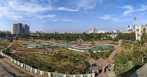
Jamboree Park
Distance: Approx. 306 meters
Latitude and longitude: 22.32417,91.80885
Jamboree Park (also spelled as Jamburi Park) is an urban park in the Agrabad area of Chittagong, Bangladesh. The park has 50,000 square feet (4,600 m2) water-body alongside 8,000 feet (2,400 m) walkway and compound road, internal master drain.

Aziz Court Imperial
Office in Chittagong, Bangladesh
Distance: Approx. 649 meters
Latitude and longitude: 22.3283989,91.8149382
Aziz Court Imperial is a high-rise building in Chittagong, Bangladesh. It is Located in Agrabad, the central business district. It rises to a height of 112 metres (367 ft) and has 29 floors.

Courtyard Marriott Hotel
Five-star hotel in Chattogram, Bangladesh
Distance: Approx. 204 meters
Latitude and longitude: 22.3215757,91.8115452
Courtyard Marriott is an international chain of hotels operated by Courtyard by Marriott owned by Marriott International. It is currently under construction and located in Agrabad, the central business area in Chattogram, Bangladesh. It is the second five-star hotel in the port city.

South Agrabad Ward
Chattogram City Corporation in Chittagong Division, Bangladesh
Distance: Approx. 347 meters
Latitude and longitude: 22.32333333,91.80833333
South Agrabad (Bengali: দক্ষিণ আগ্রাবাদ) is a No.27 Ward of Chattogram City Corporation and a part of Double Mooring Thana, Bangladesh.

Pathantooly Ward
Ward in Chittagong Division, Bangladesh
Distance: Approx. 706 meters
Latitude and longitude: 22.325,91.81833333
Pathantooly (Bengali: পাঠানটুলী) is a No.28 Ward of Chattogram City Corporation and a part of Double Mooring Thana, Bangladesh.
Weather in this IP's area
haze
29 Celsius
32 Celsius
29 Celsius
29 Celsius
1013 hPa
65 %
1013 hPa
1012 hPa
6000 meters
3.6 m/s
50 degree
75 %
05:59:09
17:13:31