202.49.158.204 - IP Lookup: Free IP Address Lookup, Postal Code Lookup, IP Location Lookup, IP ASN, Public IP
Country:
Region:
City:
Location:
Time Zone:
Postal Code:
IP information under different IP Channel
ip-api
Country
Region
City
ASN
Time Zone
ISP
Blacklist
Proxy
Latitude
Longitude
Postal
Route
Luminati
Country
ASN
Time Zone
Pacific/Auckland
ISP
Voyager Internet Ltd.
Latitude
Longitude
Postal
IPinfo
Country
Region
City
ASN
Time Zone
ISP
Blacklist
Proxy
Latitude
Longitude
Postal
Route
IP2Location
202.49.158.204Country
Region
tasman
City
motueka
Time Zone
Pacific/Auckland
ISP
Language
User-Agent
Latitude
Longitude
Postal
db-ip
Country
Region
City
ASN
Time Zone
ISP
Blacklist
Proxy
Latitude
Longitude
Postal
Route
ipdata
Country
Region
City
ASN
Time Zone
ISP
Blacklist
Proxy
Latitude
Longitude
Postal
Route
Popular places and events near this IP address

Motueka
Town in Tasman District, New Zealand
Distance: Approx. 1122 meters
Latitude and longitude: -41.12333333,173.01472222
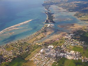
Motueka is a town in the South Island of New Zealand, close to the mouth of the Motueka River on the western shore of Tasman Bay. It is the second largest in the Tasman Region, with a population of 8,300 as of June 2024. The surrounding district has a number of apple, pear, and kiwifruit orchards, as well as growing a variety of specialised crops such as hops.

Motueka River
River in New Zealand
Distance: Approx. 5562 meters
Latitude and longitude: -41.08333333,173.01666667
The Motueka River is located in the north of the South Island of New Zealand and is a popular tourist destination for watersports and fishing. The Motueka flows 116 kilometres (72 mi) from the mountains 40 km west of the city of Nelson in the southeast of the catchment and flows north to the Tasman Bay.
Riuwaka River
River in New Zealand
Distance: Approx. 7726 meters
Latitude and longitude: -41.0648,173.0019
The Riuwaka River, formerly known as the Riwaka River, is located in the Nelson region in the northwest of New Zealand's South Island. It flows for 20 kilometres, entering Tasman Bay close to the town of Riwaka, 10 kilometres north of Motueka. The valleys of the Riuwaka and nearby Tākaka River form part of the pass over which the only road between Tasman Bay and Golden Bay runs.
Riwaka
Town in Tasman, New Zealand
Distance: Approx. 5736 meters
Latitude and longitude: -41.08333333,173
Riwaka (Māori: Riuwaka) is a small settlement in the Tasman District of New Zealand's South Island. It lies beside Tasman Bay / Te Tai-o-Aorere, five kilometres north of Motueka, and close to the mouth of the Riuwaka River. The land where the town is based was a swamp known as Tureauraki.

Motueka High School
School
Distance: Approx. 2292 meters
Latitude and longitude: -41.1148,173.0047
Motueka High School is a coeducational secondary school in Motueka, New Zealand, established in 1955.
Moutere River
River in New Zealand
Distance: Approx. 1596 meters
Latitude and longitude: -41.14454,173.00489
The Moutere River is a river of the Tasman Region of New Zealand's South Island. It flows north from its origins southwest of Māpua, reaching Tasman Bay / Te Tai-o-Aorere at the Moutere Inlet, a tidal lagoon three kilometres south of Motueka.

Memorial Park, Motueka
Sports venue in Motueka, New Zealand
Distance: Approx. 2768 meters
Latitude and longitude: -41.10935,173.00780556
Memorial Park is a cricket ground in Motueka, Tasman, New Zealand. Memorial Park is jointly owned by Tasman District Council and Wakatū Incorporation, a company representing 4,000 shareholders who are descendants of the original Te Tau Ihu Māori of the area. The first recorded match held on the ground came in January 1950 when Nelson played Marlborough in the 1950/51 Hawke Cup.
Riverside Community, New Zealand
Distance: Approx. 3883 meters
Latitude and longitude: -41.16444444,172.99583333
Riverside Community is a village at Lower Moutere, near Motueka, New Zealand, founded by Christian pacifists in 1941.
Motueka Ward
Ward in New Zealand
Distance: Approx. 8998 meters
Latitude and longitude: -41.07,172.95
Motueka Ward is a ward of Tasman District in the north of the South Island of New Zealand.

Tasman (settlement)
Settlement in Tasman District, New Zealand
Distance: Approx. 7072 meters
Latitude and longitude: -41.191,173.052
Tasman is a settlement in the Tasman District of New Zealand's upper South Island. It is located between Māpua and Motueka, 45 kilometres (28 mi) from Abel Tasman National Park and 40 kilometres (25 mi) from Nelson. The Tasman area covers a small peninsula on the southern and eastern side of the Moutere Inlet.

Lower Moutere
Rural locality in Tasman, New Zealand
Distance: Approx. 2884 meters
Latitude and longitude: -41.1525,172.99361111
Lower Moutere is a settlement in the Tasman District of New Zealand's upper South Island. It is a farming community it the Lower Moutere valley, 6 km (3.7 mi) from Motueka close to the Moutere Inlet. The road up the valley from Motueka to Upper Moutere is an alternative to the main State Highway 60 route between Nelson and Motueka.
Brooklyn, Tasman District
Distance: Approx. 5541 meters
Latitude and longitude: -41.095993,172.972964
Brooklyn is a settlement and rural valley in the Tasman District of New Zealand's upper South Island. It is located on the outskirts of Motueka, and is dominated by orchards. The Brooklyn Recreation Reserve, a flat, 4.6 ha grassed reserve, was donated to Tasman District Council in 1984.
Weather in this IP's area
overcast clouds
19 Celsius
19 Celsius
19 Celsius
19 Celsius
995 hPa
71 %
995 hPa
995 hPa
10000 meters
1.19 m/s
2.37 m/s
149 degree
100 %

