Country:
Region:
City:
Latitude and Longitude:
Time Zone:
Postal Code:
IP information under different IP Channel
ip-api
Country
Region
City
ASN
Time Zone
ISP
Blacklist
Proxy
Latitude
Longitude
Postal
Route
Luminati
Country
Region
10
City
bangkok
ASN
Time Zone
Asia/Bangkok
ISP
PTT Digital Solutions Company Limited
Latitude
Longitude
Postal
IPinfo
Country
Region
City
ASN
Time Zone
ISP
Blacklist
Proxy
Latitude
Longitude
Postal
Route
db-ip
Country
Region
City
ASN
Time Zone
ISP
Blacklist
Proxy
Latitude
Longitude
Postal
Route
ipdata
Country
Region
City
ASN
Time Zone
ISP
Blacklist
Proxy
Latitude
Longitude
Postal
Route
Popular places and events near this IP address

Bang Kho Laem district
Khet in Bangkok, Thailand
Distance: Approx. 904 meters
Latitude and longitude: 13.69333333,100.5025
Bang Kho Laem (Thai: บางคอแหลม, pronounced [bāːŋ kʰɔ̄ː lɛ̌ːm]) is one of the 50 districts (khet) of Bangkok, Thailand. The incumbent district officer is Samita Xanthavanij. The district is bounded by (clockwise from north) Sathon, Yannawa, and across the Chao Phraya River, Rat Burana, Thon Buri and Khlong San districts.

Rat Burana district
Khet in Bangkok, Thailand
Distance: Approx. 675 meters
Latitude and longitude: 13.68222222,100.50555556
Rat Burana (Thai: ราษฎร์บูรณะ, pronounced [râːt būːrānáʔ]) is one of the 50 districts (khet) of Bangkok, Thailand. The district is bounded by (clockwise from east to north) Phra Pradaeng of Samut Prakan province, Thung Khru, Chom Thong and Thon Buri districts of Bangkok while its north to east is Chao Phraya River with (clockwise) Bang Kho Laem and Yan Nawa districts across the river.

Chom Thong district, Bangkok
Khet in Bangkok, Thailand
Distance: Approx. 1920 meters
Latitude and longitude: 13.67722222,100.48472222
Chom Thong (Thai: จอมทอง, pronounced [t͡ɕɔ̄ːm tʰɔ̄ːŋ]) is one of the 50 districts (khet) of Bangkok, Thailand. The district is bounded by the districts (clockwise from north) Phasi Charoen, Thon Buri, Rat Burana, Thung Khru, Bang Khun Thian, and Bang Bon.

Rama IX Bridge
Bridge in Bangkok, Thailand
Distance: Approx. 2059 meters
Latitude and longitude: 13.682058,100.519001
Rama IX Bridge (Thai: สะพานพระราม ๙, RTGS: Saphan Phra Ram Kao, pronounced [sā.pʰāːn pʰráʔ rāːm kâːw]) is a bridge in Bangkok, Thailand over the Chao Phraya River. It connects the Yan Nawa District to Rat Burana District as a part of the Tha Ruea – Dao Khanong Section of Chaloem Maha Nakhon Expressway. The bridge was named in the honor of King Bhumibol Adulyadej's 60th birthday.

Krungthep Bridge
Bascule bridge in Bangkok, Thailand
Distance: Approx. 1973 meters
Latitude and longitude: 13.70111111,100.49166667
The Krungthep Bridge (Thai: สะพานกรุงเทพ, RTGS: Saphan Krung Thep, pronounced [sā.pʰāːn krūŋ tʰêːp]) is a bascule bridge (drawbridge) spanning the Chao Phraya river in Bangkok, Thailand. It was the third bridge to be built across the Chao Phraya river. It was constructed by Fuji Car Manufacturing Co., Ltd, with a budget of 31,912,500 baht.

Rama III Bridge
Bridge in Bangkok, Thailand
Distance: Approx. 1967 meters
Latitude and longitude: 13.701519,100.492619
The Rama III Bridge (Thai: สะพานพระราม 3, RTGS: Saphan Phra Ram Sam, pronounced [sā.pʰāːn pʰráʔ rāːm sǎːm]), also known as the New Krungthep Bridge, is a bridge crossing the Chao Phraya River in Bangkok, Thailand. The bridge was completed in 1999 and was designed to alleviate traffic congestion on the adjacent Krungthep Bridge. The bridge was named in honour of King Nangklao.
Bangpakok Wittayakom School
Public school in Bangkok, Thailand
Distance: Approx. 629 meters
Latitude and longitude: 13.683042,100.495063
"Bangpakok Wittayakom School" (Thai: โรงเรียนบางปะกอกวิทยาคม) is a public school located in Bangkok, Thailand. The school admits secondary students, grades 7 to 12, aged 11–18. The previous name of the school was Mattayom Wat Bangpakok School.

Thanon Tok
Distance: Approx. 1346 meters
Latitude and longitude: 13.69716389,100.49703333
Thanon Tok (Thai: ถนนตก, pronounced [tʰā.nǒn tòk]) is a road junction in the Bang Kho Laem Subdistrict, Bang Kho Laem District, Bangkok. It is a point of intersection where Charoen Krung, Rama III and Mahaisawan Roads meet. The boundaries of the junction are considered to be where Charoen Krung and Mahaisawan Roads terminates, and where Rama III Road originate.

Rama III Road
Street in Bangkok, Thailand
Distance: Approx. 1851 meters
Latitude and longitude: 13.687784,100.517251
Rama III Road (Thai: ถนนพระรามที่ 3, RTGS: Thanon Phra Ram Thi Sam; usually shortened to ถนนพระราม 3) is a main road in inner Bangkok. The 12 km (7.5 mi) long road runs along the bend of Chao Phraya River on the Phra Nakhon side (Bangkok core).
Charoenkrung Pracharak Hospital
Hospital in Bangkok, Thailand
Distance: Approx. 1163 meters
Latitude and longitude: 13.694388,100.494648
Charoenkrung Pracharak Hospital (Thai: โรงพยาบาลเจริญกรุงประชารักษ์) is a hospital in Thailand located in Bang Kho Laem District, Bangkok. It is a public hospital operated by the Medical Service Department, Bangkok Metropolitan Administration (BMA). It is a main teaching hospital of the School of Medicine, Mae Fah Luang University and an affiliated teaching hospital for the Faculty of Medicine Siriraj Hospital, Mahidol University and Phramongkutklao College of Medicine.

Bang Kho Laem subdistrict
Khwaeng in Thailand
Distance: Approx. 1278 meters
Latitude and longitude: 13.69333333,100.49166667
Bang Kho Laem (Thai: บางคอแหลม, pronounced [bāːŋ kʰɔ̄ː lɛ̌ːm]) is a khwaeng (subdistrict) of Bang Kho Laem District, in Bangkok, Thailand. In 2020, it had a total population of 22,697 people.
Wat Prasert Sutthawat
Distance: Approx. 736 meters
Latitude and longitude: 13.679722,100.503611
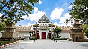
Wat Prasert Sutthawat, also written as Wat Prasoet Sutthawat (Thai: วัดประเสริฐสุทธาวาส), often abbreviated to Wat Prasert (วัดประเสริฐ) is an ancient Thai Buddhist temple in Bangkok.
Weather in this IP's area
overcast clouds
27 Celsius
27 Celsius
26 Celsius
27 Celsius
1011 hPa
91 %
1011 hPa
1011 hPa
10000 meters
3.49 m/s
5.5 m/s
351 degree
100 %
06:14:06
17:49:09
