202.44.233.240 - IP Lookup: Free IP Address Lookup, Postal Code Lookup, IP Location Lookup, IP ASN, Public IP
Country:
Region:
City:
Location:
Time Zone:
Postal Code:
ISP:
ASN:
language:
User-Agent:
Proxy IP:
Blacklist:
IP information under different IP Channel
ip-api
Country
Region
City
ASN
Time Zone
ISP
Blacklist
Proxy
Latitude
Longitude
Postal
Route
db-ip
Country
Region
City
ASN
Time Zone
ISP
Blacklist
Proxy
Latitude
Longitude
Postal
Route
IPinfo
Country
Region
City
ASN
Time Zone
ISP
Blacklist
Proxy
Latitude
Longitude
Postal
Route
IP2Location
202.44.233.240Country
Region
samut prakan
City
ban bang bo
Time Zone
Asia/Bangkok
ISP
Language
User-Agent
Latitude
Longitude
Postal
ipdata
Country
Region
City
ASN
Time Zone
ISP
Blacklist
Proxy
Latitude
Longitude
Postal
Route
Popular places and events near this IP address

Bang Bo district
District in Samut Prakan, Thailand
Distance: Approx. 2334 meters
Latitude and longitude: 13.57416667,100.83611111
Bang Bo (Thai: บางบ่อ, pronounced [bāːŋ bɔ̀ː]) is a district (amphoe) of Samut Prakan province in Thailand.

Bang Sao Thong district
District in Samut Prakan, Thailand
Distance: Approx. 1986 meters
Latitude and longitude: 13.595,100.83055556
Bang Sao Thong (Thai: บางเสาธง; pronounced [bāːŋ sǎw tʰōŋ]) is a district (amphoe) of Samut Prakan province in central Thailand.
Huachiew Chalermprakiet University
Distance: Approx. 7136 meters
Latitude and longitude: 13.612757,100.758124
Huachiew Chalermprakiet University (HCU) is a university in Samut Prakan Province, Thailand. It is organized into 13 faculties and a graduate school. Huachiew (Chinese: 華僑; pinyin: Huáqiáo) comes from Teochew dialect and means 'overseas Chinese'.

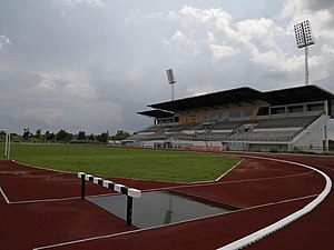
Samut Prakan Stadium
Distance: Approx. 2457 meters
Latitude and longitude: 13.579414,100.794345
Samut Prakan Stadium (Thai: สนามกีฬาสมุทรปราการ) is a multi-purpose stadium in Bang Sao Thong, Samut Prakan, Thailand. It is mostly used for football matches and currently the home stadium of Samut Prakan, competing in the Thai League 4. The stadium holds the capacity of 5,100 spectators, recorded in 2017.
Nawaminthrachinuthit Triam Udomsuksa Pattanakarn School
Public school in Thailand
Distance: Approx. 5789 meters
Latitude and longitude: 13.625315,100.848227
Nawaminthrachinuthit Triam Udomsuksa Pattanakarn School (Thai: โรงเรียนนวมินทราชินูทิศ เตรียมอุดมศึกษาพัฒนาการ), commonly abbreviated as Nawamin Triampat, is a high school located in Bang Bo, Samut Prakan, Thailand It admits lower-secondary and upper-secondary students (mathayom 1–6, equivalent to grades 7–12). Founded in 1978 as a campus school of Triam Udom Suksa Pattanakarn School, Bangkok, Thailand.The school has five permanent buildings. There are six levels M 1-6 (Grade 7–12).
Chakri Naruebodindra Medical Institute
Hospital in Samut Prakan, Thailand
Distance: Approx. 8750 meters
Latitude and longitude: 13.526464,100.760851
The Chakri Naruebodindra Medical Institute (CNMI) (Thai: สถาบันการแพทย์จักรีนฤบดินทร์) is a medical institute of the Faculty of Medicine Ramathibodi Hospital, Mahidol University in Thailand. In addition to providing medical services to the general public, it is also one of the two main facilities for training students of the faculty.
Bang Chalong
Tambon in Thailand
Distance: Approx. 7858 meters
Latitude and longitude: 13.61361111,100.75111111
Bang Chalong (Thai: บางโฉลง, pronounced [bāːŋ t͡ɕʰā.lǒːŋ]) is a tambon (subdistrict) of Bang Phli District, in Samut Prakan Province, Thailand. In 2017, it had a total population of 41,834 people.
Nong Prue, Samut Prakan
Tambon in Thailand
Distance: Approx. 9967 meters
Latitude and longitude: 13.66761111,100.78569444
Nong Prue (Thai: หนองปรือ, pronounced [nɔ̌ːŋ prɯ̄ː]) is a tambon (subdistrict) of Bang Phli District, in Samut Prakan Province, Thailand. In 2017 it had a total population of 2,719 people.

SAT Stadium Udon Thani
Distance: Approx. 2457 meters
Latitude and longitude: 13.579414,100.794345
SAT Stadium Udon Thani (Thai: สนามกีฬากลางจังหวัดอุดรธานี) is a multi-purpose stadium in Mueang Udon Thani, Udon Thani, Thailand. It was completed in 2018 and from 2019 it will be the home stadium of Udon Thani F.C., competing in the Thai League 2. The stadium holds a capacity of 10,000 spectators.
Bang Pla subdistrict, Samut Prakan
Tambon in Thailand
Distance: Approx. 8033 meters
Latitude and longitude: 13.58111111,100.7425
Bang Pla (Thai: บางปลา, pronounced [bāːŋ plāː]) is a tambon (subdistrict) of Bang Phli District, in Samut Prakan Province, Thailand. In 2018, it had a total population of 32,819 people.
Weather in this IP's area
clear sky
29 Celsius
29 Celsius
29 Celsius
31 Celsius
1008 hPa
42 %
1008 hPa
1008 hPa
10000 meters
5.14 m/s
360 degree