202.44.114.170 - IP Lookup: Free IP Address Lookup, Postal Code Lookup, IP Location Lookup, IP ASN, Public IP
Country:
Region:
City:
Location:
Time Zone:
Postal Code:
ISP:
ASN:
language:
User-Agent:
Proxy IP:
Blacklist:
IP information under different IP Channel
ip-api
Country
Region
City
ASN
Time Zone
ISP
Blacklist
Proxy
Latitude
Longitude
Postal
Route
db-ip
Country
Region
City
ASN
Time Zone
ISP
Blacklist
Proxy
Latitude
Longitude
Postal
Route
IPinfo
Country
Region
City
ASN
Time Zone
ISP
Blacklist
Proxy
Latitude
Longitude
Postal
Route
IP2Location
202.44.114.170Country
Region
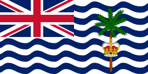
british indian ocean territory
City
diego garcia
Time Zone
Indian/Chagos
ISP
Language
User-Agent
Latitude
Longitude
Postal
ipdata
Country
Region
City
ASN
Time Zone
ISP
Blacklist
Proxy
Latitude
Longitude
Postal
Route
Popular places and events near this IP address

Diego Garcia
Island in the Indian Ocean
Distance: Approx. 4 meters
Latitude and longitude: -7.31333333,72.41111111
Diego Garcia is the largest island of the Chagos Archipelago, part of the British Indian Ocean Territory (BIOT). It has been used as a joint UK–U.S. military base since the 1970s, following the expulsion of the Chagossians by the UK government. The Chagos Islands have been a British overseas territory, but in early October 2024, the UK agreed to transfer sovereignty of the islands to Mauritius, while allowing the military base to remain under a 99-year lease, pending a treaty ratification.

Naval Support Facility Diego Garcia
Facility of the United States Navy located in the Indian Ocean
Distance: Approx. 4 meters
Latitude and longitude: -7.31333333,72.41111111
Naval Support Facility Diego Garcia, abbreviated NSF Diego Garcia, is a British Ministry of Defence facility leased to the United States Navy, located on the atoll Diego Garcia in the Indian Ocean, for an initial period of 99 years after the forced removal and expulsion of over 2,000 native inhabitants of the island. Camp Thunder Cove is part of the facility, and is operated by the United States Armed Forces and British Armed Forces. In 2016, the British renewed the lease until 2036, and stated that dispossessed islanders would not be permitted to return.

British Indian Ocean Territory
British Overseas Territory in the Indian Ocean
Distance: Approx. 1922 meters
Latitude and longitude: -7.3,72.4
The British Indian Ocean Territory (BIOT) is an Overseas Territory of the United Kingdom situated in the Indian Ocean, halfway between Tanzania and Indonesia. The territory comprises the seven atolls of the Chagos Archipelago with over 1,000 individual islands, many very small, amounting to a total land area of 60 square kilometres (23 square miles). The largest and most southerly island is Diego Garcia, 27 square kilometres (10 square miles), the site of a Joint Military Facility of the United Kingdom and the United States.

Camp Thunder Cove
United States military base on Diego Garcia
Distance: Approx. 3721 meters
Latitude and longitude: -7.291,72.386
Camp Thunder Cove, formerly Camp Justice is a United States Navy and Air Forces support facility within the US-UK Naval Support Facility on Diego Garcia, a small and isolated island in the Indian Ocean. The island is in the Chagos Archipelago, part of the British Indian Ocean Territory.

Barton Point Nature Reserve
Distance: Approx. 9044 meters
Latitude and longitude: -7.23638889,72.4375
Barton Point Nature Reserve is a 680 ha strict nature reserve on the atoll of Diego Garcia in the British Indian Ocean Territory. It lies at the northern end of the eastern side of the atoll. It holds a breeding colony of red-footed boobies, with over 16,000 pairs recorded in a 2004 survey, for which it was identified as an Important Bird Area by BirdLife International.

East Point, British Indian Ocean Territory
Ghost town in British Indian Ocean Territory, United Kingdom
Distance: Approx. 7674 meters
Latitude and longitude: -7.35338889,72.46763889
East Point is an abandoned settlement on the east of the atoll of Diego Garcia in the British Indian Ocean Territory. It was the largest civilian settlement in the archipelago, and served as the administrative capital until the depopulation of the territory. The settlement contained a church, cemetery, school, sanatorium in addition to senior management housing.
Weather in this IP's area
broken clouds
28 Celsius
32 Celsius
28 Celsius
28 Celsius
1009 hPa
78 %
1009 hPa
1009 hPa
9000 meters
2.06 m/s
270 degree
75 %