Country:
Region:
City:
Latitude and Longitude:
Time Zone:
Postal Code:
IP information under different IP Channel
ip-api
Country
Region
City
ASN
Time Zone
ISP
Blacklist
Proxy
Latitude
Longitude
Postal
Route
Luminati
Country
Region
13
City
jingumae
ASN
Time Zone
Asia/Tokyo
ISP
Teikyo University
Latitude
Longitude
Postal
IPinfo
Country
Region
City
ASN
Time Zone
ISP
Blacklist
Proxy
Latitude
Longitude
Postal
Route
db-ip
Country
Region
City
ASN
Time Zone
ISP
Blacklist
Proxy
Latitude
Longitude
Postal
Route
ipdata
Country
Region
City
ASN
Time Zone
ISP
Blacklist
Proxy
Latitude
Longitude
Postal
Route
Popular places and events near this IP address

Harajuku
District in Shibuya, Tokyo, Japan
Distance: Approx. 473 meters
Latitude and longitude: 35.6685,139.7054
Harajuku (原宿, [haɾa(d)ʑɯkɯ] ) is a district in Shibuya, Tokyo. Harajuku is the common name given to a geographic area spreading from Harajuku Station to Omotesando, corresponding on official maps of Shibuya ward as Jingūmae 1 chōme to 4 chōme. In popular reference, Harajuku also encompasses many smaller backstreets such as Takeshita Street and Cat Street spreading from Sendagaya in the north to Shibuya in the south.

Harajuku Station
Railway station in Tokyo, Japan
Distance: Approx. 169 meters
Latitude and longitude: 35.670162,139.70269
Harajuku Station (原宿駅, Harajuku-eki) is a railway station in Shibuya, Tokyo, Japan, operated by East Japan Railway Company (JR East). The station takes its name from the area on its eastern side, Harajuku.

Basketball at the 1964 Summer Olympics
International basketball tournament
Distance: Approx. 340 meters
Latitude and longitude: 35.6678,139.7003
Basketball contests at the 1964 Summer Olympics was the sixth appearance of the sport of basketball as an official Olympic medal event. It took place at the Yoyogi National Gymnasium in Tokyo, Japan from October 11 to October 23. The United States defeated the Soviet Union to win their sixth consecutive gold medal at this event, while Brazil earned the bronze against Puerto Rico.

Yoyogi National Gymnasium
Arena located at Yoyogi Park in Shibuya, Tokyo, Japan
Distance: Approx. 373 meters
Latitude and longitude: 35.6675,139.70030556
Yoyogi National Gymnasium, officially Yoyogi National Stadium (Japanese: 国立代々木競技場, Hepburn: Kokuritsu Yoyogi Kyōgi-jō) is an indoor arena located at Yoyogi Park in Shibuya, Tokyo, Japan, which is famous for its suspension roof design. It was designed by Kenzo Tange and built between 1961 and 1964 to be the aquatics center during the 1964 Summer Olympics, with the annex used for basketball events. It was also the venue for the handball competition at the 2020 Summer Olympics.

Swimming at the 1964 Summer Olympics
Distance: Approx. 340 meters
Latitude and longitude: 35.6678,139.7003
At the 1964 Summer Olympics in Tokyo, eighteen swimming events were contested, ten for men and eight for women. There were a total of 405 participants from 42 countries competing. For the first time, the 4 × 100 metres freestyle relay for men and the 400 metres individual medley for both men and women were contested.

Diving at the 1964 Summer Olympics
Distance: Approx. 340 meters
Latitude and longitude: 35.6678,139.7003
At the 1964 Summer Olympics in Tokyo, four diving events were contested during a competition that took place at the Yoyogi National Gymnasium, from 11 to 18 October, comprising 80 divers from 20 nations.
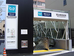
Meiji-jingumae Station
Metro station in Tokyo, Japan
Distance: Approx. 473 meters
Latitude and longitude: 35.668449,139.705351
Meiji-jingumae Station (明治神宮前駅, Meiji-Jingūmae-eki) is a subway station located in Shibuya, Tokyo, Japan. It is a part of the Tokyo Metro subway network, and is served by the Chiyoda Line and the Fukutoshin Line. Harajuku Station on the Yamanote Line is immediately adjacent to Meiji-jingumae Station and is marked as an interchange on most route maps.
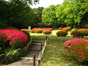
Meiji Shrine Inner Garden
Public garden in Shibuya, Tokyo Japan
Distance: Approx. 229 meters
Latitude and longitude: 35.672791,139.700352
The Meiji Shrine Inner Garden (明治神宮御苑, Meiji Jingū Gyoen) or Yoyogi Gyoen is a public garden adjacent to Meiji Shrine and Yoyogi Park in Shibuya, Tokyo. The garden was once part of the suburban residences of Katō Kiyomasa and later the Ii clan during the Edo period. During the Meiji period, the garden came under the supervision of the Imperial Household Agency and named Yoyogi Gyoen (Yoyogi Imperial Garden) and was frequently visited by Emperor Meiji and Empress Shōken.

Universal Music Japan
Japanese subsidiary of Universal Music Group
Distance: Approx. 521 meters
Latitude and longitude: 35.670797,139.70676082
Universal Music LLC (Japanese: ユニバーサル ミュージック合同会社, Hepburn: Yunibāsaru myūjikku Gōdō gaisha), often referred to as just Universal Music Japan or UMJ, is a Japanese subsidiary of the Universal Music Group founded in 1990. It is the largest subsidiary for a foreign company in Japan regarding music distribution. The company is responsible for marketing and distribution in Japan for Japanese releases under Universal.

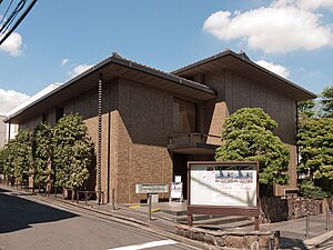
Ukiyo-e Ōta Memorial Museum of Art
Distance: Approx. 384 meters
Latitude and longitude: 35.66941667,139.70488889
The Ukiyo-e Ōta Memorial Museum of Art (浮世絵 太田記念美術館, Ukiyo-e Ōta kinen bijutsukan) is a museum that opened in Shibuya, Tokyo, Japan, in January 1980. It presents rotating exhibitions of Ukiyo-e from Ōta Seizo V's collection of over 12,000 pieces.
Washington Heights (Tokyo)
Distance: Approx. 96 meters
Latitude and longitude: 35.67021534,139.70022564
Washington Heights was a United States Armed Forces housing complex located in Shibuya, Tokyo during the occupation of Japan by Allied forces. Constructed in 1946, it remained in operation until 1964, by which point all land had been returned to Japanese control. Today, the site encompasses Yoyogi Park, Yoyogi National Gymnasium, the NHK Broadcasting Center, and other facilities.

Jingūbashi
Bridge tourist attraction
Distance: Approx. 170 meters
Latitude and longitude: 35.6697,139.7023
Jingūbashi (神宮橋, Jingūbashi), lit. Shrine Bridge, also known as Harajuku Bridge or Harajuku Cosplay Bridge, is a bridge that passes over the Yamanote Line between Harajuku Station and the entrance to the Meiji Shrine in Tokyo, Japan. Formerly a pedestrian bridge, it is now open to traffic.
Weather in this IP's area
broken clouds
16 Celsius
16 Celsius
15 Celsius
17 Celsius
1023 hPa
73 %
1023 hPa
1019 hPa
10000 meters
6.69 m/s
350 degree
75 %
06:18:02
16:34:08


