202.226.49.105 - IP Lookup: Free IP Address Lookup, Postal Code Lookup, IP Location Lookup, IP ASN, Public IP
Country:
Region:
City:
Location:
Time Zone:
Postal Code:
IP information under different IP Channel
ip-api
Country
Region
City
ASN
Time Zone
ISP
Blacklist
Proxy
Latitude
Longitude
Postal
Route
Luminati
Country
Region
19
City
uenohara
ASN
Time Zone
Asia/Tokyo
ISP
Uenohara Broadband Communications Inc.
Latitude
Longitude
Postal
IPinfo
Country
Region
City
ASN
Time Zone
ISP
Blacklist
Proxy
Latitude
Longitude
Postal
Route
IP2Location
202.226.49.105Country
Region
yamanashi
City
uenohara
Time Zone
Asia/Tokyo
ISP
Language
User-Agent
Latitude
Longitude
Postal
db-ip
Country
Region
City
ASN
Time Zone
ISP
Blacklist
Proxy
Latitude
Longitude
Postal
Route
ipdata
Country
Region
City
ASN
Time Zone
ISP
Blacklist
Proxy
Latitude
Longitude
Postal
Route
Popular places and events near this IP address

Sagamiko, Kanagawa
Former municipality in Kantō, Japan
Distance: Approx. 6836 meters
Latitude and longitude: 35.6144,139.189
Sagamiko (相模湖町, Sagamiko-machi) was a town located in Tsukui District, Kanagawa Prefecture, Japan. As of March 1, 2006, the final population data before the amalgamation, showed that the town had an estimated population of 10,404 and a density of 329.4 inhabitants per square kilometre (853/sq mi). The total area was 31.59 km2 (12.20 sq mi).

Fujino, Kanagawa
Former municipality in Kantō, Japan
Distance: Approx. 3817 meters
Latitude and longitude: 35.606,139.143
Fujino (藤野町, Fujino-chō) was a town located in Tsukui District, Kanagawa Prefecture, Japan. As of March 1, 2007, final population data before the amalgamation, the town had an estimated population of 10,720 and a density of 165.15 persons per km2. The total area was 64.91 km2.
Mount Jinba
Distance: Approx. 4977 meters
Latitude and longitude: 35.65222222,139.16666667
Mount Jinba (陣馬山, Jinba-san) is located between Hachiōji, Tokyo and Fujino, Kanagawa Prefecture. Its peak is roughly 857 m (2,812 ft) above sea level.
Uenohara
City in Chūbu, Japan
Distance: Approx. 600 meters
Latitude and longitude: 35.63019444,139.11133333
Uenohara (上野原市, Uenohara-shi) is a city located in Yamanashi Prefecture, Japan. As of 1 July 2019, the city had an estimated population of 23,158 in 9987 households, and a population density of 140 persons per km². The total area of the city is 170.57 square kilometres (65.86 sq mi).

Lake Sagami
Reservoir in Kanagawa
Distance: Approx. 6368 meters
Latitude and longitude: 35.61388889,139.18333333
Lake Sagami (相模湖, Sagami-ko) is an artificial lake located in Midori-ku, Sagamihara, Kanagawa in Japan's Kantō region. Created in 1947 after the Sagami River was dammed, it serves as use for recreational and hydroelectric purposes. The lake also served as venue for canoeing events at the 1964 Summer Olympics held in Tokyo, located 60 kilometres (37 mi) from the lake.

Sagamiko Station
Railway station in Sagamihara, Kanagawa Prefecture, Japan
Distance: Approx. 6749 meters
Latitude and longitude: 35.6170293,139.188956
Sagamiko Station (相模湖駅, Sagamiko-eki) is a passenger railway station located in Midori-ku in the city of Sagamihara, Kanagawa Prefecture, Japan, and is operated by the East Japan Railway Company (JR East).
Fujino Station
Railway station in Sagamihara, Kanagawa Prefecture, Japan
Distance: Approx. 3720 meters
Latitude and longitude: 35.616,139.1524
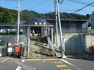
Fujino Station (藤野駅, Fujino-eki) is a passenger railway station located in Midori-ku in the city of Sagamihara, Kanagawa Prefecture, Japan, and is operated by the East Japan Railway Company (JR East).

Uenohara Station
Railway station in Uenohara, Yamanashi Prefecture, Japan
Distance: Approx. 1582 meters
Latitude and longitude: 35.6188,139.1162
Uenohara Station (上野原駅, Uenohara-eki) is a railway station of the Chūō Main Line, East Japan Railway Company (JR East) in the city of Uenohara, Yamanashi Prefecture, Japan.

Shiotsu Station
Railway station in Uenohara, Yamanashi Prefecture, Japan
Distance: Approx. 4530 meters
Latitude and longitude: 35.6142,139.0726
Shiotsu Station (四方津駅, Shiotsu-eki) is a railway station of the Chūō Main Line, East Japan Railway Company (JR East) in the city of Uenohara, Yamanashi Prefecture, Japan.
Jinba Sagamiko Prefectural Natural Park
Prefectural Natural park in Japan
Distance: Approx. 6394 meters
Latitude and longitude: 35.60333333,139.1775
Jinba Sagamiko Prefectural Natural Park (県立陣馬相模湖自然公園, Kenritsu Jinba Sagami-ko shizen kōen) is a Prefectural Natural Park in Kanagawa Prefecture, Japan. Established in 1983, it derives its name from Mount Jinba and Lake Sagami. The park lies wholly within the municipality of Sagamihara.
Yuzurihara
Village in Yamanashi Prefecture, Japan
Distance: Approx. 5264 meters
Latitude and longitude: 35.674,139.088
Yuzurihara (Japanese: 棡原村) is a village in Yamanashi Prefecture in Japan which in 1955, together with the villages of Nishihara, Shimada, Otsuru, Iwaomura, Koto and Ome, were merged into the municipality of Uenohara.

Ohno Dam
Dam in Yamanashi Prefecture, Japan
Distance: Approx. 5398 meters
Latitude and longitude: 35.61944444,139.05972222
Ohno Dam is an earthfill dam located in Yamanashi Prefecture in Japan. The dam is used for power production. The catchment area of the dam is 487.9 km2.
Weather in this IP's area
broken clouds
-0 Celsius
-0 Celsius
-1 Celsius
-0 Celsius
1023 hPa
52 %
1023 hPa
944 hPa
10000 meters
1.19 m/s
0.93 m/s
314 degree
56 %


