Country:
Region:
City:
Latitude and Longitude:
Time Zone:
Postal Code:
IP information under different IP Channel
ip-api
Country
Region
City
ASN
Time Zone
ISP
Blacklist
Proxy
Latitude
Longitude
Postal
Route
Luminati
Country
Region
wko
City
hamilton
ASN
Time Zone
Pacific/Auckland
ISP
Two Degrees Networks Limited
Latitude
Longitude
Postal
IPinfo
Country
Region
City
ASN
Time Zone
ISP
Blacklist
Proxy
Latitude
Longitude
Postal
Route
db-ip
Country
Region
City
ASN
Time Zone
ISP
Blacklist
Proxy
Latitude
Longitude
Postal
Route
ipdata
Country
Region
City
ASN
Time Zone
ISP
Blacklist
Proxy
Latitude
Longitude
Postal
Route
Popular places and events near this IP address

Waikato Hospital
Hospital in Waikato, New Zealand
Distance: Approx. 1026 meters
Latitude and longitude: -37.80430833,175.28229444
Waikato Hospital is a major regional hospital in Hamilton, New Zealand. It provides specialised and emergency healthcare for the Midlands and Waikato area with patients referred there from feeder hospitals like Whakatāne, Lakes area, Tauranga, Thames, Tokoroa and Rotorua.

Lake Rotoroa (Hamilton)
Lake in the North Island of New Zealand
Distance: Approx. 1837 meters
Latitude and longitude: -37.799,175.274
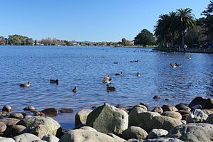
Lake Rotoroa or Hamilton Lake (officially Lake Rotoroa / Hamilton Lake) is a lake in Hamilton, Waikato, North Island, New Zealand. It has a surface area of about 54 hectares (133 acres) and an average depth of 2.4 metres (7 ft 10 in). It is the home of the Hamilton Yacht Club, which holds regular sailing in the summer.
Resthills Park
Distance: Approx. 1664 meters
Latitude and longitude: -37.82825,175.28632
Resthills Park is a multi-use sports venue and public park located in Glenview, an outer suburb of Hamilton, New Zealand. The location is currently the proud home ground for Waikato Softball and Waikato Rugby League, and recently hosted a community-focused Urban Rogaines orienteering event, a pop-up disc golf course, and the 2024 NZ Outdoor Archery Championships.

Deanwell
Suburb of Hamilton, New Zealand
Distance: Approx. 1035 meters
Latitude and longitude: -37.82036111,175.27639444
Deanwell is a suburb in south-western Hamilton in New Zealand. It is named after Deanwell Properties, the developers who subdivided the area. It was defined as a suburb of Hamilton in 1974.

Fitzroy, Hamilton
Suburb of Hamilton, New Zealand
Distance: Approx. 1339 meters
Latitude and longitude: -37.81391944,175.29939722
Fitzroy is a suburb in southern Hamilton in New Zealand. It is named after Robert FitzRoy, who commanded HMS Beagle and was later the Governor of New Zealand. It was declared a suburb in 1974.

Glenview, New Zealand
Suburb of Hamilton, New Zealand
Distance: Approx. 977 meters
Latitude and longitude: -37.82192222,175.28686389
Glenview is a suburb in southern Hamilton in New Zealand. It was named by Bruce Lugton of developers Lugton Lands. He chose Glenview because he felt it depicted the area perfectly.

Melville, New Zealand
Suburb of Hamilton, New Zealand
Distance: Approx. 271 meters
Latitude and longitude: -37.81154722,175.28218611
Melville is a suburb in southern Hamilton in New Zealand. It is named after James Dougal Melville. Many of the streets in Melville are named after war heroes, including Douglas Bader, Bernard Montgomery, Odette Hallowes, David Beatty and William Slim.
Braemar Hospital
Hospital in Waikato, New Zealand
Distance: Approx. 751 meters
Latitude and longitude: -37.80781667,175.27939722
Braemar Hospital is one of the New Zealand's largest private hospitals. It is owned by the Braemar Charitable Trust located in Hamilton, New Zealand. There was a separate and unrelated organisation, Braemar Hospital in Nelson, New Zealand which provided long term psychiatric care for children.

Cobham Bridge
Bridge
Distance: Approx. 1295 meters
Latitude and longitude: -37.80552778,175.29502778
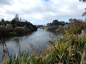
Cobham Bridge is a 143.3 m (470 ft) long girder bridge in Hamilton, New Zealand, on Cobham Drive, which is part of SH1C. It spans the Waikato River. The Ministry of Works plaque at the southern end of the bridge says they designed it and it was opened on 29 June 1963. Its deck is 28 m (92 ft) above sea level.
Melville High School
School in New Zealand
Distance: Approx. 504 meters
Latitude and longitude: -37.81722222,175.28111111
Melville High School was a state co-educational secondary school located in Hamilton, Waikato, New Zealand. The school shut down at the end of 2023. A new school, Mangakōtukutuku College, opened in 2024.

Hamilton Lake (suburb)
Suburb of Hamilton, New Zealand
Distance: Approx. 1223 meters
Latitude and longitude: -37.804,175.277
Hamilton Lake is a residential suburb of Hamilton, surrounding Lake Rotoroa and the Hamilton Lake Domain. Domain Drive was rebuilt in 1940 and most of the housing in the suburb near the lake had been built by 1943, but development of the area to the south west only began in the 1970s and was continuing in 1995. The roads close to the lake are considered to be amongst Hamilton's premium streets.
Gower Park
Distance: Approx. 1257 meters
Latitude and longitude: -37.807315,175.272144
Gower Park, is a multi-purpose stadium in the Hamilton, New Zealand, suburb of Melville. It is used for football matches and is the home stadium of New Zealand National League and Northern League side Melville United.
Weather in this IP's area
clear sky
8 Celsius
8 Celsius
8 Celsius
8 Celsius
1021 hPa
83 %
1021 hPa
1015 hPa
10000 meters
1.04 m/s
1.12 m/s
156 degree
7 %
06:08:43
19:56:05