Country:
Region:
City:
Latitude and Longitude:
Time Zone:
Postal Code:
IP information under different IP Channel
ip-api
Country
Region
City
ASN
Time Zone
ISP
Blacklist
Proxy
Latitude
Longitude
Postal
Route
Luminati
Country
Region
wko
City
hamilton
ASN
Time Zone
Pacific/Auckland
ISP
Two Degrees Networks Limited
Latitude
Longitude
Postal
IPinfo
Country
Region
City
ASN
Time Zone
ISP
Blacklist
Proxy
Latitude
Longitude
Postal
Route
db-ip
Country
Region
City
ASN
Time Zone
ISP
Blacklist
Proxy
Latitude
Longitude
Postal
Route
ipdata
Country
Region
City
ASN
Time Zone
ISP
Blacklist
Proxy
Latitude
Longitude
Postal
Route
Popular places and events near this IP address

Mission Bay, New Zealand
Suburb in Auckland, New Zealand
Distance: Approx. 738 meters
Latitude and longitude: -36.84817,174.83059
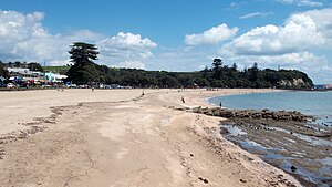
Mission Bay is a seaside suburb of Auckland city, on the North Island of New Zealand. The suburb's beach is a popular resort, located alongside Tamaki Drive. The area also has a wide range of eateries.

Kelly Tarlton's Sea Life Aquarium
Public aquarium in Auckland, New Zealand
Distance: Approx. 1645 meters
Latitude and longitude: -36.84583333,174.81722222
Kelly Tarlton's Sea Life Aquarium (formerly Kelly Tarlton's Underwater World) is a public aquarium opened in 1985 in Auckland, New Zealand. Located at 23 Tamaki Drive, it was the brainchild of New Zealand marine archaeologist and diver Kelly Tarlton (1937–1985). Built in disused sewage storage tanks, the aquarium used a new form of acrylic shaping, which allowed curved tunnels rather than viewing areas with flat panels only, as in previous aquariums.

Bastion Point
Area of coastal land in Auckland, New Zealand
Distance: Approx. 1364 meters
Latitude and longitude: -36.84416667,174.82416667
Takaparawhau / Bastion Point is a coastal piece of land in Ōrākei, Auckland, New Zealand, overlooking the Waitematā Harbour. The area is significant in New Zealand history as the site of protests in the late 1970s by Māori against forced land alienation by Pākehā (European settlers). Takaparawhau is now the site of the private Ōrākei Marae, the public Michael Joseph Savage Memorial, and privately-owned reserve land that is accessible to the public.
New Zealand Flying School
Distance: Approx. 738 meters
Latitude and longitude: -36.84817,174.83059
The New Zealand Flying School was formed in 1915, by the Walsh Brothers, Leo and Vivian, to train pilots for the Royal Flying Corps. The school flew a fleet of home-built and imported flying boats from Mission Bay on Auckland's Waitemata Harbour, near where a sculpture [1] now stands to commemorate the Walsh brothers. Over 100 pilots trained at the school, most of them going on to serve in the First World War, including ace Keith Caldwell.

Selwyn College, Auckland
State, co-educational, secondary school
Distance: Approx. 1024 meters
Latitude and longitude: -36.8625,174.8381
Selwyn College (Māori: Te Kāreti o Herewini) is a co-educational state secondary school in Kohimarama, Auckland, New Zealand.
Purewa railway station
Defunct railway station in New Zealand
Distance: Approx. 1193 meters
Latitude and longitude: -36.8654,174.8313
Purewa railway station was a station on the North Island Main Trunk line (NIMT) in Auckland, New Zealand. It was located between Glen Innes station and Ōrākei station.

Kohimarama School
State, co-educational, primary school
Distance: Approx. 449 meters
Latitude and longitude: -36.8548,174.83704
Kohimarama School is a coeducational state primary school in Kohimarama, Auckland. The initial school building was constructed in 1921, while the school grounds were opened on 6 September 1924. The memorial entrance gates to the school were opened on 14 June 1928 by the then chairman of Auckland Education Board, A. Burns.

Tamaki Drive
Road in New Zealand
Distance: Approx. 1340 meters
Latitude and longitude: -36.849423,174.818484
Tamaki Drive is the coastal road which follows the contours of the Waitematā Harbour, Auckland, New Zealand. The road links the suburbs Ōrākei, Mission Bay, and Kohimarama ending in Saint Heliers providing easy access to the local beaches. Tamaki Drive was completed in 1932 and incorporates The Strand, Bice Esplanade and, what was once part of the old Kohimarama Road.
Grammar TEC RC
Distance: Approx. 1033 meters
Latitude and longitude: -36.853068,174.8205806
Grammar TEC is a rugby club in Auckland, New Zealand resulting from an amalgamation of several rugby clubs . The clubs involved include Grafton and Cornwall, who united to form Carlton. The creation of Carlton was followed by teams called Teachers and Eastern who formed Teachers Eastern.

Barfoot & Thompson Stadium
Stadium in New Zealand
Distance: Approx. 808 meters
Latitude and longitude: -36.8612967,174.8357959
Barfoot & Thompson Stadium (formerly ASB Stadium), is a New Zealand venue for sports and entertainment events in Kohimarama, Auckland, New Zealand. The name sponsorship by Barfoot & Thompson, a leading real estate company, began in 2018. Barfoot & Thompson Stadium is a training and competition venue for many local clubs and organisations including East City Futsal Indoor Soccer Club, Auckland Ultimate, Auckland Basketball, Sparta Volleyball Club, Orakei Tigers Basketball Club, Howick & St Heliers Judo Club, Aikido Auckland Aikikai and many more.

Kepa Bush Reserve
Distance: Approx. 935 meters
Latitude and longitude: -36.86300556,174.83042222
Kepa Bush Reserve is an ecological reserve on the Auckland isthmus in New Zealand, south of Mission Bay. It is situated near the smaller St John's Bush and is also known as the Pourewa Valley.

Madills Farm Reserve
Football stadium in New Zealand
Distance: Approx. 1065 meters
Latitude and longitude: -36.85610278,174.84382222
Madills Farm Reserve, also known as Madills Farm, is a reserve and sports ground in the suburb of Kohimarama in Auckland, New Zealand. It is the home ground of Eastern Suburbs and the Kohimarama Yacht club.
Weather in this IP's area
broken clouds
11 Celsius
10 Celsius
11 Celsius
12 Celsius
1021 hPa
79 %
1021 hPa
1017 hPa
10000 meters
1.54 m/s
30 degree
75 %
06:12:18
19:56:07
