Country:
Region:
City:
Latitude and Longitude:
Time Zone:
Postal Code:
IP information under different IP Channel
ip-api
Country
Region
City
ASN
Time Zone
ISP
Blacklist
Proxy
Latitude
Longitude
Postal
Route
Luminati
Country
Region
auk
City
mangere
ASN
Time Zone
Pacific/Auckland
ISP
Two Degrees Networks Limited
Latitude
Longitude
Postal
IPinfo
Country
Region
City
ASN
Time Zone
ISP
Blacklist
Proxy
Latitude
Longitude
Postal
Route
db-ip
Country
Region
City
ASN
Time Zone
ISP
Blacklist
Proxy
Latitude
Longitude
Postal
Route
ipdata
Country
Region
City
ASN
Time Zone
ISP
Blacklist
Proxy
Latitude
Longitude
Postal
Route
Popular places and events near this IP address
Hubbard Foods
New Zealand breakfast cereal maker
Distance: Approx. 2096 meters
Latitude and longitude: -36.94887,174.79589
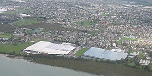
Hubbard Foods Ltd is a manufacturer of breakfast cereals based in Auckland, New Zealand. It operates under the Hubbard brand as well as producing for private labels. Hubbard Foods Ltd was founded by Dick Hubbard, who temporarily stepped down as CEO from 2004 to 2007 to serve as the mayor of Auckland.

Māngere
Suburb in Auckland, New Zealand
Distance: Approx. 349 meters
Latitude and longitude: -36.96666667,174.8
Māngere (Māori pronunciation: [ˈmaːŋɛɾɛ]) is a major suburb in South Auckland, New Zealand, located on mainly flat land on the northeastern shore of the Manukau Harbour, to the northwest of Manukau City Centre and 15 kilometres (9.3 miles) south of the Auckland city centre. It is the location of Auckland Airport, which lies close to the harbour's edge to the south of the suburb. The area has been inhabited by Tāmaki Māori since early periods of Māori history, including large-scale agricultural stonefields, such as Ihumātao, and Māngere Mountain, which was home to a fortified pā.

Favona
Suburb in Auckland, New Zealand
Distance: Approx. 1729 meters
Latitude and longitude: -36.9525,174.80027778
Favona is a mostly industry-dominated suburb of Auckland, New Zealand, and is part of the Māngere area. The suburb is in the Manukau ward, one of the thirteen administrative divisions of Auckland city, and is under governance of the Auckland Council.

Māngere Mountain
Volcanic cone in Auckland, New Zealand
Distance: Approx. 2332 meters
Latitude and longitude: -36.9496,174.7831
Māngere Mountain, also known by the names Te Pane-o-Mataaho and Te Ara Pueru, is a volcanic cone in Māngere, Auckland. Located within Māngere Domain, it is one of the largest volcanic cones in the Auckland volcanic field, with a peak 106 metres (348 ft) above sea level. It was the site of a major pā (Māori fortified settlement) and many of the pā's earthworks are still visible.
Southern Cross Campus
Composite (years 1–13) school
Distance: Approx. 1838 meters
Latitude and longitude: -36.9642,174.8165
Southern Cross Campus (Te Kura Taki o Autahi) is a composite school that caters for students in Years 1–13 in the suburb of Māngere East in Auckland, New Zealand. The school (also referred to as 'SCC', 'The Campus' or 'The Cross') has deep ties to the Mangere East community by providing education, facilities, and programmes for the wider use of the whole school. It is a Māori and Pacific Islands ethnic school, with students of European (Pākehā), Asian, and other ethnicities as a 0.5% minority.

Māngere Lagoon
Lagoon in New Zealand
Distance: Approx. 2042 meters
Latitude and longitude: -36.95702,174.77763
Māngere Lagoon is a lagoon in the Manukau Harbour, New Zealand. It occupies a volcanic crater or maar which is part of the Auckland volcanic field. Oval and about 600m long, it has a small restored scoria island remaining in the centre.

Auckland Seventh-day Adventist High School
State-integrated, day school
Distance: Approx. 1579 meters
Latitude and longitude: -36.9569,174.7848
Auckland Seventh-day Adventist High School (ASDAH) is a secondary school (years 9–13) in Māngere Bridge, a suburb of South Auckland, New Zealand. It is owned by the Seventh-day Adventist Church. It is a part of the Seventh-day Adventist education system, the world's second largest Christian school system.
Pukaki Lagoon
Volcanic lagoon in Māngere, New Zealand
Distance: Approx. 2106 meters
Latitude and longitude: -36.982998,174.810226
Pukaki Lagoon, located in the suburb of Māngere, New Zealand, is one of the volcanoes in the Auckland volcanic field. The lagoon, alongside Māngere Lagoon, Waitomokia, Crater Hill, Kohuora and Robertson Hill, is one of the volcanic features collectively referred to as Nga Tapuwae a Mataoho ("The Sacred Footprints of Mataoho"), referring to the deity in Tāmaki Māori myths who was involved in their creation. Pukaki Lagoon has a 600 m wide explosion crater, with a surrounding tuff ring.

Centre Park
Sports venue in Māngere, Auckland, New Zealand
Distance: Approx. 896 meters
Latitude and longitude: -36.964263,174.805413
Centre Park is a stadium located in Māngere, Auckland, New Zealand. The stadium hosted the 2011 OFC U-20 Championship. It is the home of Northern League side Manukau United.

Boggust Park Crater
Volcano in the Auckland volcanic field, New Zealand
Distance: Approx. 2056 meters
Latitude and longitude: -36.955413,174.813552
Boggust Park Crater is a volcano in the Auckland volcanic field, New Zealand. Located in the Favona area of the Māngere suburb, it is one of Auckland city's older volcanoes. It was first recognised as a volcano in 2011.
Manukau Rovers RFC
Rugby team
Distance: Approx. 412 meters
Latitude and longitude: -36.9682014,174.791715
Manukau Rovers Rugby Football Club is a rugby union club based in Auckland, New Zealand. The club was established in 1885 and is affiliated with the Auckland Rugby Football Union. In 1912, the club seceded to rugby league, although after a few years returned to rugby union.

Māngere-Ōtāhuhu Local Board
Local board of Auckland Council in New Zealand
Distance: Approx. 313 meters
Latitude and longitude: -36.96961988,174.798875
Māngere-Ōtāhuhu Local Board is one of the 21 local boards of the Auckland Council, and is overseen by the council's Manukau ward councillors. The board is governed by seven board members elected at-large. The board's administrative area includes the suburbs Māngere Bridge, Māngere, Ōtāhuhu, and Favona, and covers areas south of the Manukau Harbour.
Weather in this IP's area
broken clouds
11 Celsius
11 Celsius
9 Celsius
12 Celsius
1021 hPa
80 %
1021 hPa
1019 hPa
10000 meters
2.06 m/s
60 degree
75 %
06:12:14
19:56:28