Country:
 New Zealand
Region:
City:
Latitude and Longitude:
Time Zone:
Postal Code:
IP information under different IP Channel
ip-api
Country
Region
City
ASN
Time Zone
ISP
Blacklist
Proxy
Latitude
Longitude
Postal
Route
IPinfo
Country
Region
City
ASN
Time Zone
ISP
Blacklist
Proxy
Latitude
Longitude
Postal
Route
MaxMind
Country
Region
City
ASN
Time Zone
ISP
Blacklist
Proxy
Latitude
Longitude
Postal
Route
Luminati
Country
NZRegion
nsn
City
nelson
ASN
Time Zone
Pacific/Auckland
ISP
Two Degrees Networks Limited
Latitude
Longitude
Postal
db-ip
Country
Region
City
ASN
Time Zone
ISP
Blacklist
Proxy
Latitude
Longitude
Postal
Route
ipdata
Country
Region
City
ASN
Time Zone
ISP
Blacklist
Proxy
Latitude
Longitude
Postal
Route
Popular places and events near this IP address

Richmond, Tasman
Town in Tasman District, New Zealand
Distance: Approx. 28 meters
Latitude and longitude: -41.33333333,173.18333333
Richmond (Māori: Waimea) is a town and the seat of the Tasman District Council in New Zealand. It lies 13 kilometres (8 mi) south of Nelson in the South Island, close to the southern extremity of Tasman Bay. The town, first settled by Europeans in 1842, was named in 1854 after the town of Richmond on Thames near London.

Hope, New Zealand
Town in Tasman District, New Zealand
Distance: Approx. 3344 meters
Latitude and longitude: -41.354,173.154
Hope, previously known as Ranzau, is a small settlement in the Tasman District of New Zealand. It lies south of Nelson city, between Richmond and Wakefield. Hope began as a German settlement, founded by many of the families on the barque Skjold, which left Hamburg on 21 April 1844 and arrived in Nelson on 1 September.
Tasman District Council
Distance: Approx. 987 meters
Latitude and longitude: -41.34165,173.18696
Tasman District Council (Māori: Te Kaunihera o te tai o Aorere) is the unitary local authority for the Tasman District of New Zealand. The council is led by the mayor of Tasman, who is currently Tim King. Tasman elects its 13 councillors from five different wards: three from Motueka, three from Moutere/Waimea, four from Richmond, one from Murchison and two from Golden Bay.

Waimea College
Secondary school in New Zealand
Distance: Approx. 1273 meters
Latitude and longitude: -41.3383,173.1967
Waimea College is a co-educational secondary school in Richmond, Tasman District, New Zealand. Opened in 1957, the college has over 1500 students, and is the largest school in the top of the South Island.

Garin College
Integrated secondary (year 9–13) co-ed school
Distance: Approx. 1875 meters
Latitude and longitude: -41.3357,173.2052
Garin College is a New Zealand Catholic, integrated, co-educational day and boarding secondary school in Nelson on the northern outskirts of Richmond. The college opened on 28 January 2002 to serve the Catholic community, particularly in the upper South Island. The college is named after Father Antoine Marie Garin (1810–1889) who was the founding pastor of the Catholic Church in Nelson.
Waimea County
Former county in New Zealand
Distance: Approx. 28 meters
Latitude and longitude: -41.33333333,173.18333333
Waimea County was one of the counties of New Zealand on the South Island. During the period 1853 to 1876, the area that would become Waimea County was administered as part of Nelson Province. With the Abolition of Provinces Act 1876, Waimea County was created, taking over administration of its area in January 1877.
Waimea Intermediate
School
Distance: Approx. 1264 meters
Latitude and longitude: -41.3403,173.1949
Waimea Intermediate is a co-educational intermediate school in Richmond, Tasman District, New Zealand.

Saxton Oval
New Zealand Cricket ground
Distance: Approx. 2504 meters
Latitude and longitude: -41.33083333,173.21277778
Saxton Oval, also known as Saxton Field, is a cricket ground in Saxton, Stoke, Nelson Region, New Zealand. Saxton Oval was one of the venues for the 2015 Cricket World Cup. It hosted three matches during the tournament.

Monaco, New Zealand
Suburb of Nelson, New Zealand
Distance: Approx. 4005 meters
Latitude and longitude: -41.30416667,173.21111111
Monaco is a small suburb of Nelson, New Zealand, west of town centre of Stoke. It lies on a narrow peninsula which extends into Tasman Bay / Te Tai-o-Aorere immediately to the south of Nelson Airport, southwest of central Nelson. The Broadgreen-Monaco statistical area, as defined by Statistics New Zealand, covers a land area of 1.14 km², including the peninsula.

Saxton, New Zealand
Suburb of Nelson, New Zealand
Distance: Approx. 3406 meters
Latitude and longitude: -41.325,173.22222222
Saxton is a suburb of Nelson, New Zealand, south of Stoke and northwest of Richmond. Saxton covers a land area of 3.99 km2 (1.54 sq mi). Its principal feature is the Saxton Field sports complex, which includes Saxton Oval – the main cricket ground of Nelson.
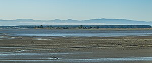
Waimea Inlet
Bay in New Zealand
Distance: Approx. 3367 meters
Latitude and longitude: -41.304,173.193
Waimea Inlet is a section of Tasman Bay / Te Tai-o-Aorere, in New Zealand's South Island. It is at the southern end of the bay, and separated from it by the partial barriers of Rabbit Island and Bell Island to the west and Monaco Peninsula and the reclaimed land of Nelson Airport to the east. The southern suburbs of Stoke and the town of Richmond lie close to the shore of Waimea Inlet.
Richmond Ward
Ward in Tasman District, New Zealand
Distance: Approx. 28 meters
Latitude and longitude: -41.33333333,173.18333333
Richmond Ward is a ward of Tasman District in the north of the South Island of New Zealand.
Weather in this IP's area
overcast clouds
7 Celsius
6 Celsius
7 Celsius
7 Celsius
992 hPa
93 %
992 hPa
991 hPa
10000 meters
1.78 m/s
3.15 m/s
188 degree
100 %
06:25:31
18:18:21