202.179.191.136 - IP Lookup: Free IP Address Lookup, Postal Code Lookup, IP Location Lookup, IP ASN, Public IP
Country:
Region:
City:
Location:
Time Zone:
Postal Code:
IP information under different IP Channel
ip-api
Country
Region
City
ASN
Time Zone
ISP
Blacklist
Proxy
Latitude
Longitude
Postal
Route
Luminati
Country
Region
jk
City
jakarta
ASN
Time Zone
Asia/Jakarta
ISP
Telemedia Dinamika Sarana, PT
Latitude
Longitude
Postal
IPinfo
Country
Region
City
ASN
Time Zone
ISP
Blacklist
Proxy
Latitude
Longitude
Postal
Route
IP2Location
202.179.191.136Country
Region
banten
City
pangarengan
Time Zone
Asia/Jakarta
ISP
Language
User-Agent
Latitude
Longitude
Postal
db-ip
Country
Region
City
ASN
Time Zone
ISP
Blacklist
Proxy
Latitude
Longitude
Postal
Route
ipdata
Country
Region
City
ASN
Time Zone
ISP
Blacklist
Proxy
Latitude
Longitude
Postal
Route
Popular places and events near this IP address

Cilegon
City in Java, Indonesia
Distance: Approx. 8492 meters
Latitude and longitude: -6.002685,106.011202
Cilegon (Indonesian: Kota Cilegon, Sundanese: ᮎᮤᮜᮨᮌᮧᮔ᮪) is a major coastal industrial city in Banten province, Indonesia, covering 162.51 km2 (62.75 sq mi). It is located on the island of Java. The city had a population of 374,464 at the 2010 Census and 434,896 at the 2020 Census; the official estimate as at mid 2023 was 470,378.
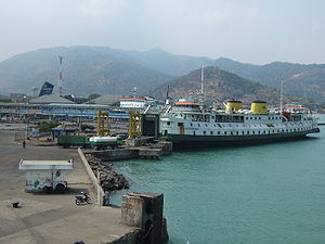
Port of Merak
Northwestern-most place of Java and seaport in Cilegon, Indonesia
Distance: Approx. 9057 meters
Latitude and longitude: -5.930833,105.995278
Port of Merak is a seaport located in the Pulo Merak District of the city of Cilegon, Banten, on the northwestern tip of Java, Indonesia. The port and district are named after the green peafowl, which once lived in the region, but now only lives in the nearby Ujung Kulon National Park. The port is connected to Jakarta via the Jakarta-Merak Toll Road and is also connected to the Bakauheni port which is located at the south of the Trans-Sumatran Highway.

Panjang Island (Jepara)
Island in Indonesia
Distance: Approx. 8958 meters
Latitude and longitude: -5.93333333,106.15
Panjang Island is an island located in the Jepara, Central Java. The island has an area of 19 hectares and is located 1.5 nautical miles from Kartini Beach, Jepara.
Suralaya Power Station
Distance: Approx. 8615 meters
Latitude and longitude: -5.89222222,106.03027778
Suralaya Power Station is a coal-fired power station located on Cilegon, Banten in Indonesia. The station has a maximum generating capacity of 4,025 megawatts.
Krakatau Steel Stadium
Stadium in Banten, Indonesia
Distance: Approx. 5677 meters
Latitude and longitude: -5.99609,106.039656
Krakatau Steel Stadium is a multi-purpose stadium in Cilegon, Banten, Indonesia. It is mostly used for football matches and is the home stadium of RANS Cilegon, Persic Cilegon and Persigon Cilegon.

Tonjong Baru railway station
Railway station in Indonesia
Distance: Approx. 9867 meters
Latitude and longitude: -6.031323,106.121419
Tonjong Baru Station (TOJB) is a class III railway station located in Tonjong, Kramatwatu, Serang Regency, Banten. The station, which is located at an altitude of +4 m, is included in the Operation Area I Jakarta.
Weather in this IP's area
overcast clouds
28 Celsius
32 Celsius
28 Celsius
28 Celsius
1010 hPa
75 %
1010 hPa
1007 hPa
10000 meters
2.75 m/s
2.3 m/s
346 degree
94 %
