Country:
 Thailand
Region:
City:
Latitude and Longitude:
Time Zone:
Postal Code:
IP information under different IP Channel
ip-api
Country
Region
City
ASN
Time Zone
ISP
Blacklist
Proxy
Latitude
Longitude
Postal
Route
IPinfo
Country
Region
City
ASN
Time Zone
ISP
Blacklist
Proxy
Latitude
Longitude
Postal
Route
MaxMind
Country
Region
City
ASN
Time Zone
ISP
Blacklist
Proxy
Latitude
Longitude
Postal
Route
Luminati
Country
THRegion
10
City
bangkok
ASN
Time Zone
Asia/Bangkok
ISP
KIRZ Service Provider
Latitude
Longitude
Postal
db-ip
Country
Region
City
ASN
Time Zone
ISP
Blacklist
Proxy
Latitude
Longitude
Postal
Route
ipdata
Country
Region
City
ASN
Time Zone
ISP
Blacklist
Proxy
Latitude
Longitude
Postal
Route
Popular places and events near this IP address

Siam University
Private university in Bangkok, Thailand
Distance: Approx. 1850 meters
Latitude and longitude: 13.72166667,100.45319444
Siam University (SU, Thai: มหาวิทยาลัยสยาม) is a university located on Phet Kasem Road in Phasi Charoen District, Bangkok. Siam University was founded by the late Narong Mongkhonvanit as a three-year private engineering school in 1965. In 1973, Siam University, then known as Siam Technical College, was formally established as a higher education institution with authorization to grant degrees.
Bang Wa station
Railway station in Bangkok, Thailand
Distance: Approx. 1607 meters
Latitude and longitude: 13.720625,100.45786944
Bang Wa station (Thai: สถานีบางหว้า, pronounced [sā.tʰǎː.nīː bāːŋ wâː]) is a rapid transit station on the BTS Silom Line and MRT Blue Line in Pak Khlong Phasi Charoen Subdistrict, Phasi Charoen District, Bangkok, Thailand. The station is on the Phet Kasem Interchange where Ratchaphruek cuts with Phet Kasem Roads. It serves as an interchange station for BTS Silom Line and MRT Blue Line, providing direct interchange, but with separate fare and ticket systems for the two lines.

Wutthakat BTS station
Distance: Approx. 1393 meters
Latitude and longitude: 13.7123,100.471
Wutthakat BTS station (Thai: สถานีวุฒากาศ, pronounced [sā.tʰǎː.nīː wút.tʰāː.kàːt]) is a BTS skytrain station, on the Silom Line at the Thon Buri and Chom Thong District boundary, Bangkok, Thailand. The station is located on Ratchaphruek Road over the Khlong Dan canal. It is surrounded by residential buildings, small shops and office towers.

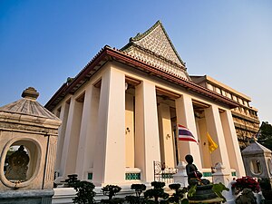
Wat Nang Chi Chotikaram
Buddhist temple in Bangkok, Thailand
Distance: Approx. 1466 meters
Latitude and longitude: 13.71666667,100.46805556
Wat Nang Chi Chotikaram (Thai: วัดนางชีโชติการาม) or Wat Nang Chi Worawihan (วัดนางชีวรวิหาร), simply known as Wat Nang Chai (วัดนางชี) is a Thai Buddhist third-class royal temple in Bangkok.

Wat Nak Prok
Buddhist temple in Bangkok, Thailand
Distance: Approx. 1413 meters
Latitude and longitude: 13.7172,100.4664
Wat Nak Prok (Thai: วัดนาคปรก) is a Thai Buddhist temple in Phasi Charoen District, Bangkok, Thailand. It can be considered as one of the most distinctive temples of the district in addition to nearby Wat Paknam Bhasicharoen. The temple also adjacent Wat Nang Chi to east.

Bang Khun Thian subdistrict
Subdistrict in Chom Thong district, Bangkok, Thailand
Distance: Approx. 1102 meters
Latitude and longitude: 13.6967,100.4572
Bang Khun Thian (Thai: บางขุนเทียน, pronounced [bāːŋ kʰǔn tʰīa̯n]) is a khwaeng (sub-district) of Chom Thong district, Bangkok.

Wat Ang Kaeo (Bangkok)
Distance: Approx. 1295 meters
Latitude and longitude: 13.71681,100.454574
Wat Ang Kaeo (Thai: วัดอ่างแก้ว, pronounced [wát ʔàːŋ kɛ̂ːw]) is a Buddhist temple in Bangkok, Thailand. It is in a bottom of narrow soi (lane) opposite Siam University, the temple situated by a Khlong Phasi Charoen. Its name "Ang Kaeo" means "crystal bowl" owing to the location that is like being in a basin.

Wat Ratchaorasaram
Distance: Approx. 640 meters
Latitude and longitude: 13.702838,100.464423
Wat Ratchaorasaram Ratchaworawihan (Thai: วัดราชโอรสารามราชวรวิหาร), often called shortened to Wat Ratchaorot (วัดราชโอรส) is an ancient Thai Buddhist temple in Bangkok. This first class royal monastery formerly known as Wat Chom Thong (วัดจอมทอง) or Wat Kong Thong (วัดกองทอง). The name "Chom Thong" is also the origin of the name of the district where it is located, Chom Thong.
Wat Nang Nong
Distance: Approx. 790 meters
Latitude and longitude: 13.703417,100.466376
Wat Nang Nong Worawihan (Thai: วัดนางนองวรวิหาร), often shortened to Wat Nang Nong is a historical Thai Buddhist temple in Bangkok. Located in the vicinity of well known Wat Ratchaorot, Khlong Dan or Khlong Sanam Chai canal runs through the western area.

Wat Sai, Chom Thong
Buddhist temple in Chom Thong district, Bangkok, Thailand
Distance: Approx. 1791 meters
Latitude and longitude: 13.69034,100.457632
Wat Sai (Thai: วัดไทร, formerly spelled วัดไซ, pronounced [wát sāj]) is an old Buddhist temple in Bangkok.

Wat Nang Ratchaworawihan
Distance: Approx. 587 meters
Latitude and longitude: 13.705173,100.465002
Wat Nang Ratchaworawihan (Thai: วัดหนังราชวรวิหาร), usually shortened to Wat Nang (วัดหนัง) is classified as the third class abbey in royal temple within Ratchaworawihan classification. It is considered to be one of the famous temples in the Chom Thong neighbourhood, also formerly known as Bang Khun Thian, as well as Wat Ratchaorot, Wat Nang Nong, or Wat Sai.

Wat Kaeo Phaithun
Distance: Approx. 1112 meters
Latitude and longitude: 13.696766,100.456639
Wat Kaeo Phaithun (Thai: วัดแก้วไพฑูรย์) formerly and still colloquially known as Wat Bang Phrathun Nai (วัดบางประทุนใน) is a historical temple in Bangkok's Thonburi side, considered to be one of the most beautiful and outstanding monasteries in the Chom Thong neighbourhood.
Weather in this IP's area
light rain
28 Celsius
33 Celsius
28 Celsius
28 Celsius
1002 hPa
87 %
1002 hPa
1001 hPa
10000 meters
2.19 m/s
4.3 m/s
282 degree
100 %
06:07:13
18:16:04