202.165.124.178 - IP Lookup: Free IP Address Lookup, Postal Code Lookup, IP Location Lookup, IP ASN, Public IP
Country:
Region:
City:
Location:
Time Zone:
Postal Code:
ISP:
ASN:
language:
User-Agent:
Proxy IP:
Blacklist:
IP information under different IP Channel
ip-api
Country
Region
City
ASN
Time Zone
ISP
Blacklist
Proxy
Latitude
Longitude
Postal
Route
db-ip
Country
Region
City
ASN
Time Zone
ISP
Blacklist
Proxy
Latitude
Longitude
Postal
Route
IPinfo
Country
Region
City
ASN
Time Zone
ISP
Blacklist
Proxy
Latitude
Longitude
Postal
Route
IP2Location
202.165.124.178Country
Region
new jersey
City
brigantine
Time Zone
America/New_York
ISP
Language
User-Agent
Latitude
Longitude
Postal
ipdata
Country
Region
City
ASN
Time Zone
ISP
Blacklist
Proxy
Latitude
Longitude
Postal
Route
Popular places and events near this IP address

Brigantine, New Jersey
City in Atlantic County, New Jersey, US
Distance: Approx. 36 meters
Latitude and longitude: 39.41,-74.365
Brigantine (or simply The Island) is a city in Atlantic County in the U.S. state of New Jersey. As of the 2020 United States census, the city's population was 7,716, a decrease of 1,734 (−18.3%) from the 2010 census count of 9,450, which in turn reflected a decline of 3,144 (−25.0%) from the 12,594 counted in the 2000 census. The city, and all of Atlantic County, is part of the Atlantic City-Hammonton metropolitan statistical area, which in turn is included in the Philadelphia-Reading-Camden combined statistical area and the Delaware Valley.

Absecon Lighthouse
Lighthouse in New Jersey, United States
Distance: Approx. 6493 meters
Latitude and longitude: 39.36611111,-74.41416667
The Absecon Lighthouse is a coastal lighthouse located in the north end of Atlantic City, New Jersey, overlooking Absecon Inlet. At 171 feet (52 m) it is the tallest lighthouse in the state of New Jersey and the third-tallest masonry lighthouse in the United States. Construction on Absecon Lighthouse began in 1854, with the light first lit on January 15, 1857.
Brigantine Island
Distance: Approx. 416 meters
Latitude and longitude: 39.4069,-74.3671
Brigantine Island (also known as Brigantine Beach Island) is an island off the Atlantic Ocean coast of New Jersey, located northeast of Atlantic City. It is 6 miles (9.7 km) long. The resort community of Brigantine is located on the island.
Brigantine Public Schools
School district in Atlantic County, New Jersey, US
Distance: Approx. 87 meters
Latitude and longitude: 39.410716,-74.363978
The Brigantine Public Schools is a community public school district that serves students in pre-kindergarten through eighth grade from Brigantine, in Atlantic County, in the U.S. state of New Jersey. As of the 2023–24 school year, the district, comprised of one school, had an enrollment of 386 students and 58.0 classroom teachers (on an FTE basis), for a student–teacher ratio of 6.7:1. The district had been classified by the New Jersey Department of Education as being in District Factor Group "CD", the sixth-highest of eight groupings.

WWFP
Radio station in Brigantine, New Jersey
Distance: Approx. 6519 meters
Latitude and longitude: 39.37944444,-74.42916667
WWFP (90.5 FM) is a non-commercial Christian radio station based in Brigantine, New Jersey. It is owned by Hope Christian Church of Marlton, Inc.. It serves the general Atlantic City metro area.

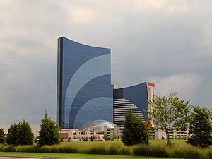
Harrah's Atlantic City
Hotel and casino in Atlantic City, New Jersey
Distance: Approx. 6237 meters
Latitude and longitude: 39.38453,-74.42911
Harrah's Resort Atlantic City is a casino hotel in the marina district of Atlantic City, New Jersey, owned by Vici Properties and operated by Caesars Entertainment. Harrah's is one of the largest hotels in New Jersey. The casino is one of three in the marina district (away from the Boardwalk and ocean beach) of the city, along with the Borgata and the Golden Nugget.

Absecon Inlet
Distance: Approx. 5650 meters
Latitude and longitude: 39.37583333,-74.41305556
Absecon Inlet is a narrow strait on the southeastern coast of New Jersey, United States.
Peters Beach
Distance: Approx. 1674 meters
Latitude and longitude: 39.402,-74.381
Peters Beach or Peter Beach is a former barrier island located on the Jersey Shore of the Atlantic Ocean in Atlantic County, New Jersey, United States. It is now a part of Brigantine Island.
Camelot Hotel/Casino
Proposed casino hotel in New Jersey, US
Distance: Approx. 6233 meters
Latitude and longitude: 39.383,-74.428
The Camelot Hotel/Casino was a proposed hotel and casino that was to be built in the early 1980s in Atlantic City, New Jersey. The site of the proposed project was located in the marina district, adjacent to Harrahs Resort, and was to consist of 990 hotel rooms and a 60,000 sq ft casino. Entertainer Merv Griffin was appointed as entertainment director of the company and planned to broadcast his television show from the hotel.

Brigantine Bridge
Bridge in Atlantic City & Brigantine, New Jersey
Distance: Approx. 5654 meters
Latitude and longitude: 39.38527778,-74.42194444
The Brigantine Bridge is a vehicular bridge over Absecon Inlet in Atlantic County, New Jersey. It is located just west of the Atlantic Ocean in Atlantic City and the resort community of Brigantine, providing the only road access to Brigantine Island. It is owned and operated by the New Jersey Department of Transportation (NJDOT).
Brigantine Inlet
Distance: Approx. 5207 meters
Latitude and longitude: 39.44638889,-74.32638889
Brigantine Inlet is an inlet connecting Little Bay with the Atlantic Ocean in Atlantic County, New Jersey.

Flagship Resort
Hotel and vacation owners property in Atlantic City, New Jersey
Distance: Approx. 6095 meters
Latitude and longitude: 39.369867,-74.412648
The Flagship Resort is a hotel and timeshare property in Atlantic City, New Jersey, that opened in 1988. It is the 13th tallest building in Atlantic City standing at 336.5 ft (102.6 m).
Weather in this IP's area
light snow
1 Celsius
-6 Celsius
1 Celsius
1 Celsius
1004 hPa
98 %
1004 hPa
1004 hPa
9.99 m/s
14.69 m/s
341 degree
100 %