Country:
Region:
City:
Latitude and Longitude:
Time Zone:
Postal Code:
IP information under different IP Channel
ip-api
Country
Region
City
ASN
Time Zone
ISP
Blacklist
Proxy
Latitude
Longitude
Postal
Route
Luminati
Country
Region
bm
City
bandarseribegawan
ASN
Time Zone
Asia/Brunei
ISP
Unified National Networks
Latitude
Longitude
Postal
IPinfo
Country
Region
City
ASN
Time Zone
ISP
Blacklist
Proxy
Latitude
Longitude
Postal
Route
db-ip
Country
Region
City
ASN
Time Zone
ISP
Blacklist
Proxy
Latitude
Longitude
Postal
Route
ipdata
Country
Region
City
ASN
Time Zone
ISP
Blacklist
Proxy
Latitude
Longitude
Postal
Route
Popular places and events near this IP address

Istana Nurul Iman
Official residence of the Sultan of Brunei
Distance: Approx. 1014 meters
Latitude and longitude: 4.87203056,114.92075556
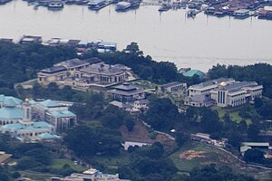
The Istana Nurul Iman (Jawi: ايستان نور الإيمان; English: The Light of Faith Palace) is the official residence of the Sultan of Brunei, Hassanal Bolkiah, and the seat of the Brunei government. The palace is located on a leafy, riverside sprawl of hills on the banks of the Brunei River, a few kilometres southwest of Bandar Seri Begawan, Brunei's capital city. The palace is often at the centre of state occasions and royal hospitality.

Awang Semaun Secondary School
Secondary school in Kampong Ayer, Brunei
Distance: Approx. 1090 meters
Latitude and longitude: 4.877056,114.939
Awang Semaun Secondary School (Malay: Sekolah Menengah Awang Semaun, abbrev: SMAS), is a co-educational government secondary school located in Kampong Sungai Kebun, Brunei.

Mukim Burong Pingai Ayer
Mukim of Brunei
Distance: Approx. 1300 meters
Latitude and longitude: 4.881,114.939
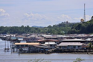
Mukim Burong Pingai Ayer is a mukim in Brunei-Muara District, Brunei. It is located within Kampong Ayer, the traditional stilt settlements on the Brunei River in the capital Bandar Seri Begawan. The population was 1,770 in 2016.

Mukim Tamoi
Mukim of Brunei
Distance: Approx. 1304 meters
Latitude and longitude: 4.88388889,114.93583333
Mukim Tamoi is a mukim in Brunei-Muara District, Brunei. It is part of Kampong Ayer, the traditional stilt settlements on the Brunei River in the country's capital Bandar Seri Begawan. The population was 1,389 in 2016.

Jong Batu
Distance: Approx. 966 meters
Latitude and longitude: 4.8662817,114.9255304
Jong Batu is a rock outcrop located in the Brunei River. It is shaped such that when viewed from the shores of the Brunei River, it resembles a sinking ship, with the bow sticking out of the water. In Brunei folklore, the legend of Nakhoda Manis (literally the "Captain Sweet" in Malay) tells of how an unfilial son was turned to the rock outcropping known as Jong Batu.

Kampong Burong Pingai Ayer
Village in Brunei-Muara, Brunei
Distance: Approx. 531 meters
Latitude and longitude: 4.876,114.934
Kampong Burong Pingai Ayer is a village in Brunei-Muara District, Brunei, within Mukim Burong Pingai Ayer. It is located within Kampong Ayer, the traditional stilted settlements on the Brunei River in the country's capital Bandar Seri Begawan. The population was 514 in 2016.
Seri Begawan Religious Teachers University College
Public university college in Brunei
Distance: Approx. 1323 meters
Latitude and longitude: 4.8857409,114.928657
The Kolej Universiti Perguruan Ugama Seri Begawan (KUPU SB or Seri Begawan Religious Teachers University College) is a public teacher-training university college situated in Bandar Seri Begawan, the capital of Brunei, founded in 2007. The institution aims to improve the standing of religious education in Brunei and create educators by integrating research and teaching knowledge based on Islamic principles and the Melayu Islam Beraja (MIB) concept.

Kampong Tumasek
Neighbourhood in Bandar Seri Begawan, Brunei
Distance: Approx. 1070 meters
Latitude and longitude: 4.8776,114.9208
Kampong Tumasek (Malay: Kampung Tumasek) or simply known as Tumasek, is an area in Bandar Seri Begawan, the capital of Brunei, as well as a village within Mukim Kianggeh in Brunei-Muara District. The population was 673 in 2016. It has the postcode BA2112.

Kampong Lupak Luas
Village in Brunei-Muara, Brunei
Distance: Approx. 1282 meters
Latitude and longitude: 4.869716,114.940467
Kampong Lupak Luas (Malay: Kampung Lupak Luas) or simply known as Lupak Luas, is a village-level subdivision of Lumapas, a mukim (subdistrict) of Brunei-Muara District, Brunei. The postcode for the village is BJ2524.

Kampong Buang Tekurok
Village in Brunei-Muara, Brunei
Distance: Approx. 834 meters
Latitude and longitude: 4.867177,114.933023
Buang Tekurok (also known as Sengkirap), commonly known as Kampong Buang Tekurok (Malay: Kampung Buang Tekurok), is a village-level subdivision of Lumapas, a mukim (subdistrict) of Brunei-Muara District, Brunei. The postcode for Kampong Buang Tekurok is BJ2524.

Istana Darul Hana
Palace in Brunei
Distance: Approx. 654 meters
Latitude and longitude: 4.8796904,114.9287151
The Istana Darul Hana (English: Darul Hana Palace) is one of the few remaining palaces in Brunei which notably, is the former residence of Omar Ali Saifuddien III from 1951 to 1987. The palace is located on a hill at Kilometer 3 of Jalan Tutong in Kampong Tumasek, Brunei-Muara District, Brunei. It is sometimes referred to as Istana Lama.

Istana Banderung Kayangan
Palace in Brunei
Distance: Approx. 611 meters
Latitude and longitude: 4.8768699,114.92507
The Istana Banderung Kayangan (English: Banderung Kayangan Palace) is a 20th century royal palace that served as the former residence of Omar Ali Saifuddien III, the 28th Sultan of Brunei. The palace is situated in Kampong Tumasek, next to Istana Darul Hana surau and the rear entrance to Istana Nurul Iman. Another name for the palace is Istana Tumasek.
Weather in this IP's area
thunderstorm with light rain
27 Celsius
30 Celsius
27 Celsius
27 Celsius
1010 hPa
88 %
1010 hPa
1010 hPa
9000 meters
2.57 m/s
180 degree
75 %
06:05:45
18:01:54