Country:
 India
IndiaRegion:
City:
Latitude and Longitude:
Time Zone:
Postal Code:
IP information under different IP Channel
ip-api
Country
Region
City
ASN
Time Zone
ISP
Blacklist
Proxy
Latitude
Longitude
Postal
Route
IPinfo
Country
Region
City
ASN
Time Zone
ISP
Blacklist
Proxy
Latitude
Longitude
Postal
Route
MaxMind
Country
Region
City
ASN
Time Zone
ISP
Blacklist
Proxy
Latitude
Longitude
Postal
Route
Luminati
Country
INASN
Time Zone
Asia/Kolkata
ISP
Mahanagar Telephone Nigam Limited
Latitude
Longitude
Postal
db-ip
Country
Region
City
ASN
Time Zone
ISP
Blacklist
Proxy
Latitude
Longitude
Postal
Route
ipdata
Country
Region
City
ASN
Time Zone
ISP
Blacklist
Proxy
Latitude
Longitude
Postal
Route
Popular places and events near this IP address

Kadri Park
Park in Karnataka, India
Distance: Approx. 2766 meters
Latitude and longitude: 12.88925,74.856167
Kadri Park is a park located in Kadri Gudde (meaning "hill" in Tulu). It is the largest park in Mangalore. This park contains a musical fountain and has hosted the Karavali Utsav.

Kadri Manjunath Temple
Hindu temple in Karnataka
Distance: Approx. 3153 meters
Latitude and longitude: 12.88577778,74.85558333
Kadri Manjunatha Temple is a historic temple in Mangalore in the state of Karnataka, India. The incharge and priests in the temple are Shivalli Madhva Brahmins.
Mudushedde
Village in Karnataka, India
Distance: Approx. 3149 meters
Latitude and longitude: 12.93,74.88
Mudushedde is a village within Mangalore city in Dakshina Kannada district in the Indian state of Karnataka.
Kadri, Mangalore
Commercial & Residential locality in Karnataka, India
Distance: Approx. 3331 meters
Latitude and longitude: 12.88418611,74.85526111
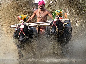
Kadri is home to the famous Kadri Manjunath Temple. Kadri is also famous for its annual buffalo race known as Kambala. A famous personality from Kadri is Kadri Gopalnath.
Siege of Mangalore
Event in the Second Anglo-Mysore War
Distance: Approx. 3589 meters
Latitude and longitude: 12.90205,74.8253166
The siege of Mangalore was conducted during the Second Anglo-Mysore War by Tipu Sultan and forces of the Kingdom of Mysore against a British East India Company garrison led by Colonel Campbell. The port city of Mangalore on the west coast of India was besieged from 20 May 1783 until the garrison capitulated on 30 January 1784 after being reduced to starvation; of the original garrison of 700 British soldiers and 2000 Indian troops there were only 850 survivors. The siege was one of the last major actions of the war; Mangalore was where the treaty ending the war was signed in March 1784.

Bondel
Area of Mangalore in Karnataka, India
Distance: Approx. 2625 meters
Latitude and longitude: 12.9258,74.877
Bondel is a residential locality in Mangalore city, Karnataka, India. It is one of the upscale residential localities of Mangalore. Bondel along with Maryhill houses many highrise buildings and also developing rapidly as a commercial center.

Mangalore Assembly constituency
Constituency of the Karnataka legislative assembly in India
Distance: Approx. 1856 meters
Latitude and longitude: 12.92,74.84
Mangalore Assembly constituency (erstwhile Ullal) is one of the Karnataka Legislative Assemblies or Vidhan Sabha constituencies in Karnataka, India which belongs to Dakshina Kannada Lok Sabha constituency. Mangalore constituency, along with Mangalore City South and Mangalore City North, represents Mangalore City. The constituency has a majority of religious minorities, with 45% Muslims and 6% Christians.
St. Joseph's Monastery, Bikarnakatte
Historic site in Mangalore, India
Distance: Approx. 3831 meters
Latitude and longitude: 12.88227778,74.86944444
St. Joseph's Monastery in Mangalore is a house of monastic observance, founded by Belgian Carmelites in 1947 in the area of Carmel Hill, though the Carmelite order had been serving the region since the late 17th Century. On the grounds is the Infant Jesus church, a Roman Catholic Shrine dedicated to infant Jesus, built in a symbolic style, with the basement surrounded by five columns representing the palm of the hand of God.
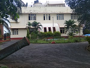
Srimanthi Bhai Memorial Government Museum
Historic house museum in Mangaluru, Karnataka
Distance: Approx. 3188 meters
Latitude and longitude: 12.887,74.846491
Srimanthi Bhai Memorial Government Museum Mangalore, Karnataka, Collection of archaeological and geological artefacts, a unit of Directorate of Archaeology & Museums Karnataka was founded on 4 May 1960 by Sri B.D Jatti, the chief minister of Karnataka Government. The museum is located in Mangalore, the coastal land of Karnataka.
Kavoor, Mangalore
Suburb of Mangalore in Karnataka, India
Distance: Approx. 1364 meters
Latitude and longitude: 12.92616,74.85821
Kavoor is a suburban area and the name of a ward in the city of Mangalore in the Mysore division of the Indian state of Karnataka. Kannada and Tulu are the two most commonly spoken languages in Kavoor. This place got the name as "Kavoor" because of the Saint "Kuvera Maharshi" who had visited this place.

Sri Mahalingeshwara Temple, Kavoor
Hindu temple in Mangalore
Distance: Approx. 547 meters
Latitude and longitude: 12.91829,74.85864
Sri Mahalingeshwara Temple, Kavoor is in the Kavoor area of Mangalore, Karnataka, India. It is dedicated to Mahalingeshwara, a form of Lord Shiva. The temple was founded in the 13th or 14th century AD by Maharshi Kavera, who came here to worship Parameswara.
Mangalore City Assembly constituency
Former Assembly constituency in Karnataka, India
Distance: Approx. 3693 meters
Latitude and longitude: 12.885437,74.838864
Mangalore City or Mangalore I Assembly constituency was one of the Karnataka Legislative Assemblies or Vidhan Sabha constituencies in Karnataka. It was part of Mangalore Lok Sabha constituency.
Weather in this IP's area
mist
25 Celsius
26 Celsius
25 Celsius
25 Celsius
1008 hPa
88 %
1008 hPa
1005 hPa
5000 meters
1.54 m/s
100 degree
75 %
06:19:43
18:29:05