Country:
 India
IndiaRegion:
City:
Latitude and Longitude:
Time Zone:
Postal Code:
IP information under different IP Channel
ip-api
Country
Region
City
ASN
Time Zone
ISP
Blacklist
Proxy
Latitude
Longitude
Postal
Route
IPinfo
Country
Region
City
ASN
Time Zone
ISP
Blacklist
Proxy
Latitude
Longitude
Postal
Route
MaxMind
Country
Region
City
ASN
Time Zone
ISP
Blacklist
Proxy
Latitude
Longitude
Postal
Route
Luminati
Country
INASN
Time Zone
Asia/Kolkata
ISP
Mahanagar Telephone Nigam Limited
Latitude
Longitude
Postal
db-ip
Country
Region
City
ASN
Time Zone
ISP
Blacklist
Proxy
Latitude
Longitude
Postal
Route
ipdata
Country
Region
City
ASN
Time Zone
ISP
Blacklist
Proxy
Latitude
Longitude
Postal
Route
Popular places and events near this IP address

Red Fort
Historical fort in Delhi, India
Distance: Approx. 390 meters
Latitude and longitude: 28.65583333,77.24083333
The Red Fort, also known as Lal Qila (Hindustani: [laːl qiːlaː]) is a historic fort in Delhi, India, that historically served as the main residence of the Mughal emperors. Emperor Shah Jahan commissioned construction of the Red Fort on 12 May 1639, when he decided to shift his capital from Agra to Delhi. Originally red and white, its design is credited to architect Ustad Ahmad Lahori, who also constructed the Taj Mahal.

Sri Digambar Jain Lal Mandir
Jain temple in India
Distance: Approx. 202 meters
Latitude and longitude: 28.65577778,77.23627778
Sri Digambar Jain Lal Mandir (Śrī Digambar Jain Lāl Mandir) is the oldest and best-known Jain temple in Delhi, India. It is directly across from the Red Fort in the historical Chandni Chowk area. The temple is known for an avian veterinary hospital, called the Jain Birds Hospital, in a second building behind the main temple.
Dariba Kalan
Neighborhood of Delhi in North India, India
Distance: Approx. 327 meters
Latitude and longitude: 28.6553,77.2342
For other places with the same name, see Wazirabad (disambiguation) Dariba Kalan (Hindi: दरीबा कलान, English: Street of the Incomparable Pearl), is a 17th-century street in Chandni Chowk area of Old Delhi or Shahjahanbad. It lies within the walled city of Delhi, and connects the Chandni Chowk area with Jama Masjid. The words Khurd and Kalan, "small" and "big" in Persian, respectively, are used to distinguish two villages that have the same name.
Akbarabadi Mosque
Mosque in Delhi, India
Distance: Approx. 482 meters
Latitude and longitude: 28.6499,77.2379
Akbarabadi Mosque was a mosque in Delhi, India. It was built by Akbarabadi Mahal, one of Shah Jahan's wives in 1650. One of the several Mughal era mosques in Old Delhi, it was demolished by the British, following their recapture of Delhi during the 1857 Uprising.

Naubat Khana (Red Fort)
Distance: Approx. 401 meters
Latitude and longitude: 28.655774,77.240991
The Naubat Khana, or Naqqar Khana, is the drum house that stands at the entrance between the outer and inner court at the Red Fort in Delhi. The British initially installed the museum of the fort in this gate. It was later moved to the Mumtaz Mahal.

Lahori Gate, Delhi
Distance: Approx. 222 meters
Latitude and longitude: 28.655918,77.238459
The Lahori Gate is the main entrance to the Red Fort in Delhi. The fort is approached through a covered street flanked by arcaded apartments called the Chhatta Chowk. Situated on the western wall of the fort, the gate received its name because it led to the city of Lahore, (Present Day Pakistan).

Chhatta Chowk
Marketplace in the Red Fort of Delhi, India
Distance: Approx. 265 meters
Latitude and longitude: 28.655847,77.239261
The Chhatta Chowk (transl. Covered Bazaar) is a long passage way that contains a bazaar, or market, located in the Red Fort of Delhi, India. The Chhatta Chowk is located behind the Lahori Gate and is set within an arched passage. It is lined with two-story flats that contain 32 arched bays serving as shops.

Delhi Gate (Red Fort)
Distance: Approx. 369 meters
Latitude and longitude: 28.651985,77.240105
The Delhi Gate is an entrance to the Red Fort in Delhi and is on the Fort's southern wall. The gate received its name from the Fort's city. The primary gate is the Lahori Gate, which is very similar in appearance.

Golden Mosque (Red Fort)
Mosque in Old Delhi, India
Distance: Approx. 471 meters
Latitude and longitude: 28.650452,77.239537
The Golden Mosque, or Sunehri Masjid, is a mosque in Chandni Chowk of Old Delhi. It is located outside the southwestern corner of Delhi Gate of the Red Fort, opposite the Netaji Subhash Park.

Indian War Memorial Museum
War memorial museum in Naubat Khana of the Red Fort in Delhi, northern India.
Distance: Approx. 400 meters
Latitude and longitude: 28.655767,77.240988
The Indian War Memorial Museum is in the Naubat Khana of the Red Fort in Delhi, northern India. It was built in 1919 as a tribute to commemorate the soldiers who had joined the First World War in India or abroad on behalf of the British Empire.
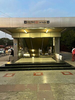
Lal Qila metro station
Metro station in Delhi, India
Distance: Approx. 280 meters
Latitude and longitude: 28.65665689,77.236693
Lal Qila is a station on the Violet Line of Delhi Metro system. This station serves the iconic Red Fort (Lal Qila) and the nearby Chandni Chowk in Delhi.
Dharampura Haveli
Distance: Approx. 501 meters
Latitude and longitude: 28.6533046,77.2322728
Haveli Dharampura, built in 1887 CE and currently owned by BJP leader Vijay Goel, is a 19th-century haveli in Chandani Chowk area of old Delhi that as awarded a special mention in UNESCO Asia-Pacific Awards for Cultural Heritage Conservation in 2017.
Weather in this IP's area
mist
28 Celsius
33 Celsius
28 Celsius
28 Celsius
1005 hPa
83 %
1005 hPa
980 hPa
4000 meters
40 %
06:07:05
18:24:09