202.150.55.212 - IP Lookup: Free IP Address Lookup, Postal Code Lookup, IP Location Lookup, IP ASN, Public IP
Country:
 Japan
JapanRegion:
City:
Location:
Time Zone:
Postal Code:
ISP:
ASN:
language:
User-Agent:
Proxy IP:
Blacklist:
IP information under different IP Channel
ip-api
Country
Region
City
ASN
Time Zone
ISP
Blacklist
Proxy
Latitude
Longitude
Postal
Route
db-ip
Country
Region
City
ASN
Time Zone
ISP
Blacklist
Proxy
Latitude
Longitude
Postal
Route
IPinfo
Country
Region
City
ASN
Time Zone
ISP
Blacklist
Proxy
Latitude
Longitude
Postal
Route
IP2Location
202.150.55.212Country
jpRegion
aichi
City
tokoname
Time Zone
Asia/Tokyo
ISP
Language
User-Agent
Latitude
Longitude
Postal
ipdata
Country
Region
City
ASN
Time Zone
ISP
Blacklist
Proxy
Latitude
Longitude
Postal
Route
Popular places and events near this IP address
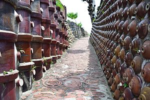
Tokoname
City in Chūbu, Japan
Distance: Approx. 397 meters
Latitude and longitude: 34.88652778,136.83233333
Tokoname (常滑市, Tokoname-shi) is a city in Aichi Prefecture, Japan. As of 1 October 2019, the city had an estimated population of 57,872 in 24,872 households, and a population density of 1,035 persons per km2. The total area of the city is 55.90 square kilometres (21.58 sq mi).

Chubu Centrair International Airport
Primary airport serving Nagoya, Japan
Distance: Approx. 3735 meters
Latitude and longitude: 34.85833333,136.80527778
Chubu Centrair International Airport (中部国際空港, Chūbu Kokusai Kūkō) (IATA: NGO, ICAO: RJGG) is an international airport on an artificial island (which also houses the Aichi International Exhibition Center) in Ise Bay, Tokoname City in Aichi Prefecture, 35 km (22 mi) south of Nagoya in central Japan. The airport covers about 470 hectares (1,161 acres) of land and has one 3,500 m (11,500 ft) runway. Centrair is classified as a first class airport and is the main international gateway for the Chubu ("central") region of Japan.

Chubu International Airport Connecting Road
Distance: Approx. 1588 meters
Latitude and longitude: 34.87382,136.819696
The Chubu International Airport Connecting Road (中部国際空港連絡道路, Chūbu Kokusai Kūkō Renraku Dōro) is a 4-laned toll road in Tokoname, Aichi, Japan. It is managed by Aichi Prefectural Road Public Corporation.

Nishinokuchi Station
Railway station in Tokoname, Aichi Prefecture, Japan
Distance: Approx. 4890 meters
Latitude and longitude: 34.9266,136.8265
Nishinokuchi Station (西ノ口駅, Nishinokuchi-eki) is a railway station in the city of Tokoname, Aichi, Japan, operated by Meitetsu.
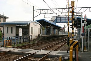
Kabaike Station
Railway station in Tokoname, Aichi Prefecture, Japan
Distance: Approx. 3674 meters
Latitude and longitude: 34.9155,136.826
Kabaike Station (蒲池駅, Kabaike-eki) is a railway station in the city of Tokoname, Aichi, Japan, operated by Meitetsu.
Enokido Station (Aichi)
Railway station in Tokoname, Aichi Prefecture, Japan
Distance: Approx. 2491 meters
Latitude and longitude: 34.905,136.828
Enokido Station (榎戸駅, Enokido-eki) is a railway station in the city of Tokoname, Aichi, Japan, operated by Meitetsu.

Taya Station
Railway station in Tokoname, Aichi Prefecture, Japan
Distance: Approx. 1571 meters
Latitude and longitude: 34.897,136.8308
Taya Station (多屋駅, Taya-eki) is a railway station in the city of Tokoname, Aichi, Japan, operated by Meitetsu.
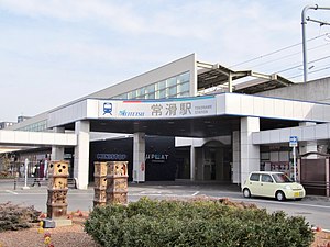
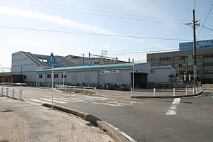
Tokoname Station
Railway station in Tokoname, Aichi Prefecture, Japan
Distance: Approx. 944 meters
Latitude and longitude: 34.8913,136.8351
Tokoname Station (常滑駅, Tokoname-eki) is a junction railway station in the city of Tokoname, Aichi, Japan, operated by Meitetsu.

Rinkū Tokoname Station
Railway station in Tokoname, Aichi Prefecture, Japan
Distance: Approx. 586 meters
Latitude and longitude: 34.8795,136.8282
Rinkū Tokoname Station (りんくう常滑駅, Rinkū Tokoname-eki) is a railway station in the city of Tokoname, Aichi, Japan, operated by Meitetsu.

Central Japan International Airport Station
Railway station in Tokoname, Aichi Prefecture, Japan
Distance: Approx. 3019 meters
Latitude and longitude: 34.8595,136.8165
Central Japan International Airport Station (中部国際空港駅, Chūbukokusaikūkō-eki) is a railway station in the city of Tokoname, Aichi, Japan, owned by Central Japan International Airport Line Company, Ltd. and leased to the private railway operator Meitetsu. The station serves Chūbu Centrair International Airport and the station concourse is connected to Terminal 1 by a short walkway and to the Flight of Dreams and Terminal 2 by a passage through the P1 parking lot building.

Ōno Castle (Chita District, Owari Province)
Distance: Approx. 5065 meters
Latitude and longitude: 34.9285,136.8337
Ōno Castle (大野城, Ōno-jō) is a Japanese castle located in Ōno, Chita District, Aichi, former Owari Province. It is also known as Miyayama Castle (宮山城). The area is since 1954 a part of the town of Tokoname in Aichi Prefecture.

Shōjū-in, Tokoname
Distance: Approx. 890 meters
Latitude and longitude: 34.879343,136.841672
Shōjū-in (正住院) is a Buddhist temple of the Jōdo-shū, located in Tokoname, Aichi Prefecture, central Japan.
Weather in this IP's area
broken clouds
9 Celsius
8 Celsius
9 Celsius
9 Celsius
1021 hPa
61 %
1021 hPa
1023 hPa
10000 meters
2.57 m/s
270 degree
75 %