202.150.50.164 - IP Lookup: Free IP Address Lookup, Postal Code Lookup, IP Location Lookup, IP ASN, Public IP
Country:
Region:
City:
Location:
Time Zone:
Postal Code:
IP information under different IP Channel
ip-api
Country
Region
City
ASN
Time Zone
ISP
Blacklist
Proxy
Latitude
Longitude
Postal
Route
Luminati
Country
Region
23
City
nagoya
ASN
Time Zone
Asia/Tokyo
ISP
Chubu Telecommunications Company, Inc.
Latitude
Longitude
Postal
IPinfo
Country
Region
City
ASN
Time Zone
ISP
Blacklist
Proxy
Latitude
Longitude
Postal
Route
IP2Location
202.150.50.164Country
Region
aichi
City
tokai
Time Zone
Asia/Tokyo
ISP
Language
User-Agent
Latitude
Longitude
Postal
db-ip
Country
Region
City
ASN
Time Zone
ISP
Blacklist
Proxy
Latitude
Longitude
Postal
Route
ipdata
Country
Region
City
ASN
Time Zone
ISP
Blacklist
Proxy
Latitude
Longitude
Postal
Route
Popular places and events near this IP address
Tōkai, Aichi
City in Chūbu, Japan
Distance: Approx. 701 meters
Latitude and longitude: 35.02305556,136.90219444
Tōkai (東海市, Tōkai-shi) is a city located in Aichi Prefecture, Japan. As of 1 October 2019, the city had an estimated population of 113,698 in 51,035 households, and a population density of 2,618 persons per km2. The total area of the city was 43.43 square kilometres (16.77 sq mi).
Chita, Aichi
City in Chūbu, Japan
Distance: Approx. 3588 meters
Latitude and longitude: 35,136.86666667
Chita (知多市, Chita-shi) is a city in Aichi Prefecture, Japan. As of 1 October 2019, the city had an estimated population of 83,891 in 35,798 households, and a population density of 1,828 persons per km2. The total area of the city is 45.90 km2 (17.72 sq mi).
Shin Nittetsu-mae Station
Railway station in Tōkai, Aichi Prefecture, Japan
Distance: Approx. 2038 meters
Latitude and longitude: 35.0353,136.8993
Shin Nittetsu-mae Station (新日鉄前駅, Shin Nittetu-mae-eki) is a railway station in the city of Tōkai, Aichi Prefecture, Japan, operated by Meitetsu.
Shūrakuen Station
Railway station in Tōkai, Aichi Prefecture, Japan
Distance: Approx. 2906 meters
Latitude and longitude: 35.043,136.9029
Shūrakuen Station (聚楽園駅, Shūrakuen-eki) is a railway station in the city of Tōkai, Aichi Prefecture, Japan, operated by Meitetsu.

Ōtagawa Station
Railway station in Tōkai, Aichi Prefecture, Japan
Distance: Approx. 792 meters
Latitude and longitude: 35.0203,136.8924
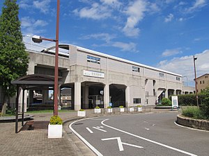
Ōtagawa Station (太田川駅, Ōtagawa-eki) is a junction railway station in the city of Tōkai, Aichi Prefecture, Japan, operated by Meitetsu.

Owari Yokosuka Station
Railway station in Tōkai, Aichi Prefecture, Japan
Distance: Approx. 1494 meters
Latitude and longitude: 35.0103,136.8859
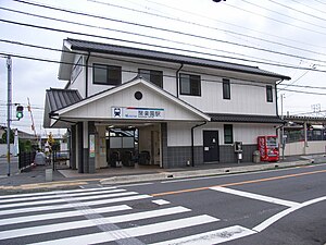
Owari Yokosuka Station (尾張横須賀駅, Owari Yokosuka-eki) is a railway station in the city of Tōkai, Aichi Prefecture, Japan, operated by Meitetsu.

Teramoto Station
Railway station in Chita, Aichi Prefecture, Japan
Distance: Approx. 2920 meters
Latitude and longitude: 35.0004,136.8753
Teramoto Station (寺本駅, Teramoto-eki) is a railway station in the city of Chita, Aichi, Japan, operated by Meitetsu.

Takayokosuka Station
Railway station in Tōkai, Aichi Prefecture, Japan
Distance: Approx. 999 meters
Latitude and longitude: 35.0096,136.8939
Takayokosuka Station (高横須賀駅, Takayokosuka-eki) is a railway station in the city of Tōkai, Aichi Prefecture, Japan, operated by Meitetsu.

Minami Kagiya Station
Railway station in Tōkai, Aichi Prefecture, Japan
Distance: Approx. 3156 meters
Latitude and longitude: 34.9892,136.9069
Minami Kagiya Station (南加木屋駅, Minami Kagiya-eki) is a railway station in the city of Tōkai, Aichi Prefecture, Japan, operated by Meitetsu.
Chita Daini Thermal Power Station
Distance: Approx. 3479 meters
Latitude and longitude: 35.00655,136.86413333
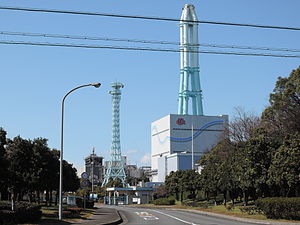
Chita Daini Thermal Power Station (知多第二火力発電所, Chita Dai-ni Karyoku Hatsudensho) is an LNG-fired thermal power station operated by JERA in the city of Chita, Aichi, Japan. The facility is located on reclaimed land at the east side of Ise Bay. It is located about three kilometers northeast of the Chita Thermal Power Station.

Nagakusa Tenjin Shrine
Shrine for Tenjin
Distance: Approx. 4126 meters
Latitude and longitude: 35.02909,136.94288
Nagakusa Tenjinsha (長草天神社) is a Shinto shrine in Aichi Prefecture, Obu City.

Kagiya-nakanoike Station
Railway station in Tōkai, Aichi Prefecture, Japan
Distance: Approx. 1906 meters
Latitude and longitude: 35,136.90258333
Kagiya-nakanoike Station (加木屋中ノ池駅, Kagiya-nakanoike-eki) is a railway station in the city of Tōkai, Aichi Prefecture, Japan, operated by Meitetsu.
Weather in this IP's area
scattered clouds
8 Celsius
4 Celsius
8 Celsius
9 Celsius
1006 hPa
83 %
1006 hPa
1005 hPa
10000 meters
10.8 m/s
270 degree
26 %


