Country:
 Pakistan
Region:
City:
Latitude and Longitude:
Time Zone:
Postal Code:
IP information under different IP Channel
ip-api
Country
Region
City
ASN
Time Zone
ISP
Blacklist
Proxy
Latitude
Longitude
Postal
Route
Luminati
Country
PKRegion
sd
City
karachi
ASN
Time Zone
Asia/Karachi
ISP
Multinet Pakistan Pvt. Ltd.
Latitude
Longitude
Postal
IPinfo
Country
Region
City
ASN
Time Zone
ISP
Blacklist
Proxy
Latitude
Longitude
Postal
Route
db-ip
Country
Region
City
ASN
Time Zone
ISP
Blacklist
Proxy
Latitude
Longitude
Postal
Route
ipdata
Country
Region
City
ASN
Time Zone
ISP
Blacklist
Proxy
Latitude
Longitude
Postal
Route
Popular places and events near this IP address
Nawabad
Residential neighborhood locality in Karachi, Pakistan
Distance: Approx. 860 meters
Latitude and longitude: 24.86666667,67
Nawabad or Nayaabad or Naya Abad (Urdu: نو آباد) is a neighbourhood in Lyari, located in the Karachi South district of Karachi, Pakistan. There are several ethnic groups in Nawabad including Muhajirs, Sindhis, Punjabis, Kashmiris, Seraikis, Pakhtuns, Balochis, Memons, Bohras and Ismailis. Over 99% of the population is Muslim.
Chakiwara
Neighbourhood locality in the city of Karachi, Pakistan
Distance: Approx. 860 meters
Latitude and longitude: 24.86666667,67
Chakiwara (Urdu: چاکیواڑا) is a neighbourhood locality in Lyari, located in the Karachi South district of Karachi, Pakistan. The area gets its name from the Chakee, a community of Gujarati Muslims. Chakiwara is home mainly to the Balochs, and other Gujarati Muslims such as the Ghanchi, Chhipa and Kachchi.
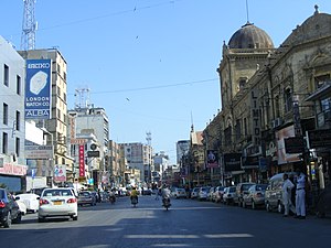
Saddar Town
Residential town within the city of Karachi, Pakistan
Distance: Approx. 486 meters
Latitude and longitude: 24.8575,67.00277778
Saddar Town (صدر ٹاؤن), lies in the District Karachi South of the city that formed much of the historic colonial core of Karachi, Sindh province of Pakistan. According to 2023 Pakistani census Saddar Subdivision had a population 159,363.
Baghdadi, Karachi
Neighbourhood locality in the city of Karachi, Pakistan
Distance: Approx. 346 meters
Latitude and longitude: 24.8618,66.9966
Baghdadi (Urdu: بغدادی) is a residential neighbourhood in Lyari, located in the Karachi South district of Karachi, Pakistan.
Denso Hall
Library in Karachi, Pakistan
Distance: Approx. 897 meters
Latitude and longitude: 24.853,67.0041
Denso Hall (Urdu: ڈینسو ہال), officially The Max Denso Hall and Library, is a library located in Karachi, Pakistan. It was built in 1886 as the first library in Karachi to serve the native population.
Church Mission School
Public school
Distance: Approx. 834 meters
Latitude and longitude: 24.8618,67.006
The Church Mission School (CMS), officially known as CMS Government Boys Higher Secondary School, is a public school located in Karachi, Sindh, Pakistan. The school was operated by the Christ Church before its 1971 nationalisation. Azizullah Sharif of Dawn stated that CMS, while operated by the church, was "one of the best educational institutions of the city where many students passed their matric examinations with flying colours." As of 2010, four institutions occupy the complex: CMS Primary School, CMS Secondary School, Cutchhi Memon Association (CMA) Primary, and CMA Girls Secondary School.

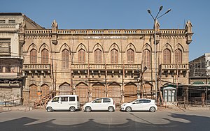
Lakshmi Building
Building in Karachi, Pakistan
Distance: Approx. 889 meters
Latitude and longitude: 24.85222222,67.00277778
Lakshmi Building is located in Karachi, Sindh, Pakistan. It is located at the intersection of Muhammad Ali Jinnah Road and Aiwan-e-Tijarat Road in Karachi's Mithadar district. Built in 1938, the Lakshmi Building was Karachi's tallest building at the time of Pakistan's independence and thereafter until it was surpassed in 1955 by Qamar House in the adjacent neighborhood of Kharadar.

New Memon Masjid
Mosque in Karachi, Pakistan
Distance: Approx. 876 meters
Latitude and longitude: 24.8514,67.0001
The New Memon Masjid (Urdu: نئی میمن مسجد) known as the Memon Masjid is a mosque located in Karachi, Pakistan. It is one of the largest and oldest mosques in the city. The first committee of the Memon Masjid was formed on 17 September 1948, The First Adhan, also known as Azan or Azaan was given on 15 July 1949.
Pamwal Das Shiv Mandir
Hindu temple in Sindh, Pakistan
Distance: Approx. 288 meters
Latitude and longitude: 24.85652778,66.998
Pamwal Das Shiv Mandir at Pawaldass compound at Kakri Ground in Baghdadi area of Lyari Town. According to the Human Rights Commission of Pakistan and The News International Muslim clerics have illegally turned this centuries-old historic temple into a Muslim pir and slaughterhouse for cows with the help of Baghdadi police after making series of attacks on Hindu families living in the area.
Spencer Eye Hospital
Pakistani hospital
Distance: Approx. 712 meters
Latitude and longitude: 24.863778,67.003102
The Spencer Eye Hospital is an eye hospital located in Karachi, Pakistan. It is the oldest specialized hospital of Pakistan, having been established in 1938 (or 1940) and is run by the Karachi Metropolitan Corporation.
Kharadar General Hospital
Hospital in Karachi, Pakistan
Distance: Approx. 682 meters
Latitude and longitude: 24.853651,66.995216
Kharadar General Hospital, formerly known as Cement Hospital, (Urdu: کھارادر جنرل ہسپتال) is a private hospital located in Kharadar, a neighborhood in Karachi, Pakistan. The hospital provides medical services to patients in various fields such as internal medicine, pediatrics, gynecology, surgery, and orthopedics, among others.
Aga Khan Secondary Hospital, Kharadar
Hospital in Karachi
Distance: Approx. 534 meters
Latitude and longitude: 24.854741,66.996086
The Aga Khan Secondary Hospital, Kharadar (AKHW&C), also known as Aga Khan Hospital for Women and Children, Kharadar, formerly known as Janbai Maternity Home, is a non-profit hospital in Karachi, Pakistan. It is one of the oldest hospital in Karachi.
Weather in this IP's area
smoke
26 Celsius
26 Celsius
26 Celsius
26 Celsius
1013 hPa
89 %
1013 hPa
1011 hPa
5000 meters
2.06 m/s
250 degree
20 %
06:40:30
17:50:33