202.138.202.239 - IP Lookup: Free IP Address Lookup, Postal Code Lookup, IP Location Lookup, IP ASN, Public IP
Country:
Region:
City:
Location:
Time Zone:
Postal Code:
IP information under different IP Channel
ip-api
Country
Region
City
ASN
Time Zone
ISP
Blacklist
Proxy
Latitude
Longitude
Postal
Route
Luminati
Country
Region
vic
City
melbourne
ASN
Time Zone
Australia/Melbourne
ISP
AAPT Limited
Latitude
Longitude
Postal
IPinfo
Country
Region
City
ASN
Time Zone
ISP
Blacklist
Proxy
Latitude
Longitude
Postal
Route
IP2Location
202.138.202.239Country
Region
victoria
City
boronia
Time Zone
Australia/Melbourne
ISP
Language
User-Agent
Latitude
Longitude
Postal
db-ip
Country
Region
City
ASN
Time Zone
ISP
Blacklist
Proxy
Latitude
Longitude
Postal
Route
ipdata
Country
Region
City
ASN
Time Zone
ISP
Blacklist
Proxy
Latitude
Longitude
Postal
Route
Popular places and events near this IP address

Bayswater, Victoria
Suburb of Melbourne, Victoria, Australia
Distance: Approx. 2961 meters
Latitude and longitude: -37.843,145.268
Bayswater is a residential and industrial suburb in Melbourne, Victoria, Australia, 27 km (17 mi) east of Melbourne's Central Business District, located within the City of Knox local government area. Bayswater recorded a population of 12,262 at the 2021 census.

Ferntree Gully, Victoria
Suburb of Melbourne, Victoria, Australia
Distance: Approx. 2173 meters
Latitude and longitude: -37.8862,145.2821
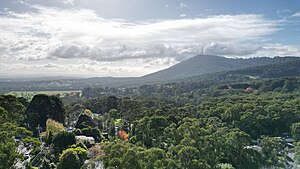
Ferntree Gully is a suburb in Melbourne, Victoria, Australia, at the foothills of the Dandenong Ranges, 30 km east of Melbourne's Central Business District, located within the City of Knox local government area. Ferntree Gully recorded a population of 27,398 at the 2021 census. Ferntree Gully, The Basin, Boronia and Upper Ferntree Gully are the only Dandenong Ranges towns or suburbs in the City of Knox (although some parts of Upper Ferntree Gully are within the Shire of Yarra Ranges).

The Basin, Victoria
Suburb of Melbourne, Victoria, Australia
Distance: Approx. 2799 meters
Latitude and longitude: -37.86,145.314
The Basin is a suburb in Melbourne, Victoria, Australia, 31 km east of Melbourne's Central Business District, located within the City of Knox local government area. The Basin recorded a population of 4,497 at the 2021 census.
Boronia, Victoria
Suburb of Melbourne, Victoria, Australia
Distance: Approx. 574 meters
Latitude and longitude: -37.862,145.286
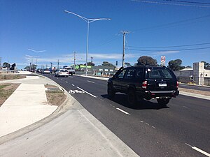
Boronia is an eastern suburb in Melbourne, Victoria, Australia, 29 km east of Melbourne's Central Business District, located within the City of Knox local government area. Boronia recorded a population of 23,607 at the 2021 census. The area was originally occupied by the Wurundjeri, Indigenous Australians of the Kulin nation, who spoke variations of the Woiwurrung language group.

Bayswater railway station, Melbourne
Railway station in Melbourne, Australia
Distance: Approx. 3087 meters
Latitude and longitude: -37.8417,145.2681
Bayswater railway station is a commuter railway station on the Belgrave line, part of the Melbourne railway network. It serves the eastern Melbourne suburb of Bayswater in Victoria, Australia. Bayswater is a below ground premium station, featuring an island platform with two faces.

Boronia railway station
Railway station in Melbourne, Australia
Distance: Approx. 703 meters
Latitude and longitude: -37.86044,145.28434
Boronia railway station is a commuter railway station on the Belgrave line, part of the Melbourne railway network. It serves the eastern Melbourne suburb of Boronia in Victoria, Australia. Boronia is a below ground premium station, featuring an island platform with two faces.

Ferntree Gully railway station
Railway station in Melbourne, Australia
Distance: Approx. 1955 meters
Latitude and longitude: -37.88156,145.29516
Ferntree Gully railway station is a commuter railway station on the Belgrave line, part of the Melbourne railway network. It serves the eastern Melbourne suburb of Ferntree Gully in Victoria, Australia. Ferntree Gully is a ground level premium station, featuring two side platforms.
St Joseph's College, Ferntree Gully
Private school in Ferntree Gully, Victoria, Australia
Distance: Approx. 3008 meters
Latitude and longitude: -37.89166667,145.29638889
St Joseph's College is a Salesian Roman Catholic boys' secondary school in the outer-eastern suburb of Ferntree Gully, Melbourne, Victoria, Australia.
Boronia Heights College
School in Australia
Distance: Approx. 1712 meters
Latitude and longitude: -37.86,145.30083333
Boronia Heights College was a public secondary school in Boronia, a suburb of Melbourne, Victoria, Australia. It has formerly had the names of Boronia Technical School and Boronia Heights Secondary College. In 2014, Boronia Heights College merged with Boronia Primary School to form Boronia K-12 College.
The Basin Music Festival
Annual festival near Melbourne, Australia
Distance: Approx. 2790 meters
Latitude and longitude: -37.86,145.31388889
The Basin Music Festival is held every March in the small fringe suburb/village of The Basin at the foot of Mount Dandenong, on the eastern outskirts of Melbourne, Australia. The first festival took place in March 2005. Growing out of the music found in the community, the non-profit, volunteer-run festival presents an eclectic collection of musical styles, including but not limited to rock, jazz, blues, folk, country and world music.
Swagman Restaurant
Restaurant in Melbourne, Australia
Distance: Approx. 2463 meters
Latitude and longitude: -37.88833333,145.28916667
The Swagman Restaurant was a restaurant in Ferntree Gully, Melbourne, Australia, which opened in 1972 and was destroyed by fire in 1991. The restaurant was famous in Melbourne for its long-running television commercials, cabaret shows, and smorgasbord. The Swagman was located on Burwood Highway, Ferntree Gully.
St Andrews Christian College
School in Wantirna South, Victoria, Australia
Distance: Approx. 3483 meters
Latitude and longitude: -37.87388889,145.24472222
St Andrews Christian College is an independent, co-educational school situated in the eastern Melbourne suburb of Wantirna South. The school was founded in 1983 by the Presbyterian Church of Victoria, and takes students from Prep to Year 12. The College expresses a Christian and biblical perspective and approach in its curriculum and culture.
Weather in this IP's area
scattered clouds
27 Celsius
26 Celsius
25 Celsius
28 Celsius
1006 hPa
32 %
1006 hPa
994 hPa
10000 meters
1.34 m/s
4.47 m/s
43 degree
32 %
