Country:
 New Zealand
Region:
City:
Latitude and Longitude:
Time Zone:
Postal Code:
IP information under different IP Channel
ip-api
Country
Region
City
ASN
Time Zone
ISP
Blacklist
Proxy
Latitude
Longitude
Postal
Route
IPinfo
Country
Region
City
ASN
Time Zone
ISP
Blacklist
Proxy
Latitude
Longitude
Postal
Route
MaxMind
Country
Region
City
ASN
Time Zone
ISP
Blacklist
Proxy
Latitude
Longitude
Postal
Route
Luminati
Country
NZRegion
hkb
City
napiercity
ASN
Time Zone
Pacific/Auckland
ISP
Mercury NZ Limited
Latitude
Longitude
Postal
db-ip
Country
Region
City
ASN
Time Zone
ISP
Blacklist
Proxy
Latitude
Longitude
Postal
Route
ipdata
Country
Region
City
ASN
Time Zone
ISP
Blacklist
Proxy
Latitude
Longitude
Postal
Route
Popular places and events near this IP address

Hastings, New Zealand
City in North Island, New Zealand
Distance: Approx. 1350 meters
Latitude and longitude: -39.64166667,176.84444444
Hastings (; Māori: Heretaunga) is an inland city of New Zealand and is one of the two major urban areas in Hawke's Bay, on the east coast of the North Island. The population of Hastings (including Flaxmere) is 51,500 (as of June 2023), with a further 15,200 people in Havelock North and 2,090 in Clive. Hastings is about 18 kilometres inland of the coastal city of Napier.

Hastings District, New Zealand
Territorial authority district in Hawke's Bay Region, New Zealand
Distance: Approx. 962 meters
Latitude and longitude: -39.645,176.843
Hastings District is a Territorial authority district within the Hawke's Bay Region, on the east coast of the North Island of New Zealand. It covers the southern half of the Hawke's Bay coast, excluding Napier City, which is a separate territorial authority. Hastings District Council is headquartered in the city of Hastings, the district's largest town.

Heretaunga Street
Street in New Zealand
Distance: Approx. 1254 meters
Latitude and longitude: -39.642318,176.843573
Heretaunga Street (Māori pronunciation: [hɛɾɛˈtɑːʉŋa]) is the main arterial road through Hastings, New Zealand. The street forms the heart of the Central Business District of Hastings City across six blocks numbered 100, 200, and 300 Blocks with the railway line dividing the blocks by East and West. The name Heretaunga is taken from the name of the Māori Land Block on which Hastings was established in 1873.
Raureka
Suburb of Hastings, New Zealand
Distance: Approx. 1070 meters
Latitude and longitude: -39.64583333,176.82916667
Raureka is a suburb of Hastings City, in the Hawke's Bay Region of New Zealand's North Island. The suburb has three council-owned parks: Ebbett Park, St Leonards Park and Whenua Takoha Reserve. Raureka locals established a campaign in 2018 to stop the council selling part of Ebbett Park to developers.
Hastings Boys' High School
School
Distance: Approx. 346 meters
Latitude and longitude: -39.6501,176.8357
Hastings Boys' High School is a boys' secondary school in Hastings, New Zealand. The school is part of the Super 8. The school was founded in 1904 as Hastings High School.
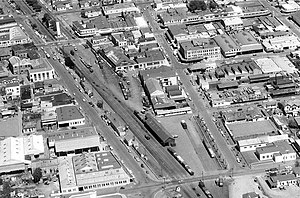
Hastings railway station, New Zealand
Defunct railway station in New Zealand
Distance: Approx. 1684 meters
Latitude and longitude: -39.6391,176.8465
The Hastings railway station in Hastings, New Zealand is the main railway station in Hastings and an intermediate stop on the Palmerston North–Gisborne Line. The station is on the corner of Russell Street (which ran alongside the line) and St Aubyn Street, and is close to the centre of Hastings. It is no longer used by any regularly-scheduled passenger services.
Akina, New Zealand
Suburb of Hastings, New Zealand
Distance: Approx. 675 meters
Latitude and longitude: -39.651266,176.845557
Akina is a suburb of Hastings City, in the Hawke's Bay Region of New Zealand's North Island. The suburb includes Akina Park, Hawke's Bay soccer and softball park.
Hastings Central
Central Business District of Hastings, New Zealand
Distance: Approx. 1276 meters
Latitude and longitude: -39.642031,176.843341
Hastings Central is the central suburb and business district of Hastings City, in the Hawke's Bay Region of New Zealand's North Island.

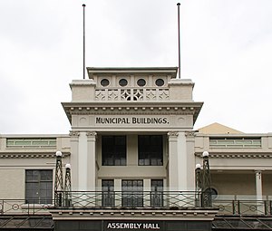
Hastings District Council
Territorial authority for the Hastings District of New Zealand
Distance: Approx. 849 meters
Latitude and longitude: -39.6453153,176.840366
Hastings District Council (Māori: Te Kaunihera ā-Rohe o Heretaunga) is the territorial authority for the Hastings District of New Zealand. The council covers the urban areas of Havelock North, Hastings and Flaxmere, and the surrounding settlements of Clive, Te Awanga, Haumoana and Waimarama. It was formed in 1989, through the merger of Hastings City Council, Havelock North Borough Council and the Hawke's Bay County Council.

Longlands, New Zealand
Rural community in Hawke's Bay Region, New Zealand
Distance: Approx. 879 meters
Latitude and longitude: -39.66,176.834
Longlands is a rural community in the Hastings District and Hawke's Bay Region of New Zealand's North Island. The area is on the southern and western outskirts of Hastings city. The Longlands Estate occupied much of the land around 1880, but was broken up into smaller farms and a freezing works in the early 20th century.
Rush Munro's
New Zealand ice creamery
Distance: Approx. 1187 meters
Latitude and longitude: -39.6432,176.8442
Rush Munro's is the oldest running ice creamery in New Zealand. It is based in Hawke's Bay, and its ice cream is sold in supermarkets, cafés, restaurants and ice cream parlours. The company still uses the 1926 recipes of founder Frederick Charles Rush Munro, which contain no preservatives or food colourings.

Hastings Clock Tower
Clocktower in New Zealand
Distance: Approx. 1264 meters
Latitude and longitude: -39.64202778,176.84294444
The Hastings Clock Tower is a public landmark in the New Zealand city of Hastings. Designed by Sidney George Chaplin, and erected in 1935, the tower is located in the Hastings central business district alongside the Palmerston North-Gisborne railway line adjacent to the intersection of Heretaunga Street and Russell Street. The clock tower was designed as a symbol of recovery from the 1931 Hawke's Bay earthquake and was not intended as a memorial; however, in 1995, brass plaques were added to the tower in memory of those who died during the earthquake.
Weather in this IP's area
overcast clouds
9 Celsius
9 Celsius
9 Celsius
9 Celsius
1026 hPa
88 %
1026 hPa
1024 hPa
10000 meters
1.87 m/s
2.13 m/s
243 degree
100 %
06:19:35
19:35:22