Country:
 Hong Kong (China)
Region:
City:
Latitude and Longitude:
Time Zone:
Postal Code:
IP information under different IP Channel
ip-api
Country
Region
City
ASN
Time Zone
ISP
Blacklist
Proxy
Latitude
Longitude
Postal
Route
IPinfo
Country
Region
City
ASN
Time Zone
ISP
Blacklist
Proxy
Latitude
Longitude
Postal
Route
MaxMind
Country
Region
City
ASN
Time Zone
ISP
Blacklist
Proxy
Latitude
Longitude
Postal
Route
Luminati
Country
ASN
db-ip
Country
Region
City
ASN
Time Zone
ISP
Blacklist
Proxy
Latitude
Longitude
Postal
Route
ipdata
Country
Region
City
ASN
Time Zone
ISP
Blacklist
Proxy
Latitude
Longitude
Postal
Route
Popular places and events near this IP address

Admiralty station (MTR)
MTR interchange station on Hong Kong Island
Distance: Approx. 129 meters
Latitude and longitude: 22.2788,114.1646
Admiralty (Chinese: 金鐘; Jyutping: Gam1 zung1; Cantonese Yale: Gāmjūng) is a station of the MTR rapid transit system in Admiralty, Hong Kong. The station's livery is blue and white. Served by the largest number of lines of any MTR station at four: the East Rail line, the Tsuen Wan line, the Island line, and the South Island line, Admiralty is a major interchange station within the MTR network.

High Court of Hong Kong
Superior court of record with unlimited civil and criminal jurisdiction in Hong Kong
Distance: Approx. 186 meters
Latitude and longitude: 22.27833333,114.16333333
The High Court of the Hong Kong Special Administrative Region is a part of the legal system of Hong Kong. It consists of the Court of Appeal and the Court of First Instance; it deals with criminal and civil cases which have risen beyond the lower courts. It is a superior court of record of unlimited civil and criminal jurisdiction.
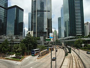
Queensway, Hong Kong
Road in Admiralty, Hong Kong
Distance: Approx. 143 meters
Latitude and longitude: 22.2789,114.1645
Queensway is a major road in the Admiralty area of Central, Hong Kong. It was originally a section of Queen's Road East and forms part of the continuum of Queen's Road that had been split into Queen's Road West, Queen's Road Central, Queensway, and Queen's Road East after World War II. At its western end it splits into Queen's Road Central and Des Voeux Road Central while at its eastern end it merges into Hennessy Road, at the junction with Queen's Road East.

Victoria Barracks, Hong Kong
Distance: Approx. 178 meters
Latitude and longitude: 22.279,114.164
The Victoria Barracks (Chinese: 域多利兵房) were a barracks in the Admiralty area of Central on Hong Kong Island, Hong Kong. The barracks were constructed between the 1840s and 1874, and situated within the area bounded by Cotton Tree Drive, Kennedy Road and Queensway. Together with Murray Barracks, Wellington Barracks and Admiralty Dock, the barracks formed a British military zone in Central.
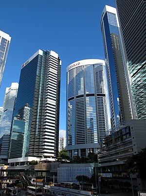
Pacific Place (Hong Kong)
Building complex in Admiralty, Hong Kong
Distance: Approx. 48 meters
Latitude and longitude: 22.27726944,114.16493056
Pacific Place is a complex of office towers and hotels and a shopping centre situated at 88 Queensway, Admiralty, Hong Kong. The latest phase, Three Pacific Place, is located at 1 Queen's Road East, Wan Chai. The four-level shopping centre is home to over 160 shops and boutiques and one major department store.
Wellington Barracks, Hong Kong
Military barracks in Admiralty, Hong Kong
Distance: Approx. 108 meters
Latitude and longitude: 22.278,114.166
Wellington Barracks (Chinese: 威靈頓兵房) was a military barracks located to the east of Garden Road in Admiralty, Hong Kong. One of many military complexes constructed by the British Army in the area, the land was returned to the Hong Kong government in the 1970s and gradually reverted to civilian use. As a result, the barracks was closed at the end of that decade, demolished in the mid-1980s and replaced with Harcourt Garden.

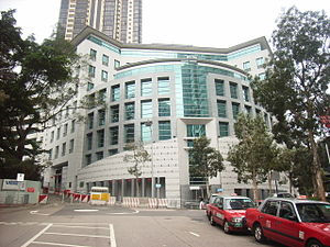
High Court Building (Hong Kong)
Distance: Approx. 191 meters
Latitude and longitude: 22.27824,114.16324
The High Court Building of Hong Kong is located at 38 Queensway, Admiralty, and is home to the High Court. The 20 storey building was built in 1985 as the home of the then Supreme Court of Hong Kong, which was renamed in 1997. The structure is a white clad tower and has a water fountain outside its front door.
Consulate General of the United Kingdom, Hong Kong
British Consulate General serving Hong Kong
Distance: Approx. 169 meters
Latitude and longitude: 22.27618056,114.16491667
The British Consulate General Hong Kong (BCGHK), located at 1 Supreme Court Road, Admiralty, Hong Kong Island, is one of the largest British consulates general in the world and is bigger than many British embassies and high commissions. It is responsible for maintaining British ties with Hong Kong and Macau. Together with the Consulate General of the United States of America, Hong Kong and Macau; the Consulate General of Malaysia; and the Consulate General of the Republic of Indonesia, the British consulate general is among the few consulates general in Hong Kong to be housed in its own building.
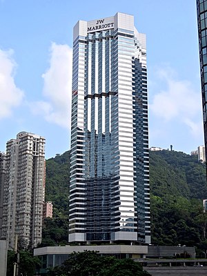
JW Marriott Hotel Hong Kong
Hotel in Hong Kong, China
Distance: Approx. 52 meters
Latitude and longitude: 22.27781,114.16549
The JW Marriott Hotel Hong Kong is a hotel of JW Marriott Hotels. It is located in the Admiralty area of Hong Kong, on the border of Wan Chai and Central, on Hong Kong Island. The hotel opened on 27 February 1989 in the Pacific Place complex.

Royal Naval Hospital (Hong Kong)
Former hospital in Hong Kong Island, Hong Kong
Distance: Approx. 138 meters
Latitude and longitude: 22.2784,114.1661
Royal Naval Hospital (Hong Kong) was the Royal Navy's medical facility in the colony. The RNH began in 1841 in a matshed on the site of the Wellington Barracks on Hong Kong Island. In early 1841, Hong Kong was occupied for the first time by British.

Queensway Government Offices
Building in Admiralty, Hong Kong
Distance: Approx. 115 meters
Latitude and longitude: 22.27777778,114.16388889
The Queensway Government Office Building (in short form QGO) is a skyscraper located in the Admiralty district of Hong Kong near Admiralty station. The tower rises 56 floors and 199 metres (653 ft) in height. The building was completed in 1985.

Admiralty (East) Public Transport Interchange
Distance: Approx. 116 meters
Latitude and longitude: 22.27861111,114.16555556
The Admiralty (East) Public Transport Interchange (Chinese: 金鐘(東)公共運輸交匯處) is a major bus terminus located in Admiralty, Central and Western District, Hong Kong. Located above Admiralty Station of the MTR, the terminus hosts bus routes to most destinations in the Southern District west of Deep Water Bay, so the usage is relatively high. The interchange has different names named by different bus companies.
Weather in this IP's area
scattered clouds
32 Celsius
37 Celsius
32 Celsius
33 Celsius
1014 hPa
62 %
1014 hPa
1011 hPa
10000 meters
2.24 m/s
280 degree
37 %
06:21:05
17:55:11