Country:
 Colombia
Region:
City:
Latitude and Longitude:
Time Zone:
Postal Code:
IP information under different IP Channel
ip-api
Country
Region
City
ASN
Time Zone
ISP
Blacklist
Proxy
Latitude
Longitude
Postal
Route
IPinfo
Country
Region
City
ASN
Time Zone
ISP
Blacklist
Proxy
Latitude
Longitude
Postal
Route
MaxMind
Country
Region
City
ASN
Time Zone
ISP
Blacklist
Proxy
Latitude
Longitude
Postal
Route
Luminati
Country
COASN
Time Zone
America/Bogota
ISP
Ses Astra S.A.
Latitude
Longitude
Postal
db-ip
Country
Region
City
ASN
Time Zone
ISP
Blacklist
Proxy
Latitude
Longitude
Postal
Route
ipdata
Country
Region
City
ASN
Time Zone
ISP
Blacklist
Proxy
Latitude
Longitude
Postal
Route
Popular places and events near this IP address

Bogotá Colombia Temple
Distance: Approx. 2965 meters
Latitude and longitude: 4.707801,-74.056247
The Bogotá Colombia Temple is the 57th operating temple of the Church of Jesus Christ of Latter-day Saints (LDS Church).
Colombia Masters
Golf tournament in Colombia
Distance: Approx. 2369 meters
Latitude and longitude: 4.712127,-74.040384
The Club Colombia Masters was a golf tournament co-sanctioned by the European Challenge Tour and the Tour de las Américas and was first played in 2007. The event was held at the Country Club de Bogotá, in Bogotá, Colombia. The tournament was organized by the Corporacion Internacional de Golf, managed by German Calle Jr.

93 Park
Park in Bogotá, Colombia
Distance: Approx. 2208 meters
Latitude and longitude: 4.67694444,-74.04861111
93 Park or 93rd Street Park (Parque de la calle 93, commonly known as Parque de la 93) is a commercial and recreational park located at the 93rd Street (calle 93) in El Chicó, in the north of Bogota, Colombia. It is an upmarket area popular for shopping, nightlife and restaurants.
HJCK
Radio station
Distance: Approx. 3128 meters
Latitude and longitude: 4.67055556,-74.05388889
HJCK El Mundo en Bogotá is a Colombian cultural radio station, founded 15 September 1950 and based in Bogotá. HJCK became an online-only station in 2005. HJCK was founded by intellectuals Eduardo Caballero Calderón, Hernando and Alfonso Martínez Rueda, Alfonso Peñaranda, Gonzalo Rueda Caro, Álvaro Castaño Castillo and his wife, Gloria Valencia de Castaño, as the first privately owned cultural radio station in Colombia.

Tren Turístico de la Sabana
Company that runs heritage trains in Bogota, Colombia
Distance: Approx. 359 meters
Latitude and longitude: 4.6906,-74.0382
The Tren Turístico de la Sabana or Turistren runs heritage trains in Bogota, Colombia. The company runs steam trains from Bogota (Sabana railway station) to Parque and Zipaquira.

New Granada Military University
University based in the city of Bogotá, Colombia
Distance: Approx. 1205 meters
Latitude and longitude: 4.68307,-74.0419
The New Granada Military University (Spanish: Universidad Militar Nueva Granada), also called UMNG or Unimilitar, is a public university, self-funded, national university based in the city of Bogotá, Colombia. The university has 8 faculties, 20 undergraduate, 66 graduate programs, 9 master's degrees, 44 Diploma and 52 research programs. The university offers academic programs for part-time (also referred as "distance") education, being one of the most important nationally.
El Chicó
Barrio in Distrito Capital, Colombia
Distance: Approx. 1816 meters
Latitude and longitude: 4.67877778,-74.04533333
El Chicó is an affluent neighbourhood (barrio) in the locality of Chapinero in Bogotá, Colombia.

1938 Santa Ana air show disaster
Distance: Approx. 743 meters
Latitude and longitude: 4.68527778,-74.0375
The 1938 Santa Ana air show disaster occurred on 24 July 1938 at a military review on the Campo de Marte in the Santa Ana district of Bogota, Colombia. During the review, a Curtiss Hawk II biplane of the Colombian Air Force piloted by Lieutenant César Abadia performed a stunt before crashing into a grandstand and then into the crowd. The pilot attempted to fly between the presidential stand and the stand for diplomats when he miscalculated the distance and the aircraft's wing-tip struck the diplomatic stand.
Lycée français Louis Pasteur (Colombia)
French international school in Bogota, Colombia
Distance: Approx. 2951 meters
Latitude and longitude: 4.6677,-74.0468
The Lycée français Louis Pasteur (Spanish: Liceo Francés Louis Pasteur) is a French international school in Bogotá, Colombia. It serves the levels maternelle until lycée (senior high school).

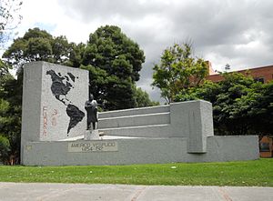
Carrera Séptima
Transit artery in Bogotá, Colombia
Distance: Approx. 321 meters
Latitude and longitude: 4.69277778,-74.0325
Carrera Séptima (Seventh Street), also known as Eduardo Posada Flórez Avenue, is one of the principal transit arteries which crosses the eastern side of Bogotá north and south. It is the most important thoroughfare of the city in the sense of history, culture, economy, and society. Carrera Séptima is bound to the east by the Eastern Hills.
Taipei Commercial Office in Bogotá, Colombia
Distance: Approx. 2297 meters
Latitude and longitude: 4.6750761,-74.0476239
The Taipei Commercial Office in Bogotá, Colombia (Chinese: 駐哥倫比亞代表處; pinyin: Zhù Gēlúnbǐyǎ Dàibiǎo Chù) (Spanish: Oficina Comercial de Taipéi en Bogotá, Colombia) represents the interests of Taiwan in Colombia in the absence of formal diplomatic relations, functioning as a de facto embassy. Until 1980, Colombia recognised Taiwan as the Republic of China, which, in addition to its embassy in Bogotá, had a consulate general in Barranquilla. In that year, it established diplomatic relations with the People's Republic of China.

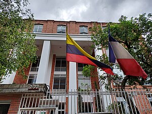
Embassy of the Philippines, Bogotá
Diplomatic mission of the Philippines in Colombia
Distance: Approx. 2690 meters
Latitude and longitude: 4.67188889,-74.04925
The Embassy of the Philippines in Bogotá is the diplomatic mission of the Republic of the Philippines to the Republic of Colombia. Opened in 2024, it is currently located in the barrio (neighborhood) of El Chicó, part of the locality of Chapinero in northern Bogotá.
Weather in this IP's area
broken clouds
14 Celsius
14 Celsius
14 Celsius
14 Celsius
1017 hPa
100 %
1017 hPa
752 hPa
10000 meters
1.03 m/s
75 %
05:40:54
17:41:09