Country:
Region:
City:
Latitude and Longitude:
Time Zone:
Postal Code:
IP information under different IP Channel
ip-api
Country
Region
City
ASN
Time Zone
ISP
Blacklist
Proxy
Latitude
Longitude
Postal
Route
Luminati
Country
ASN
Time Zone
America/Mexico_City
ISP
SECURITYSERVICES
Latitude
Longitude
Postal
IPinfo
Country
Region
City
ASN
Time Zone
ISP
Blacklist
Proxy
Latitude
Longitude
Postal
Route
db-ip
Country
Region
City
ASN
Time Zone
ISP
Blacklist
Proxy
Latitude
Longitude
Postal
Route
ipdata
Country
Region
City
ASN
Time Zone
ISP
Blacklist
Proxy
Latitude
Longitude
Postal
Route
Popular places and events near this IP address

San Pedro Garza García
Place in Nuevo León, Mexico
Distance: Approx. 2382 meters
Latitude and longitude: 25.66666667,-100.3
San Pedro Garza García (also known as San Pedro) is a city-municipality in the Mexican state of Nuevo León and part of the Monterrey Metropolitan area. It is a contemporary commercial suburb of the larger metropolitan city of Monterrey between Puente de la Unidad and the Alfa Planetarium, including areas surrounding Calzada del Valle/Calzada San Pedro. In 2018 it was evaluated as having the best quality of life in Mexico.

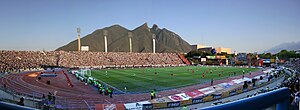
Estadio Tecnológico
Former stadium in Monterrey, Nuevo León, Mexico
Distance: Approx. 569 meters
Latitude and longitude: 25.65225,-100.286417
The Estadio Tecnológico was a multi-purpose stadium located in Monterrey, Nuevo León, Mexico, located on the campus of the Monterrey Institute of Technology and Higher Education (ITESM). It hosted football and American football games during its 67-year existence, from 1950 to 2017. Starting 2017, the stadium was demolished.

XHAW-TDT
Multimedios Televisión station in Monterrey
Distance: Approx. 1496 meters
Latitude and longitude: 25.65721,-100.29953
XHAW-TDT, virtual channel 6 (UHF digital channel 25), is the flagship station of the Multimedios television network, licensed to Monterrey, Nuevo León and Saltillo, Coahuila, Mexico. The station is owned by Grupo Firmas Globales.
Galerías Valle Oriente
Distance: Approx. 2750 meters
Latitude and longitude: 25.638,-100.3142
Galerías Valle Oriente is a shopping mall in Monterrey, Mexico, located in the limits with San Pedro Garza García, on Lazaro Cardenas Avenue, close to the Valle Oriente upscale development district. The mall takes its name from the district. It opened in April, 2003.

Basilica of Guadalupe, Monterrey
Roman Catholic church in Mexico
Distance: Approx. 2789 meters
Latitude and longitude: 25.65777778,-100.31444444
The Basilica of Guadalupe or Santuario de Nuestra Señora de Guadalupe is a Roman Catholic church located in the metropolitan area of Monterrey, Nuevo León, Mexico.

Cervantine Library
Library in Monterrey, Nuevo León, Mexico
Distance: Approx. 466 meters
Latitude and longitude: 25.65145833,-100.29105
The Cervantine Library Spanish: Biblioteca Cervantina (also known as the Library Miguel de Cervantes) is a library located on the main campus of Tecnológico de Monterrey, in the city of Monterrey, Nuevo León, Mexico.The library has about 130,000 items in its collection, with its holdings on Mexican history and culture ranked second in the Americas. It also houses series of photographs covering the history of Mexico and Monterrey during the 19th and 20th centuries. Since 1998, the library has worked to digitalize its collection and put it online.

Barrio Antiguo
Distance: Approx. 2798 meters
Latitude and longitude: 25.66684444,-100.30706944
Popularly known as the Barrio Antiguo (Spanish old quarter) comprise what is preserved from the historical quarter of the city of Monterrey, Nuevo León, Mexico. Currently located next to the Government Palace and the Macroplaza, it originally covered a larger space from the Santa Catarina River to 5 de Mayo Street, south to north, and from Mina Street to Roble Street (nowadays Avenida Benito Juárez), east to west. Most of the buildings now preserved are from the Spanish Colonial period and from the last years of the 19th century.

Mexican Professional Baseball Hall of Fame
Baseball hall of fame
Distance: Approx. 2875 meters
Latitude and longitude: 25.67277778,-100.29583333
The Salón de la Fama del Beisbol Mexicano (in English, Mexican Professional Baseball Hall of Fame), commonly called the Salón de la Fama (Hall of Fame) is a baseball hall of fame and museum located in Monterrey, Nuevo León, inaugurated on 10 March 1973. It is dedicated to recognizing people who have contributed greatly to baseball in México. It had its first five inductees in 1939.

Urban water management in Monterrey, Mexico
City in Nuevo León, Mexico
Distance: Approx. 2382 meters
Latitude and longitude: 25.66666667,-100.3
Early in the 20th century, Monterrey, Mexico began a successful economic metamorphosis and growth pattern that remains an exception in Mexico. This all began with increased investments in irrigation that fueled a boom in agriculture and ranching for this northern Mexican city. The economic growth has fueled income disparity for the 3.86 million residents who live in the Monterrey Metro area (MMA).
Timeline of Monterrey, Mexico
Distance: Approx. 2383 meters
Latitude and longitude: 25.666667,-100.3
The following is a timeline of the history of the city of Monterrey, Nuevo León, Mexico.
Colegio Americano del Noreste shooting
2017 school shooting in Mexico
Distance: Approx. 2850 meters
Latitude and longitude: 25.6221,-100.2885
On January 18, 2017, 15-year-old high school student Federico Guevara opened fire with a .22 caliber handgun inside a classroom at Colegio Americano del Noreste in Monterrey, Nuevo León, Mexico. Guevara then attempted to commit suicide by shooting himself but missed, then ran out of ammunition. Students Ana Cecilia Ramos and Luis Fernando Martínez, both 14 years old, and 24-year-old teacher Cecilia Cristina Solís, suffered critical head injuries.

Estadio Borregos
Multi-purpose stadium in Monterrey, Mexico
Distance: Approx. 837 meters
Latitude and longitude: 25.65413889,-100.28469444
Estadio Borregos, also referred to as Estadio Banorte for sponsorship reasons, is a multi-purpose stadium in Monterrey, Mexico. It is the home stadium for the college football team Borregos Salvajes Monterrey of the ONEFA and the professional American football team Fundidores de Monterrey from the Liga de Fútbol Americano Profesional. The stadium was inaugurated in April 2019 and seats 10,057 spectators.
Weather in this IP's area
clear sky
24 Celsius
25 Celsius
23 Celsius
25 Celsius
1006 hPa
79 %
1006 hPa
946 hPa
10000 meters
1.46 m/s
2.52 m/s
158 degree
1 %
06:51:39
17:57:47