Country:
Region:
City:
Latitude and Longitude:
Time Zone:
Postal Code:
IP information under different IP Channel
ip-api
Country
Region
City
ASN
Time Zone
ISP
Blacklist
Proxy
Latitude
Longitude
Postal
Route
Luminati
Country
ASN
Time Zone
America/Sao_Paulo
ISP
FUNDACAO DE AMPARO A PESQUISA DO ESTADO SAO PAULO
Latitude
Longitude
Postal
IPinfo
Country
Region
City
ASN
Time Zone
ISP
Blacklist
Proxy
Latitude
Longitude
Postal
Route
db-ip
Country
Region
City
ASN
Time Zone
ISP
Blacklist
Proxy
Latitude
Longitude
Postal
Route
ipdata
Country
Region
City
ASN
Time Zone
ISP
Blacklist
Proxy
Latitude
Longitude
Postal
Route
Popular places and events near this IP address

São Paulo–Congonhas Airport
Domestic airport in São Paulo, Brazil
Distance: Approx. 2301 meters
Latitude and longitude: -23.62611111,-46.65638889
São Paulo/Congonhas–Deputado Freitas Nobre Airport (IATA: CGH, ICAO: SBSP) Portuguese pronunciation: [kõˈɡõɲɐs] is one of the four commercial airports serving São Paulo, Brazil. The airport is named after the neighborhood where it is located, called Vila Congonhas, property of the descendants of Lucas Antônio Monteiro de Barros (1767–1851), Viscount of Congonhas do Campo, first president of the province of São Paulo after the independence of Brazil in 1822, during the Empire. In turn, the Viscount's domain was named after the plural of a shrub known in Brazil as congonha-do-campo (Luxemburgia polyandra, of the Ochnaceae family).

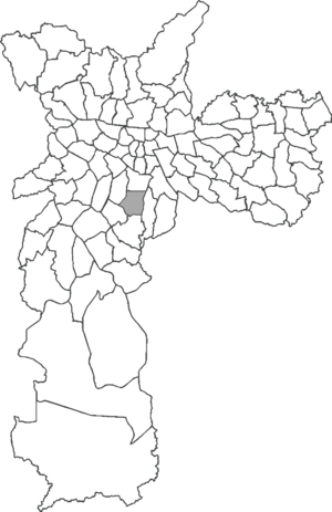
Saúde (district of São Paulo)
District of São Paulo, Brazil
Distance: Approx. 936 meters
Latitude and longitude: -23.61,-46.63694444
Saúde is a district in the city of São Paulo, Brazil. Saúde is a district in the South Zone of the city of São Paulo, included in the area of the Vila Mariana Subprefecture. The district is served by Line 1-Blue of the São Paulo Metro, with the stations Praça da Árvore, Saúde-Ultrafarma and São Judas.
Santa Cruz (São Paulo Metro)
São Paulo Metro station
Distance: Approx. 2134 meters
Latitude and longitude: -23.599162,-46.636681
Santa Cruz is an interchange station metro station on Line 1 (Blue) and Line 5 (Lilac) of the São Paulo Metro in the Vila Mariana district of São Paulo, Brazil.

Praça da Árvore (São Paulo Metro)
São Paulo Metro station
Distance: Approx. 893 meters
Latitude and longitude: -23.610576,-46.637861
Praça da Árvore is a station on Line 1 (Blue) of the São Paulo Metro.
Saúde-Ultrafarma (São Paulo Metro)
São Paulo Metro station
Distance: Approx. 403 meters
Latitude and longitude: -23.619133,-46.639345
Saúde-Ultrafarma, or simply Saúde, is a station on Line 1 (Blue) of the São Paulo Metro.
São Judas (São Paulo Metro)
São Paulo Metro station
Distance: Approx. 974 meters
Latitude and longitude: -23.625609,-46.64075
São Judas is a station on Line 1 (Blue) of the São Paulo Metro. It will be integrated with the planned Line 20 (Pink).

Conceição (São Paulo Metro)
São Paulo Metro station
Distance: Approx. 2075 meters
Latitude and longitude: -23.636209,-46.641142
Conceição is a station on Line 1 (Blue) of the São Paulo Metro.

Hospital São Paulo (São Paulo Metro)
São Paulo Metro station
Distance: Approx. 2438 meters
Latitude and longitude: -23.598431,-46.645556
Hospital São Paulo is a metro station on Line 5 (Lilac) of the São Paulo Metro in the Vila Mariana district of São Paulo, Brazil.

Paróquia Nossa Senhora de Lourdes (São Paulo)
Church in São Paulo, Brazil
Distance: Approx. 1507 meters
Latitude and longitude: -23.61833333,-46.65027778
Paróquia Nossa Senhora de Lourdes is a church located in São Paulo, Brazil. The church was created on 8 December 1939.

Paróquia Santa Rita de Cássia
Church in São Paulo, Brazil
Distance: Approx. 1433 meters
Latitude and longitude: -23.60638889,-46.64083333
Paróquia Santa Rita de Cássia is a church located in São Paulo, Brazil. It was established on 25 May 1937.

Jabaquara (district of São Paulo)
District of São Paulo, Brazil
Distance: Approx. 2277 meters
Latitude and longitude: -23.6364,-46.6459
Jabaquara is one of 96 districts in the city of São Paulo, Brazil. The name Jabaquara comes from tupi-guarani YAB-A-QUAR-A, which means rock or hole.

Cursino
District of São Paulo, Brazil
Distance: Approx. 1994 meters
Latitude and longitude: -23.6028,-46.6257
Cursino is one of 96 districts in the city of São Paulo, Brazil.
Weather in this IP's area
broken clouds
23 Celsius
23 Celsius
21 Celsius
23 Celsius
1008 hPa
78 %
1008 hPa
918 hPa
10000 meters
7.72 m/s
13.38 m/s
340 degree
75 %
05:16:48
18:23:44
