200.58.145.2 - IP Lookup: Free IP Address Lookup, Postal Code Lookup, IP Location Lookup, IP ASN, Public IP
Country:
 Uruguay
Region:
City:
Location:
Time Zone:
Postal Code:
ISP:
ASN:
language:
User-Agent:
Proxy IP:
Blacklist:
IP information under different IP Channel
ip-api
Country
Region
City
ASN
Time Zone
ISP
Blacklist
Proxy
Latitude
Longitude
Postal
Route
db-ip
Country
Region
City
ASN
Time Zone
ISP
Blacklist
Proxy
Latitude
Longitude
Postal
Route
IPinfo
Country
Region
City
ASN
Time Zone
ISP
Blacklist
Proxy
Latitude
Longitude
Postal
Route
IP2Location
200.58.145.2Country
uyRegion
colonia
City
colonia del sacramento
Time Zone
America/Montevideo
ISP
Language
User-Agent
Latitude
Longitude
Postal
ipdata
Country
Region
City
ASN
Time Zone
ISP
Blacklist
Proxy
Latitude
Longitude
Postal
Route
Popular places and events near this IP address
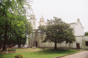
Colonia del Sacramento
Capital city in Colonia, Uruguay
Distance: Approx. 748 meters
Latitude and longitude: -34.47138889,-57.84416667
Colonia del Sacramento (Spanish: [koˈlonja ðel sakɾaˈmento] ; Portuguese: Colônia do Sacramento) is a city in southwestern Uruguay, by the Río de la Plata, facing Buenos Aires, Argentina. It is one of the oldest towns in Uruguay and the capital of the Colonia Department. It has a population of around 27,000.
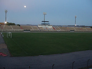
Estadio Profesor Alberto Suppici
Stadium in Uruguay
Distance: Approx. 434 meters
Latitude and longitude: -34.46694444,-57.84527778
Estadio Profesor Alberto Suppici is a multi-use stadium in Colonia, Uruguay. It is currently used mostly for football matches. The stadium holds 6,500 people.

Plaza de toros Real de San Carlos
Derelict bull ring in Uruguay
Distance: Approx. 3637 meters
Latitude and longitude: -34.436527,-57.865189
Plaza de toros Real de San Carlos is a former bullring in Colonia del Sacramento, Uruguay. Built in 1909 it was shortly closed after prohibition of bull fighting in 1912. After a century of abandonment, in 2021 it was finally restored and transformed into a cultural center for musical or sportive events.

Colonia Airport
Airport in Uruguay
Distance: Approx. 7473 meters
Latitude and longitude: -34.45694444,-57.76944444
Colonia International Airport (Spanish: Aeropuerto Internacional de Colonia "Laguna de los Patos") (IATA: CYR, ICAO: SUCA) is a general aviation airport serving Colonia del Sacramento, capital of the Colonia Department of Uruguay. The airport is just inland from the shore of the Río de la Plata estuary, 6 kilometres (4 mi) east of Colonia. Southeast approach and departure are over the water.
Siege of Colonia del Sacramento
1704 siege
Distance: Approx. 746 meters
Latitude and longitude: -34.4714,-57.8442
The siege of Colonia del Sacramento was a successful siege in 1704 by Spanish forces of the Portuguese colonial town of Colonia del Sacramento, opposite Buenos Aires and now in the nation of Uruguay. Four thousand natives and 650 Spaniards, led by the governor of Buenos Aires, Don Alonso Juan de Valdes e Inclán, and Baltasar García Ros, besieged the city beginning late in 1704. One week after a frontal assault failed, in early February 1705, the Portuguese abandoned Colonia del Sacramento.

Basílica del Santísimo Sacramento, Colonia del Sacramento
Distance: Approx. 329 meters
Latitude and longitude: -34.46777778,-57.85333333
The Basilica of the Holy Sacrament (Spanish: Basílica del Santísimo Sacramento) is a Roman Catholic parish church in Colonia del Sacramento, Uruguay.

Battle of Colonia del Sacramento (1826)
Distance: Approx. 528 meters
Latitude and longitude: -34.470702,-57.853078
The battle of Colonia del Sacramento (or Colônia do Sacramento) consisted of a series of failed attempts made by admiral William Brown of capturing the town of Colonia del Sacramento, which was under Brazilian control and being sieged on land by insurgent Uruguayan forces, in the context of the Cisplatine War between the Empire of Brazil and the United Provinces of the Río de la Plata. The confrontations began in the morning of 26 February 1826 and ended on 14 March 1826.

Farallón Island, Uruguay
Islet in Uruguay
Distance: Approx. 6565 meters
Latitude and longitude: -34.48416667,-57.91833333
Farallón Island is an islet belonging to Uruguay, located on the Río de la Plata near the city of Colonia del Sacramento. It is notable for its lighthouse. Farallón and nearby San Gabriel Island have been declared National Monument.

San Gabriel Island
Islet in Uruguay
Distance: Approx. 3695 meters
Latitude and longitude: -34.47333333,-57.88944444
San Gabriel Island is a small island belonging to Uruguay, located on the Río de la Plata near the city of Colonia del Sacramento. It was named by explorer Sebastian Cabot in 1527. San Gabriel and nearby Farallón have been declared National Monument.

Battle of Colonia del Sacramento (1807)
Distance: Approx. 748 meters
Latitude and longitude: -34.47138889,-57.84416667
The Battle of Colonia del Sacramento took place in the night of 21/22 April 1807, during the British invasions of the River Plate. A force of 1,500 militias led by Colonel Francisco Javier de Eíío was repelled by 1,000 British infantry and cavalry troops holding the fortress of Colonia del Sacramento and commanded by Colonel Dennis Pack.
Weather in this IP's area
clear sky
24 Celsius
23 Celsius
24 Celsius
24 Celsius
1008 hPa
46 %
1008 hPa
1007 hPa
10000 meters
6.81 m/s
10.62 m/s
56 degree