Country:
 Mexico
Region:
City:
Latitude and Longitude:
Time Zone:
Postal Code:
IP information under different IP Channel
ip-api
Country
Region
City
ASN
Time Zone
ISP
Blacklist
Proxy
Latitude
Longitude
Postal
Route
IPinfo
Country
Region
City
ASN
Time Zone
ISP
Blacklist
Proxy
Latitude
Longitude
Postal
Route
MaxMind
Country
Region
City
ASN
Time Zone
ISP
Blacklist
Proxy
Latitude
Longitude
Postal
Route
Luminati
Country
MXRegion
nle
City
monterrey
ASN
Time Zone
America/Monterrey
ISP
Operbes, S.A. de C.V.
Latitude
Longitude
Postal
db-ip
Country
Region
City
ASN
Time Zone
ISP
Blacklist
Proxy
Latitude
Longitude
Postal
Route
ipdata
Country
Region
City
ASN
Time Zone
ISP
Blacklist
Proxy
Latitude
Longitude
Postal
Route
Popular places and events near this IP address

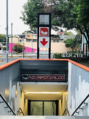
Azcapotzalco
Borough in Mexico City, Mexico
Distance: Approx. 998 meters
Latitude and longitude: 19.47222222,-99.18333333
Azcapotzalco (Classical Nahuatl: Āzcapōtzalco Nahuatl pronunciation: [aːskapoːˈt͡saɬko] , Spanish pronunciation: [askapoˈtsalko] , from āzcapōtzalli “anthill” + -co “place”; literally, “In the place of the anthills”) is a borough (demarcación territorial) in Mexico City. Azcapotzalco is in the northwestern part of Mexico City. The town began in the pre-Hispanic era and was the seat of the Tepanec dominion until the Aztec Triple Alliance overthrew it.
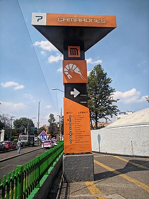
Camarones metro station
Mexico City metro station
Distance: Approx. 138 meters
Latitude and longitude: 19.479135,-99.190063
Camarones is a station along Line 7 of the Mexico City Metro. It is located in Colonia Barrio Santa Cruz Acayucan district in the Azcapotzalco borough, north of Mexico City, Mexico. The station was opened with the others along the northern portion of Line 7 on 29 November 1988.

Tacuba metro station
Mexico City metro station
Distance: Approx. 2081 meters
Latitude and longitude: 19.459349,-99.189205
Tacuba is a station of the Mexico City Metro. It is located in the Tacuba district of the Miguel Hidalgo borough, to the west of downtown Mexico City. It lies along Lines 2 and 7.
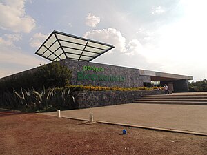
UAM-Azcapotzalco metro station
Mexico City metro station
Distance: Approx. 1511 meters
Latitude and longitude: 19.490989,-99.186416
UAM-Azcapotzalco (; formerly Azcapotzalco) is a metro station in northern Mexico City, located in the Azcapotzalco borough, along Line 6. In 2019, the station had an average ridership of 8,076 passengers per day.

Tezozómoc metro station
Mexico City metro station
Distance: Approx. 1997 meters
Latitude and longitude: 19.495116,-99.196286
Tezozómoc is a metro station on Mexico's Line 6. It is located in the Azcapotzalco borough. In 2019, the station had an average ridership of 5,757 passengers per day.

Aquiles Serdán metro station
Mexico City metro station
Distance: Approx. 1454 meters
Latitude and longitude: 19.490423,-99.19487
Aquiles Serdán (Spanish: Estación Aquiles Serdán) is a station along Line 7 of the Mexico City Metro. It is located in the Colonia La Preciosa neighborhood of the Azcapotzalco borough of northwestern Mexico City.

Refinería metro station
Mexico City metro station
Distance: Approx. 896 meters
Latitude and longitude: 19.469951,-99.190578
Refinería (Spanish: Estación Refinería) is a station along Line 7 of the metro of Mexico City. The station is located close to the Pemex 18 de marzo refinery in the Colonia Ángel Zimbrón neighborhood of the Azcapotzalco borough northwest of the city center, between the stations of Camarones and Tacuba. Its logo represents three containers of the Pemex refinery.
Azcapotzalco (former administrative division)
Distance: Approx. 1094 meters
Latitude and longitude: 19.48611111,-99.18472222
Azcapotzalco was a Mexican municipality. It was disestablished in 1928, when the municipalities of the Federal District were replaced by boroughs (delegaciones). There is now a borough of the same name.
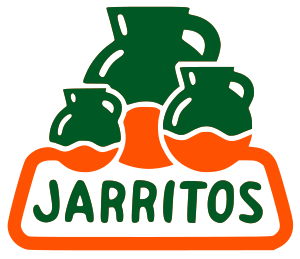
Jarritos
Brand of soft drink
Distance: Approx. 1114 meters
Latitude and longitude: 19.48566667,-99.18377778
Jarritos is a brand of soft drink in Mexico, owned by Novamex, a large independent bottling conglomerate based in El Paso, Texas. Jarritos was founded in 1950 by Don Francisco "El Güero" Hill. Jarritos is made with fruit flavors and cane sugar, and is less carbonated than many popular soft drinks.
Parque de la China
Distance: Approx. 1928 meters
Latitude and longitude: 19.4648,-99.1787
Parque de la China is a park in Mexico City. It is located in the Colonia Clavería of the Azcapotzalco delegation of Mexico's Federal District. It is adjacent to the Obrero Popular neighborhood and is close to Cuitláhuac Avenue.
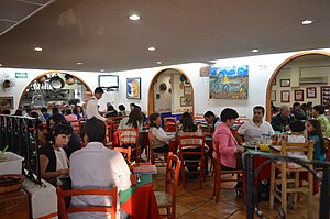
El Bajío (restaurant)
Restaurant in Mexico City, Mexico
Distance: Approx. 2163 meters
Latitude and longitude: 19.46273889,-99.17784444
El Bajío is a group of eighteen restaurants in Mexico City which are run by Carmen Ramírez Degollado, noted for their colorful decoration and traditional cuisine from central Mexico which has received awards and praise from notable food experts. The restaurant business began in 1972 when Carmen's husband Raúl Ramírez Degollado bought a restaurant selling carnitas in the northwestern borough of Azcapotzalco. Four years later, Raúl died and Carmen took over the business, expanding the menu and adding waiters.
Bicentennial Park (Mexico City)
Distance: Approx. 1137 meters
Latitude and longitude: 19.46972222,-99.19694444
Bicentennial Park (Spanish: Parque Bicentenario) is a park in Mexico City. It is located in the western part of the city, on the boundary of Azcapotzalco and Miguel Hidalgo. It was built as part of the Celebration of the Bicentennial of the Independence of Mexico and inaugurated by then President Felipe Calderón on November 7, 2010.
Weather in this IP's area
scattered clouds
26 Celsius
25 Celsius
23 Celsius
26 Celsius
1008 hPa
36 %
1008 hPa
783 hPa
10000 meters
3.09 m/s
90 degree
40 %
06:25:10
18:35:38