Country:
Region:
City:
Latitude and Longitude:
Time Zone:
Postal Code:
IP information under different IP Channel
ip-api
Country
Region
City
ASN
Time Zone
ISP
Blacklist
Proxy
Latitude
Longitude
Postal
Route
Luminati
Country
ASN
Time Zone
America/Argentina/Buenos_Aires
ISP
Telefonica Moviles Argentina S.A. Movistar Argentina
Latitude
Longitude
Postal
IPinfo
Country
Region
City
ASN
Time Zone
ISP
Blacklist
Proxy
Latitude
Longitude
Postal
Route
db-ip
Country
Region
City
ASN
Time Zone
ISP
Blacklist
Proxy
Latitude
Longitude
Postal
Route
ipdata
Country
Region
City
ASN
Time Zone
ISP
Blacklist
Proxy
Latitude
Longitude
Postal
Route
Popular places and events near this IP address

Boedo
Neighborhood of Buenos Aires in C5, Argentina
Distance: Approx. 1324 meters
Latitude and longitude: -34.63333333,-58.41666667
Boedo is a working-class barrio or neighborhood of Buenos Aires, Argentina. The neighborhood and one of its principal streets were named after Mariano Boedo, a leading figure in the Argentine independence. It is the home of San Lorenzo de Almagro football club.

Nueva Pompeya
Neighborhood of Buenos Aires in C4, Argentina
Distance: Approx. 1318 meters
Latitude and longitude: -34.65,-58.41666667
Nueva Pompeya (Spanish for New Pompei), often loosely referred to as Pompeya, is a neighbourhood in the city of Buenos Aires, Argentina. Located in the South side, it has long been one of the city's proletarian districts steeped in the tradition of tango and one where many of the first tangos were written and performed. A neighborhood local, the legendary tango composer Homero Manzi, set a very popular tango (Sur) in Nueva Pompeya, describing a melancholy landscape (“Pompeya and beyond the flood”) that, even today, defines much of the district's physionomy.

Buenos Aires Belgrano Sur Line railway station
Former railway station in Buenos Aires, Argentina
Distance: Approx. 1243 meters
Latitude and longitude: -34.6454,-58.3936
Buenos Aires (Spanish: Estación Buenos Aires) is a former passenger railway station in the city of Buenos Aires, Argentina. The station was terminus of the Belgrano Sur line that runs trains along Greater Buenos Aires region. The station is located a short distance north of the Riachuelo River, on the boundaries between the barrios of Parque Patricios and Barracas, two outlying neighbourhoods in the southern part of the city.

Parque Patricios
Neighborhood of Buenos Aires in C4, Argentina
Distance: Approx. 1100 meters
Latitude and longitude: -34.63333333,-58.4
Parque Patricios is a barrio located on the southern side of Buenos Aires, Argentina belonging to the fourth comuna. Parque Patricios underwent a transformation during the beginning of the 1900s. The government moved the main slaughterhouse to Mataderos, removed refuse piles and the notorious trash incinerators ("la quema") and the cemetery used during the 1871 yellow fever epidemic, now Parque Ameghino.

Battle of Los Corrales
Distance: Approx. 1100 meters
Latitude and longitude: -34.63333333,-58.4
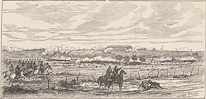
The Battle of Los Corrales (Spanish: Batalla de los Corrales Viejos) was one of the final conflicts during the brief Argentinian Revolution of 1880. It took place in Parque Patricios, Buenos Aires, Argentina, on June 21, 1880, and confronted the side led by Carlos Tejedor, governor of Buenos Aires, against the National Army led by president Nicolás Avellaneda.

Bernasconi Institute
Architecturally-significant primary school in Buenos Aires
Distance: Approx. 933 meters
Latitude and longitude: -34.63416667,-58.40194444
The Bernasconi Institute is an architecturally-significant primary school in the Parque Patricios section of Buenos Aires, Argentina. It sits on an eight-hectare (20 acre) property in the city's southside.

Caseros (Buenos Aires Underground)
Buenos Aires Underground station
Distance: Approx. 947 meters
Latitude and longitude: -34.63583333,-58.39891667
Caseros Station is a station on Line H of the Buenos Aires Underground. The station was opened on 18 October 2007, as the southern terminus of the inaugural section of the line, between Once - 30 de Diciembre and Caseros. It remained the line's southern terminus until the opening of Parque Patricios Station on 4 October 2011.

Parque Patricios (Buenos Aires Underground)
Buenos Aires Underground station
Distance: Approx. 348 meters
Latitude and longitude: -34.63861111,-58.40583333
Parque Patricios Station is a station on Line H of the Buenos Aires Underground. It was inaugurated on 4 October 2011 as the southern terminus of one-station extension from Caseros. It remained the terminus of the line until 27 May 2013, when the line was extended to Hospitales.
Hospitales (Buenos Aires Underground)
Buenos Aires Underground station
Distance: Approx. 560 meters
Latitude and longitude: -34.64138889,-58.4125
Hospitales Station is a station and terminus on Line H of the Buenos Aires Underground. Here passengers may transfer to Metrobus Sur. It was opened on 27 May 2013 as a one-station extension from Parque Patricios.

Hospital Muñiz
Hospital in Buenos Aires Province, Argentina
Distance: Approx. 1255 meters
Latitude and longitude: -34.637616,-58.393627
The Infectious Diseases Hospital “Dr. Francisco Javier Muñiz" is a public metropolitan-area hospital serving Buenos Aires, Argentina and the surrounding area since 1882. As the name implies, the hospital specializes in infectious diseases.

ConDiT
Distance: Approx. 136 meters
Latitude and longitude: -34.6429,-58.4061
conDiT (acronym of Concerts of Technological District) was a musical creation platform founded in Buenos Aires on 28 October 2011.

Estadio Claudio Chiqui Tapia
Football stadium in Buenos Aires, Argentina
Distance: Approx. 1092 meters
Latitude and longitude: -34.64688889,-58.39627778
Estadio Claudio "Chiqui" Tapia is a stadium located in the Barracas neighborhood of Buenos Aires, Argentina. The stadium has a capacity of 4,400 spectators, and is the home ground of club Barracas Central.
Weather in this IP's area
clear sky
29 Celsius
29 Celsius
28 Celsius
30 Celsius
1010 hPa
46 %
1010 hPa
1009 hPa
10000 meters
5.81 m/s
360 degree
05:40:09
19:36:42
