Country:
Region:
City:
Latitude and Longitude:
Time Zone:
Postal Code:
IP information under different IP Channel
ip-api
Country
Region
City
ASN
Time Zone
ISP
Blacklist
Proxy
Latitude
Longitude
Postal
Route
Luminati
Country
ASN
Time Zone
America/Argentina/Buenos_Aires
ISP
Telefonica Moviles Argentina S.A. Movistar Argentina
Latitude
Longitude
Postal
IPinfo
Country
Region
City
ASN
Time Zone
ISP
Blacklist
Proxy
Latitude
Longitude
Postal
Route
db-ip
Country
Region
City
ASN
Time Zone
ISP
Blacklist
Proxy
Latitude
Longitude
Postal
Route
ipdata
Country
Region
City
ASN
Time Zone
ISP
Blacklist
Proxy
Latitude
Longitude
Postal
Route
Popular places and events near this IP address

Colegio Nacional de Buenos Aires
Public secondary school in Buenos Aires, Argentina
Distance: Approx. 396 meters
Latitude and longitude: -34.611,-58.374
Colegio Nacional de Buenos Aires (National School of Buenos Aires) is a public high school in Buenos Aires, Argentina, affiliated to the University of Buenos Aires. In the tradition of the European gymnasium it provides a free education that includes classical languages such as Latin and Greek. The school is one of the most prestigious in Latin America.

National Institute of Statistics and Census of Argentina
Argentina's statistics and census agency
Distance: Approx. 527 meters
Latitude and longitude: -34.61,-58.375
The National Institute of Statistics and Censuses (Spanish: Instituto Nacional de Estadística y Censos, mostly known for its acronym INDEC) is an Argentine decentralized public body that operates within the Ministry of Economy, which exercises the direction of all official statistical activities carried out in the country. In February 2013, the International Monetary Fund censured Argentina for failing to report accurate inflation data. Political intervention in the INDEC figures ended, and the IMF declared in November 2016 that Argentine statistics were again in accordance with international standards.

Otto Krause Technical School
Distance: Approx. 429 meters
Latitude and longitude: -34.61527778,-58.36861111
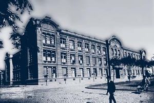
The Escuela Técnica Otto Krause is a degree grating educational institution located at the intersection of Paseo Colón Avenue and Chile Street, in the San Telmo section of Buenos Aires, Argentina. Named after its founder, the engineer Otto Krause, son of German immigrants, the school was founded in 1897 and is the oldest technological school in the country. The school currently has around 2000 students and operates a six-year programme.

Télam
Argentine national news agency
Distance: Approx. 39 meters
Latitude and longitude: -34.61416667,-58.37333333
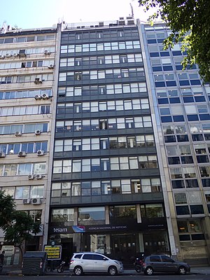
Télam (an acronym for "Telenoticiosa Americana") was an Argentine government-ran national news agency founded in 1945 by then Secretary of Labor Juan Perón during the presidency of Edelmiro Julián Farrell. Télam was the biggest newswire of Latin America with about 2,800 subscribers. The service was suspended in March 2024 by the government of President Javier Milei.

Illuminated Block
Distance: Approx. 454 meters
Latitude and longitude: -34.61055556,-58.37444444
The Illuminated Block (Spanish: Manzana de las Luces) is a historical landmark in the Monserrat neighbourhood of Buenos Aires, Argentina.

La Trastienda Club
Distance: Approx. 291 meters
Latitude and longitude: -34.61305556,-58.37055556
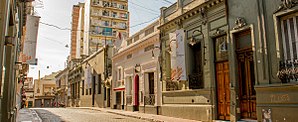
La Trastienda Club is a prominent café-concert style venue in Buenos Aires. The club was established in 1993 in a late 19th-century building originally housing a corner grocery in the Montserrat section of Buenos Aires. Seating 400 with standing-room capacity for another 1,000, its proximity to both downtown and the bohemian chic San Telmo section of the city has since helped make it one of the city's best known café-concerts and a leading local venue for artists in the world music, funk, jazz and other genres, featuring performers and bands from both Argentina and abroad.
Belgrano (Buenos Aires Underground)
Buenos Aires Underground station
Distance: Approx. 436 meters
Latitude and longitude: -34.61286111,-58.37752778
Belgrano is a station on Line E of the Buenos Aires Underground. The station was opened on 24 April 1966 as part of the extension of the line from San José to Bolívar. The name of the station pays homage to Manuel Belgrano, creator of the Argentinian flag.
Juan B. Ambrosetti Museum of Ethnography
Museum in Argentina
Distance: Approx. 396 meters
Latitude and longitude: -34.61138889,-58.37111111
The Juan B. Ambrosetti Museum of Ethnography (Spanish: Museo Etnográfico "Juan B. Ambrosetti") is an Argentine museum overseen by the University of Buenos Aires Faculty of Philosophy and Letters and located in Buenos Aires.
Santo Domingo Convent
Church in Argentina
Distance: Approx. 214 meters
Latitude and longitude: -34.61305556,-58.37166667
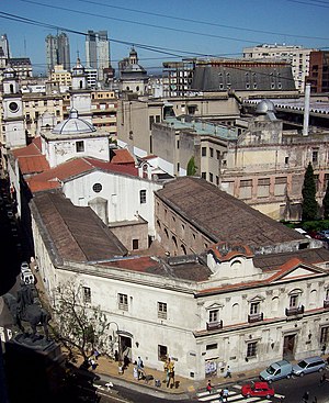
The Santo Domingo Convent, or Basilic of Our Lady of the Rosary and Convent of Santo Domingo is a convent for Our Lady of the Rosary located in the Monserrat neighborhood of Buenos Aires. Built during the colonial times, it was the scenario of a military conflict during the British invasions of the Río de la Plata. It holds as well the tomb of the Argentine national hero Manuel Belgrano.

St. Ignatius Church (Buenos Aires)
Distance: Approx. 450 meters
Latitude and longitude: -34.6105,-58.3739
Saint Ignatius of Loyola' Church (Spanish: Iglesia de San Ignacio de Loyola) is a Roman Catholic church situated at the Illuminated Block, in Buenos Aires's neighbourhood of Montserrat. The first building, which was made of adobe, was built by the Society of Jesus in 1675. The southern tower and the present facade were built in 1686, and the rest of the Church construction started in 1712.

Fundación Universidad del Cine
Distance: Approx. 447 meters
Latitude and longitude: -34.6179,-58.3706
Universidad del Cine (FUC; English: "University of Cinema/Film") is a private not-for-profit university located in the neighbourhood of San Telmo in Buenos Aires, Argentina. It was founded in 1991 by Manuel Antin, who currently serves as Rector. The school offers undergraduate, graduate and post graduate programmes focused in film and media arts.

Otto Wulff Building
Distance: Approx. 272 meters
Latitude and longitude: -34.6125,-58.3749
Otto Wulff building (Spanish: Edificio Otto Wulff) is a historic building of Buenos Aires. It is located in the corner of Belgrano and Peru, neighborhood of Monserrat. This building was built on the grounds of an old colonial house known by the name of "La Casa de la Virreina Vieja", which had been owned by the Viceroy Joaquín del Pino and his family.
Weather in this IP's area
clear sky
26 Celsius
26 Celsius
25 Celsius
28 Celsius
1012 hPa
57 %
1012 hPa
1008 hPa
10000 meters
5.81 m/s
360 degree
8 %
05:40:05
19:36:30


