200.39.14.225 - IP Lookup: Free IP Address Lookup, Postal Code Lookup, IP Location Lookup, IP ASN, Public IP
Country:
 Mexico
Region:
City:
Location:
Time Zone:
Postal Code:
ISP:
ASN:
language:
User-Agent:
Proxy IP:
Blacklist:
IP information under different IP Channel
ip-api
Country
Region
City
ASN
Time Zone
ISP
Blacklist
Proxy
Latitude
Longitude
Postal
Route
db-ip
Country
Region
City
ASN
Time Zone
ISP
Blacklist
Proxy
Latitude
Longitude
Postal
Route
IPinfo
Country
Region
City
ASN
Time Zone
ISP
Blacklist
Proxy
Latitude
Longitude
Postal
Route
IP2Location
200.39.14.225Country
mxRegion
coahuila de zaragoza
City
ciudad acuna
Time Zone
America/Matamoros
ISP
Language
User-Agent
Latitude
Longitude
Postal
ipdata
Country
Region
City
ASN
Time Zone
ISP
Blacklist
Proxy
Latitude
Longitude
Postal
Route
Popular places and events near this IP address

Cienegas Terrace, Texas
Census-designated place in Val Verde County, Texas, United States
Distance: Approx. 4833 meters
Latitude and longitude: 29.36583333,-100.94277778
Cienegas Terrace is a census-designated place (CDP) in Val Verde County, Texas, United States. The population was 3,424 at the 2010 census.

Del Rio, Texas
City in the United States
Distance: Approx. 6803 meters
Latitude and longitude: 29.364,-100.9
Del Rio is a city in and the county seat of Val Verde County in southwestern Texas, United States. As of 2020, Del Rio had a population of 34,673.
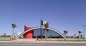
Ciudad Acuña
City in the Mexican state of Coahuila
Distance: Approx. 1996 meters
Latitude and longitude: 29.32416667,-100.93166667
Ciudad Acuña (Spanish for 'Acuña City'), also known simply as Acuña, (originally Garza Galán, later Villa Acuña) is a city located in the Mexican state of Coahuila, at 29°19′27″N 100°55′54″W and a mean height above sea level of 271 m (889 ft). It stands on the Rio Grande (locally known as the Río Bravo), which marks the U.S.-Mexico border, and offers two border crossings via Lake Amistad Dam International Crossing and Del Río-Ciudad Acuña International Bridge with the neighboring city of Del Rio in the U.S. state of Texas. It serves as the municipal seat of the surrounding municipality of Acuña.

Del Rio International Airport
Airport in Val Verde County, Texas, U.S.
Distance: Approx. 6170 meters
Latitude and longitude: 29.37416667,-100.92722222
Del Rio International Airport (IATA: DRT, ICAO: KDRT, FAA LID: DRT) is two miles northwest of Del Rio, in Val Verde County, Texas, United States. It is used for general aviation, and, being near Laughlin Air Force Base, it is often used by USAF students during training flights.
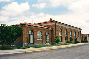
Del Rio station
Intermodal transportation center in Del Rio, Texas, U.S.
Distance: Approx. 6603 meters
Latitude and longitude: 29.36271,-100.90144
Del Rio station is an intermodal transportation center in Del Rio, Texas, United States served by Amtrak, the national railroad passenger system, as well as by local bus service.

Del Río–Ciudad Acuña International Bridge
International bridge crossing the Mexico–United States border
Distance: Approx. 2428 meters
Latitude and longitude: 29.32675556,-100.92751389
The Del Río–Ciudad Acuña International Bridge is an international bridge which crosses the Rio Grande connecting the United States-Mexico border cities of Del Rio, Texas and Ciudad Acuña. The bridge is also known as "Del Río International Bridge", "Puente Acuña" and "Puente Ciudad Acuña-Ciudad Del Río".

Del Rio Texas Port of Entry
Mexican-American point of entry in Del Rio, Texas, U.S.
Distance: Approx. 3447 meters
Latitude and longitude: 29.333627,-100.918761
The Del Rio Texas Port of Entry is located at the Del Río – Ciudad Acuña International Bridge. A pontoon bridge was first built around 1919, and it was replaced by a more permanent bridge in 1929 built by the Citizens Bridge Company. That bridge was replaced in 1987.
KWMC (AM)
Radio station in Del Rio, Texas, United States
Distance: Approx. 9982 meters
Latitude and longitude: 29.3716,-100.8656
KWMC 1490 AM is a radio station licensed to Del Rio, Texas. The station airs a classic hits format and is owned by Guillermo Garza.
San Felipe Springs
Groundwater spring in Texas
Distance: Approx. 8748 meters
Latitude and longitude: 29.37333333,-100.88277778
San Felipe Springs is a spring in Val Verde County, Texas. it lies at an elevation of 961 feet.

Whitehead Memorial Museum
American western museum
Distance: Approx. 6142 meters
Latitude and longitude: 29.3517,-100.898
The Whitehead Memorial Museum is a western museum located at located at 1308 South Main Street, in Del Rio, Texas. It boasts a replica of "The Jersey Lilly" saloon, and the gravesites of Judge Roy Bean and his son Sam, the latter of whom "was killed there in a street fight". The two-and-a-half acre property was donated to the city and county for by the Del Rio ranching family in 1962.
Weather in this IP's area
broken clouds
19 Celsius
19 Celsius
18 Celsius
19 Celsius
1015 hPa
85 %
1015 hPa
976 hPa
10000 meters
3.6 m/s
100 degree
75 %