200.25.104.177 - IP Lookup: Free IP Address Lookup, Postal Code Lookup, IP Location Lookup, IP ASN, Public IP
Country:
Region:
City:
Location:
Time Zone:
Postal Code:
IP information under different IP Channel
ip-api
Country
Region
City
ASN
Time Zone
ISP
Blacklist
Proxy
Latitude
Longitude
Postal
Route
Luminati
Country
ASN
Time Zone
America/Bogota
ISP
EDGEUNO S.A.S
Latitude
Longitude
Postal
IPinfo
Country
Region
City
ASN
Time Zone
ISP
Blacklist
Proxy
Latitude
Longitude
Postal
Route
IP2Location
200.25.104.177Country
Region
asuncion
City
asuncion
Time Zone
America/Asuncion
ISP
Language
User-Agent
Latitude
Longitude
Postal
db-ip
Country
Region
City
ASN
Time Zone
ISP
Blacklist
Proxy
Latitude
Longitude
Postal
Route
ipdata
Country
Region
City
ASN
Time Zone
ISP
Blacklist
Proxy
Latitude
Longitude
Postal
Route
Popular places and events near this IP address

Asunción
Capital and most populous city of Paraguay
Distance: Approx. 270 meters
Latitude and longitude: -25.3,-57.63333333
Asunción (English: , Spanish: [asunˈsjon]) is the capital and the largest city of Paraguay. The city stands on the eastern bank of the Paraguay River, almost at the confluence of this river with the Pilcomayo River. The Paraguay River and the Bay of Asunción in the northwest separate the city from the Occidental Region of Paraguay and from Argentina in the south part of the city.

Estadio General Pablo Rojas
Football stadium in Asunción, Paraguay
Distance: Approx. 179 meters
Latitude and longitude: -25.3,-57.6375
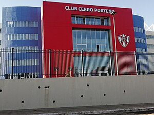
Estadio General Pablo Rojas, locally known as La Olla or La Nueva Olla and for sponsorship reasons known as Estadio ueno La Nueva Olla, is a football stadium in the neighbourhood of Barrio Obrero in Asunción, Paraguay. It is the home venue of Cerro Porteño. The stadium's nickname La Olla was given by the club's former president General Pablo Rojas, after whom the stadium was named when he died.
Catedral (Asunción)
Cathedral in Asunción
Distance: Approx. 1648 meters
Latitude and longitude: -25.286,-57.634
La Catedral is a barrio (neighbourhood) of Asunción, the capital of Paraguay. It has a population of 3,676 people and it is located next to the Paraguay River and other barrios such as La Encarnación, General Díaz, San Roque and Ricardo Brugada (La Chacarita). It was named after the cathedral of Asunción.

Universidad Columbia del Paraguay
Distance: Approx. 1758 meters
Latitude and longitude: -25.2859,-57.6298
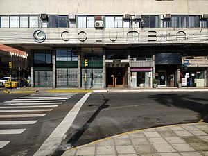
The Universidad Columbia del Paraguay (Columbia University of Paraguay) is a private university. It was founded in 1943, but it obtained the title of university only in 1991. In 60 years it had more than 200,000 students.

Universidad Autónoma de Asunción (university)
Distance: Approx. 1650 meters
Latitude and longitude: -25.28735833,-57.64303333
The Universidad Autónoma de Asunción (Autonomous University of Asuncion) is a private university. It was founded in 1978 as the Escuela Superior de Administración de Empresas (Superior School of Business Administration). It obtained its title of university in 1991.
Colegio Cristo Rey
Private, catholic, jesuit school in Asunción, Paraguay
Distance: Approx. 1840 meters
Latitude and longitude: -25.28709722,-57.64629444
The Colegio Cristo Rey is a Jesuit elementary and secondary school located in the city of Asunción, Paraguay. It was founded in 1938.
Museo Nacional de Bellas Artes de Asunción
Art museum in Asunción, Paraguay
Distance: Approx. 1993 meters
Latitude and longitude: -25.2887,-57.6212
The National Museum of Fine Arts of Asunción (Spanish: Museo Nacional de Bellas Artes de Asunción), located on Mcal. Estigarribia and Iturbe St. in Asuncion, the capital city of Paraguay, displays over 650 works of art, paintings, sculptures, ceramics, prints, photographs, Paraguayan and international artists.

General Díaz
Barrio in Gran Asunción, Paraguay
Distance: Approx. 846 meters
Latitude and longitude: -25.2933,-57.6378
General Díaz is a neighbourhood (barrio) of Asunción, Paraguay.
Roberto L. Pettit (neighborhood)
Barrio in Asunción, Paraguay
Distance: Approx. 1321 meters
Latitude and longitude: -25.3108,-57.6428
Roberto L. Pettit is a neighbourhood (barrio) of Asunción, Paraguay. It is named after Roberto Pettit.

Obrero (Asunción)
Barrio in Gran Asunción, Paraguay
Distance: Approx. 270 meters
Latitude and longitude: -25.3,-57.63333333
Obrero, also known as Barrio Obrero, is a neighbourhood (barrio) of Asunción, the capital and largest city of Paraguay; and has a population of 19,823 people. The name of this barrio comes from the word "worker" (obrero) in reference to the humble and working class people who form the majority of the population.
La Encarnación (Asunción)
Barrio in Gran Asunción, Paraguay
Distance: Approx. 1950 meters
Latitude and longitude: -25.28333333,-57.63333333
La Encarnación is a neighbourhood (barrio) of Asunción, the capital and largest city of Paraguay.
Pettirossi (Asunción)
Barrio in Gran Asunción, Paraguay
Distance: Approx. 270 meters
Latitude and longitude: -25.3,-57.63333333
Pettirossi is a neighbourhood (barrio) of Asunción, the capital and largest city of Paraguay.
Weather in this IP's area
clear sky
20 Celsius
20 Celsius
20 Celsius
21 Celsius
1013 hPa
80 %
1013 hPa
998 hPa
10000 meters
5.14 m/s
190 degree

