Lookup
Country:
 Brazil
Region:
sp
City:
iracemápolis
Latitude and Longitude:
-22.618000,-47.518500
Time Zone:
America/Sao_Paulo
Postal Code:
13495
IP information under different IP Channel
ip-api
Country
Region
City
ASN
Time Zone
ISP
Blacklist
Proxy
Latitude
Longitude
Postal
Route
IPinfo
Country
Region
City
ASN
Time Zone
ISP
Blacklist
Proxy
Latitude
Longitude
Postal
Route
MaxMind
Country
Region
City
ASN
Time Zone
ISP
Blacklist
Proxy
Latitude
Longitude
Postal
Route
Luminati
Country
BRASN
Time Zone
America/Sao_Paulo
ISP
INSTITUTO CYBER DE ENSINO E PESQUISA
Latitude
-22.8305
Longitude
-43.2192
Postal
-
db-ip
Country
Region
City
ASN
Time Zone
ISP
Blacklist
Proxy
Latitude
Longitude
Postal
Route
ipdata
Country
Region
City
ASN
Time Zone
ISP
Blacklist
Proxy
Latitude
Longitude
Postal
Route
Popular places and events near this IP address
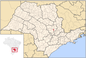
Iracemápolis
Municipality in Southeast, Brazil
Distance: Approx. 4168 meters
Latitude and longitude: -22.58055556,-47.51861111
Iracemápolis is a municipality in the state of São Paulo in Brazil. The population is 24,614 (2020 est.) in an area of 115.1 km². The elevation is 608 m.
Weather in this IP's area
Current Weather
scattered clouds
Current Temperature
33 Celsius
Feeling temperature
31 Celsius
lowest temperature
33 Celsius
Maximum temperature
33 Celsius
Atmospheric pressure
1010 hPa
humidity
25 %
Sea level pressure
1010 hPa
Surface atmospheric pressure
946 hPa
visibility
10000 meters
Wind speed
2.33 m/s
gust
3.55 m/s
wind direction
262 degree
cloud
43 %
Sunrise time
05:34:46
Sunset time
18:15:10