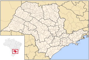
Country:
 Brazil
Region:
City:
Latitude and Longitude:
Time Zone:
Postal Code:
IP information under different IP Channel
ip-api
Country
Region
City
ASN
Time Zone
ISP
Blacklist
Proxy
Latitude
Longitude
Postal
Route
IPinfo
Country
Region
City
ASN
Time Zone
ISP
Blacklist
Proxy
Latitude
Longitude
Postal
Route
MaxMind
Country
Region
City
ASN
Time Zone
ISP
Blacklist
Proxy
Latitude
Longitude
Postal
Route
Luminati
Country
BRASN
Time Zone
America/Sao_Paulo
ISP
Scala Data Centers
Latitude
Longitude
Postal
db-ip
Country
Region
City
ASN
Time Zone
ISP
Blacklist
Proxy
Latitude
Longitude
Postal
Route
ipdata
Country
Region
City
ASN
Time Zone
ISP
Blacklist
Proxy
Latitude
Longitude
Postal
Route
Popular places and events near this IP address

Carapicuíba
Municipality in São Paulo, Brazil
Distance: Approx. 4794 meters
Latitude and longitude: -23.51916667,-46.83583333
Carapicuíba (Portuguese pronunciation: [kaɾapikuˈibɐ]) is a municipality in the state of São Paulo in Brazil. It is part of the Metropolitan Region of São Paulo. The population is 403,183 (2020 est.) in an area of 34.55 square kilometres (13.34 sq mi).

Pinheiros River
River in São Paulo state, Brazil
Distance: Approx. 4301 meters
Latitude and longitude: -23.52666667,-46.75
The Pinheiros River (Portuguese: Rio Pinheiros) is a tributary of the Tietê River that runs 25 kilometres (16 mi) through the city of São Paulo, Brazil. Until 1920, the river was known as Jurubatuba. After being channelized its name was changed to Pinheiros.
RedeTV!
Brazilian television network
Distance: Approx. 3183 meters
Latitude and longitude: -23.52146,-46.763165
RedeTV! (Portuguese: [ˈʁedʒi teˈve], also Rede TV! or RTV!
Taboão da Serra
Municipality in Southeast, Brazil
Distance: Approx. 814 meters
Latitude and longitude: -23.53277778,-46.79944444
Taboão da Serra is a municipality in the state of São Paulo in Brazil. It is part of the Metropolitan Region of São Paulo. The population is 293,652 (2020 est.) in an area of 20.39 km².

Osasco
Municipality in Southeast, Brazil
Distance: Approx. 83 meters
Latitude and longitude: -23.53277778,-46.79194444
Osasco (Portuguese pronunciation: [oˈzasku]) is a municipality in São Paulo State, Brazil, located in the Greater São Paulo area and ranking 5th in population among São Paulo municipalities. According to the IBGE 2015, Osasco currently has the 9th highest gross domestic product in Brazil, and the 2nd largest in the State of São Paulo. The population is 699,944 (2020 est.) in an area of 64.95 km2.

São Domingos (district of São Paulo)
District of São Paulo, Brazil
Distance: Approx. 5932 meters
Latitude and longitude: -23.5035,-46.7434
São Domingos is one of 96 districts in the city of São Paulo, Brazil.

Presidente Altino (CPTM)
Railway station in São Paulo, Brazil
Distance: Approx. 3046 meters
Latitude and longitude: -23.53125,-46.76175
Presidente Altino is a train station on ViaMobilidade Lines 8-Diamond and 9-Emerald, located in the district of President Altino in the city of Osasco.

Ceasa (CPTM)
Railway station in São Paulo, Brazil
Distance: Approx. 5010 meters
Latitude and longitude: -23.537412,-46.742604
Ceasa is a train station on ViaMobilidade Line 9-Emerald, located in the district of Vila Leopoldina, city of São Paulo.

Imperatriz Leopoldina (CPTM)
Railway station in São Paulo, Brazil
Distance: Approx. 5618 meters
Latitude and longitude: -23.523779,-46.737462
Imperatriz Leopoldina is a train station on ViaMobilidade Line 8-Diamond, located in the district of Vila Leopoldina in São Paulo.

Comandante Sampaio (CPTM)
Railway station in São Paulo, Brazil
Distance: Approx. 950 meters
Latitude and longitude: -23.525756,-46.795637
Comandante Sampaio is a rail station belonging to ViaMobilidade Line 8-Diamond, located in the city of Osasco, in the Km 18 borough.

Quitaúna (CPTM)
Railway station in São Paulo, Brazil
Distance: Approx. 1984 meters
Latitude and longitude: -23.522785,-46.807112
Quitaúna is a train station, belonging to ViaMobilidade Line 8-Diamond, located in the municipality of Osasco.

General Miguel Costa (CPTM)
Railway station in São Paulo, Brazil
Distance: Approx. 5608 meters
Latitude and longitude: -23.523779,-46.737562
General Miguel Costa is a train station, belonging to ViaMobilidade Line 8-Diamond, located in the municipality of Osasco, Brazil.
Weather in this IP's area
clear sky
24 Celsius
24 Celsius
22 Celsius
26 Celsius
1015 hPa
60 %
1015 hPa
932 hPa
10000 meters
2.57 m/s
100 degree
05:47:02
18:06:10