Country:
 Brazil
Region:
City:
Latitude and Longitude:
Time Zone:
Postal Code:
IP information under different IP Channel
ip-api
Country
Region
City
ASN
Time Zone
ISP
Blacklist
Proxy
Latitude
Longitude
Postal
Route
IPinfo
Country
Region
City
ASN
Time Zone
ISP
Blacklist
Proxy
Latitude
Longitude
Postal
Route
MaxMind
Country
Region
City
ASN
Time Zone
ISP
Blacklist
Proxy
Latitude
Longitude
Postal
Route
Luminati
Country
BRASN
Time Zone
America/Sao_Paulo
ISP
Scala Data Centers
Latitude
Longitude
Postal
db-ip
Country
Region
City
ASN
Time Zone
ISP
Blacklist
Proxy
Latitude
Longitude
Postal
Route
ipdata
Country
Region
City
ASN
Time Zone
ISP
Blacklist
Proxy
Latitude
Longitude
Postal
Route
Popular places and events near this IP address
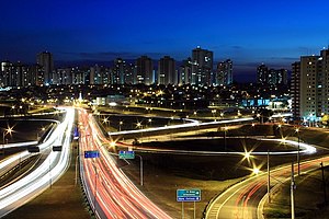
São José dos Campos
Municipality in Southeast, Brazil
Distance: Approx. 3482 meters
Latitude and longitude: -23.17888889,-45.88694444
São José dos Campos (Portuguese pronunciation: [sɐ̃w ʒuˈzɛ dus ˈkɐ̃pus], meaning Saint Joseph of the Fields) is a major city and the seat of the municipality of the same name in the state of São Paulo, Brazil. One of the leading industrial and research centers with emphasis in aerospace sciences in Latin America, the city is located in the Paraíba Valley, between the two most active production and consumption regions in the country; São Paulo (80 km (50 mi) from the city) and Rio de Janeiro (320 km (200 mi)). It is the main city of the Metropolitan Region of Vale do Paraíba e Litoral Norte.
Instituto Tecnológico de Aeronáutica
Brazilian higher education institution
Distance: Approx. 1404 meters
Latitude and longitude: -23.21013333,-45.87678056
The Instituto Tecnológico de Aeronáutica (ITA; English: Aeronautics Institute of Technology) is an institution of higher education maintained by the Brazilian Air Force and is located in São José dos Campos, Brazil. ITA is consistently ranked as one of the top engineering schools in Brazil and engages in advanced research in aerospace science and technology. ITA is one of five institutes that encompass the Brazilian General Command for Aerospace Technology (CTA), having its facilities, along with its laboratories and R&D centers, inside the campus of CTA. Despite its status as a military institution, TA accommodates civilian teachers, directors, and students.

Department of Aerospace Science and Technology
Brazilian aerospace military research department
Distance: Approx. 1951 meters
Latitude and longitude: -23.20966111,-45.87143889
The Brazilian Department of Science and Aerospace Technology (Portuguese: Departamento de Ciência e Tecnologia Aeroespacial; DCTA) is the national military research center for aviation and space flight. It is subordinated to the Brazilian Air Force (FAB). It coordinates all technical and scientific activities related to the aerospace sector in which there are interests by the Ministry of Defense.

Estádio Martins Pereira
Distance: Approx. 3189 meters
Latitude and longitude: -23.1885,-45.8699
Estádio Municipal Dr. Mário Martins Pereira, usually known simply as Estádio Martins Pereira, is a football (soccer) stadium in São José dos Campos, São Paulo state, Brazil. The stadium holds 12,234 people.

Estádio ADC Parahyba
Multi-use stadium in São José dos Campos, Brazil
Distance: Approx. 5154 meters
Latitude and longitude: -23.16370556,-45.88995
Estádio ADC Parahyba is a multi-use stadium located in São José dos Campos, Brazil. It is used mostly for football matches and hosts the home matches of Clube Atlético Joseense and Futebol Clube Primeira Camisa. The stadium has a maximum capacity of 2,500 people.

São José dos Campos Airport
Airport
Distance: Approx. 2891 meters
Latitude and longitude: -23.22888889,-45.87111111
São José dos Campos-Professor Urbano Ernesto Stumpf International Airport (IATA: SJK, ICAO: SBSJ), is the airport serving São José dos Campos, Brazil. Since November 9, 2004, it is named after Urbano Ernesto Stumpf (1916–1998), colonel-aviator, Aerospace Engineer, professor at several universities and inventor of the motor that runs on ethanol fuel. The airport is operated by SJK Airport.
Buquira River
River in Brazil
Distance: Approx. 6333 meters
Latitude and longitude: -23.153398,-45.896737
The Buquira River (Portuguese: Rio Buquira) is a river of São Paulo state in southeastern Brazil. It is a tributary of the Paraíba do Sul. The headwaters are protected by the 292,000 hectares (720,000 acres) Mananciais do Rio Paraíba do Sul Environmental Protection Area, created in 1982 to protect the sources of the Paraíba do Sul river.
Jaguari River (Paraíba do Sul)
River in Brazil
Distance: Approx. 4663 meters
Latitude and longitude: -23.173893,-45.913609
The Jaguari River (Portuguese: Rio Jaguari) is a river of São Paulo state in southeastern Brazil. It is a tributary of the Paraíba do Sul. The headwaters are protected by the 292,000 hectares (720,000 acres) Mananciais do Rio Paraíba do Sul Environmental Protection Area, created in 1982 to protect the sources of the Paraíba do Sul river.

National Institute for Space Research
Brazilian space technology organization
Distance: Approx. 3111 meters
Latitude and longitude: -23.20694444,-45.86027778
The National Institute for Space Research (Portuguese: Instituto Nacional de Pesquisas Espaciais, INPE) is a research unit of the Brazilian Ministry of Science, Technology and Innovations, the main goals of which are fostering scientific research and technological applications and qualifying personnel in the fields of space and atmospheric sciences, space engineering, and space technology. While INPE is the civilian research center for aerospace activities, the Brazilian Air Force's General Command for Aerospace Technology is the military arm. INPE is located in the city of São José dos Campos, São Paulo.
Comprido River (Paraíba do Sul)
River in Brazil
Distance: Approx. 8213 meters
Latitude and longitude: -23.23333333,-45.96666667
The Comprido River is a river of São Paulo state in southeastern Brazil. Rising in the municipality of Jacareí, it follows the boundary with São José dos Campos and before discharging into the Paraíba do Sul.
TV Vanguarda São José dos Campos
Television station in São Paulo, Brazil
Distance: Approx. 6430 meters
Latitude and longitude: -23.15411111,-45.90636111
Vanguarda (channel 17) is a Brazilian television station based in São José dos Campos, a city in the state of São Paulo serving as the affiliate of the TV Globo network for said city and its surroundings. Owned-and-operated by locally based Rede Vanguarda, it transmits its programming to part of Vale do Paraíba, while the other half and the North Coast are covered by TV Vanguarda Taubaté. Its headquarters are located in an annex to CenterVale Shopping in Jardim Oswaldo Cruz, while its transmission antenna is at the top of Morro do Cruzeiro, in Jardim Guimarães.
Weather in this IP's area
clear sky
23 Celsius
23 Celsius
23 Celsius
23 Celsius
1016 hPa
64 %
1016 hPa
949 hPa
10000 meters
3.6 m/s
40 degree
05:43:32
18:02:28