Country:
Region:
City:
Latitude and Longitude:
Time Zone:
Postal Code:
IP information under different IP Channel
ip-api
Country
Region
City
ASN
Time Zone
ISP
Blacklist
Proxy
Latitude
Longitude
Postal
Route
Luminati
Country
ASN
Time Zone
America/Sao_Paulo
ISP
Scala Data Centers
Latitude
Longitude
Postal
IPinfo
Country
Region
City
ASN
Time Zone
ISP
Blacklist
Proxy
Latitude
Longitude
Postal
Route
db-ip
Country
Region
City
ASN
Time Zone
ISP
Blacklist
Proxy
Latitude
Longitude
Postal
Route
ipdata
Country
Region
City
ASN
Time Zone
ISP
Blacklist
Proxy
Latitude
Longitude
Postal
Route
Popular places and events near this IP address

Anhangabaú River
River in São Paulo state, Brazil
Distance: Approx. 1474 meters
Latitude and longitude: -23.53333333,-46.63333333
The Anhangabaú River (in Portuguese: Rio Anhangabaú) is a river in São Paulo, Brazil. The Anhangabaú River cuts through the very oldest part of central São Paulo, though it has been canalized since the first decade of the 20th century. The green space and plazas above the subterranean river is a popular place for various large public gatherings, including cultural events at the annual Virada Cultural, as well as numerous political protests.
Edifício São Vito
Residential in São Paulo, Brazil
Distance: Approx. 1216 meters
Latitude and longitude: -23.5425,-46.62833333
Edifício São Vito, popularly known as Treme-Treme (literally "Shiver-Shiver"), was a 112-metre (367 ft), 27-story former residential building, located in São Paulo, Brazil, finished in 1959. Throughout its existence, the building became deteriorated and earned a reputation of São Paulo's biggest vertical cortiço (slum). The city expropriated and evacuated the building in 2004.

Temple of Solomon (São Paulo)
Distance: Approx. 1320 meters
Latitude and longitude: -23.53777778,-46.60638889
The Temple of Solomon (Portuguese: Templo de Salomão, IPA: [ˈtẽplu dʒi saloˈmɐ̃w]) is a replica of the Temple of Solomon built by the Universal Church of the Kingdom of God (UCKG) in São Paulo. According to Brazilian press reports, the new temple is an "exact replica" of the ancient Temple of Solomon in Jerusalem. According to the church's leader, "The outside is exactly the same as that which was built in Jerusalem", but with increased dimensions.
Tiradentes (São Paulo Metro)
São Paulo Metro station
Distance: Approx. 1416 meters
Latitude and longitude: -23.530832,-46.631963
Tiradentes is a metro station on São Paulo Metro Line 1-Blue, located in the district of Bom Retiro, in São Paulo.

Brás (São Paulo Metro)
São Paulo Metro station
Distance: Approx. 1172 meters
Latitude and longitude: -23.545833,-46.616389
Brás is a station on the Line 3-Red of São Paulo Metro and on the Lines 10-Turquoise, 11-Coral, 12-Sapphire and the Service 710 of CPTM.

Igreja de São Cristóvão (São Paulo)
Church in São Paulo, Brazil
Distance: Approx. 1426 meters
Latitude and longitude: -23.535,-46.63305556
Igreja de São Cristóvão is a church located in São Paulo, Brazil on the Avenida Tiradentes. Originally part of a larger religious complex, the church dates back to 1853. It is situated in the Luz district.

Brás
District of São Paulo, Brazil
Distance: Approx. 679 meters
Latitude and longitude: -23.541,-46.616
Brás is one of 96 districts in the city of São Paulo, Brazil. Administratively part of the Southeast Zone of São Paulo, Brás is located immediately to the east of the historic downtown in the Subprefecture of Mooca. The district is an area of heavy industry with many factories and warehouses, known as a center of textile manufacturing.

Pari (district of São Paulo)
District of São Paulo, Brazil
Distance: Approx. 1123 meters
Latitude and longitude: -23.5276,-46.6124
Pari is one of 96 districts in the city of São Paulo, Brazil. Administratively part of the Southeast Zone of São Paulo, Pari is located immediately to the east of the historic downtown in the Subprefecture of Mooca.

Municipal Market of São Paulo
Public market in São Paulo, Brazil
Distance: Approx. 1229 meters
Latitude and longitude: -23.54166667,-46.62916667
The Municipal Market of São Paulo (Portuguese: Mercado Municipal Paulistano, Mercado Municipal de São Paulo) is a large public market in São Paulo, Brazil. It was designed by the architect Francisco Ramos de Azevedo and inaugurated on January 25, 1933 as a wholesale and retail post specializing in fruits, vegetables, cereals, meats, spices and other food products. The market is located in the Mercado neighborhood, a name that references the market, in the historic center of São Paulo.
St. Gregory the Illuminator Cathedral, São Paulo
Church in São Paulo, Brazil
Distance: Approx. 1423 meters
Latitude and longitude: -23.52964,-46.63143
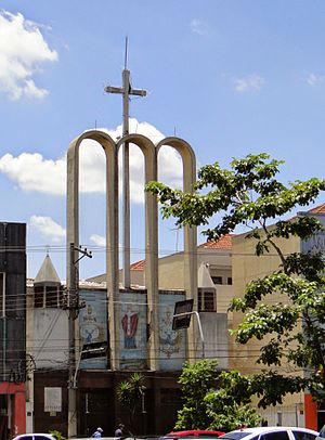
The St. Gregory the Illuminator Cathedral (Portuguese: Catedral Armênia São Gregório Iluminador ) also called Armenian Cathedral of St. Gregory the Illuminator Is the name that receives a religious building affiliated to the Catholic Church that follows the Armenian rite and that is located in the Tiradentes Avenue, 718 Lux of the city of São Paulo in the state of the same name in the South part of the South American country of Brazil.

Palácio das Indústrias
Industrial in São Paulo, Brazil
Distance: Approx. 1272 meters
Latitude and longitude: -23.5442,-46.6273
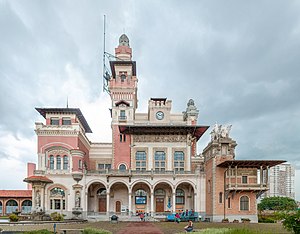
The Palácio das Indústrias is a historical building in São Paulo, under the protection of the Council for the Defense of Historical, Archaeological, Artistic and Tourist Heritage (CONDEPHAAT). It was designed by Domiziano Rossi in conjunction with Ramos de Azevedo and Ricardo Severo and is located in the Parque Dom Pedro II. It is a representative of the Eclectic style and was designed for hosting industrial exhibitions. The first exhibition was held there in 1917.

Catavento Museum
Interactive science museum in São Paulo, Brazil
Distance: Approx. 1321 meters
Latitude and longitude: -23.54416667,-46.62805556
The Catavento Museum is an interactive museum, inaugurated in 2009. It is dedicated to science and its dissemination, and is located in the Palácio das Indústrias ("Palace of the Industries"), in São Paulo, Brazil. The 12,000 square meter space is divided into 4 sections: "Universo" ("Universe"),"Vida" ("Life"), "Engenho" ("Ingenuity") and "Sociedade" ("Society") and has more than 250 installations.
Weather in this IP's area
clear sky
21 Celsius
21 Celsius
21 Celsius
21 Celsius
1012 hPa
78 %
1012 hPa
930 hPa
10000 meters
05:12:34
18:31:41


