Country:
Region:
City:
Latitude and Longitude:
Time Zone:
Postal Code:
IP information under different IP Channel
ip-api
Country
Region
City
ASN
Time Zone
ISP
Blacklist
Proxy
Latitude
Longitude
Postal
Route
Luminati
Country
ASN
Time Zone
America/Sao_Paulo
ISP
Scala Data Centers
Latitude
Longitude
Postal
IPinfo
Country
Region
City
ASN
Time Zone
ISP
Blacklist
Proxy
Latitude
Longitude
Postal
Route
db-ip
Country
Region
City
ASN
Time Zone
ISP
Blacklist
Proxy
Latitude
Longitude
Postal
Route
ipdata
Country
Region
City
ASN
Time Zone
ISP
Blacklist
Proxy
Latitude
Longitude
Postal
Route
Popular places and events near this IP address

Daslu
Department store in São Paulo, Brazil
Distance: Approx. 805 meters
Latitude and longitude: -23.59277778,-46.69166667
Daslu was an upmarket multi-brand boutique-department store in São Paulo, Brazil. The boutique is known as the "fashion designers mecca" of Brazil as it houses more than 60 labels plus 30 store-in-stores and is the place where Brazilian socialites, ranging from multi-millionaire soccer players to conglomerate bigwigs shop for the latest accessories and clothing. It is also a renowned shopping institution in South America for being a "purveyor" in chic and exclusive couture.

Anhembi Morumbi University
Private university in Brazil
Distance: Approx. 1110 meters
Latitude and longitude: -23.6005,-46.6749
Universidade Anhembi Morumbi is a Brazilian private university located in São Paulo and member of the Anima Educação group. Ranked one of the top three private universities in the state of São Paulo, the university is one of the most prestigious in various areas of knowledge such as medicine, engineering, business, communication, gastronomy and fashion design. UAM is also known as the first international university of Brazil.
Via Funchal
Multi-purpose arena in São Paulo, Brazil
Distance: Approx. 440 meters
Latitude and longitude: -23.59288611,-46.68741667
Via Funchal, with an area of 15,000 m2, was an arena in São Paulo, Brazil, that hosted many events, such as concerts and other shows before closing in December 2012.Seated, it hosted 3,120 people and standing, it hosted as many as 6,000 people.

Plaza Centenário
Office in SP, Brazil
Distance: Approx. 1617 meters
Latitude and longitude: -23.6057,-46.6961
Plaza Centenário is an office skyscraper in the city of São Paulo located in United Nations Avenue, where there was also the construction of several commercial buildings of high standard.

Itaim Bibi
District of São Paulo, Brazil
Distance: Approx. 470 meters
Latitude and longitude: -23.60000001,-46.68500001
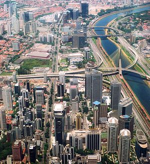
Itaim Bibi is a district in the subprefecture of Pinheiros in the city of São Paulo, Brazil. It includes in its area an eponymous neighborhood. Popularly and in some reports, the region once belonged to the South Zone, but is administered by the Pinheiros Subprefecture, being officially integrated into the West Zone.
Vila Olímpia
São Paulo neighborhood in Southeast, Brazil
Distance: Approx. 805 meters
Latitude and longitude: -23.59277778,-46.69166667
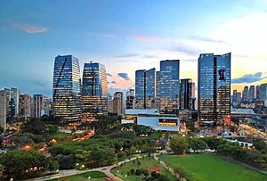
The Vila Olímpia (in English 'Olympia Village') is an upper-class neighborhood in the district of Itaim Bibi in the city of São Paulo, Brazil. Vila Olímpia is home to the Brazilian offices of several multinational companies including Unilever, Google, Yahoo!, CNET, Intel, Symantec, Microsoft, among many others. The region is also well known for its nightlife district with several bars and nightclubs.

E-Tower
Office in São Paulo, Brazil
Distance: Approx. 586 meters
Latitude and longitude: -23.59361111,-46.68972222
E-Tower is a 37-storey skyscraper located in Vila Olímpia neighborhood, near Marginal Pinheiros, in the Brazilian city of São Paulo. At 148 metres, it is the 17th-tallest skyscraper in the city, with a postmodern architecture inspired by the Westend Tower in Frankfurt. Its original project was taller, but due to the intense traffic of helicopters in the region it had to be changed.
Faculdade de Informática e Administração Paulista
Brazilian university
Distance: Approx. 279 meters
Latitude and longitude: -23.59511,-46.68713
Faculdade de Informática e Administração Paulista (FIAP) is a higher education institution in São Paulo, Brazil. It was created in São Paulo, in 1993. It has traditions in the area of Informatics.

Engenheiro Luís Carlos Berrini Avenue
Avenue in São Paulo
Distance: Approx. 1314 meters
Latitude and longitude: -23.60490278,-46.6927
The Engenheiro Luís Carlos Berrini Avenue (in Portuguese: Avenida Engenheiro Luís Carlos Berrini) is an important arterial route in the city of São Paulo, which concentrates in its extent and nearby offices of companies linked to advanced service providers. The boulevard is part of the city area known as "West Zone of São Paulo", an area of economic expansion that follows the trajectory of the city throughout the twentieth century. The construction of the avenue, however, occurred only in the 1970s and was accompanied by controversy, having been considered by some urban planning scholars as a "social disaster", because the arrival of large companies drove out the low-income people who lived there.

People's Park (São Paulo)
Park in São Paulo, Brazil
Distance: Approx. 984 meters
Latitude and longitude: -23.5878,-46.6886
The Mário Pimenta Camargo Municipal Park, or People's Park, was inaugurated on 28 September 2008, in the district of Itaim Bibi, in the district of Chácara Itaim, in São Paulo, Brazil. The People's Park is referred to as the "Parque do Povo" in Portuguese.

Cidade Jardim (CPTM)
Railway station in São Paulo, Brazil
Distance: Approx. 1342 meters
Latitude and longitude: -23.5853404,-46.6910362
Cidade Jardim is a train station on ViaMobilidade Line 9-Emerald, located in the district of Pinheiros in São Paulo. It is next to São Paulo Jockey Club and Pinheiros Sport Club.

Vila Olímpia (CPTM)
Railway station in São Paulo, Brazil
Distance: Approx. 877 meters
Latitude and longitude: -23.593477,-46.69271
Vila Olímpia is a train station on ViaMobilidade Line 9-Emerald, located in the district of Itaim Bibi in São Paulo.
Weather in this IP's area
clear sky
21 Celsius
22 Celsius
21 Celsius
23 Celsius
1012 hPa
74 %
1012 hPa
930 hPa
10000 meters
0.89 m/s
0.89 m/s
65 degree
05:12:44
18:32:03
