Country:
Region:
City:
Latitude and Longitude:
Time Zone:
Postal Code:
IP information under different IP Channel
ip-api
Country
Region
City
ASN
Time Zone
ISP
Blacklist
Proxy
Latitude
Longitude
Postal
Route
Luminati
Country
ASN
Time Zone
America/Sao_Paulo
ISP
Scala Data Centers
Latitude
Longitude
Postal
IPinfo
Country
Region
City
ASN
Time Zone
ISP
Blacklist
Proxy
Latitude
Longitude
Postal
Route
db-ip
Country
Region
City
ASN
Time Zone
ISP
Blacklist
Proxy
Latitude
Longitude
Postal
Route
ipdata
Country
Region
City
ASN
Time Zone
ISP
Blacklist
Proxy
Latitude
Longitude
Postal
Route
Popular places and events near this IP address

Ginásio do Ibirapuera
Distance: Approx. 1082 meters
Latitude and longitude: -23.577721,-46.656048
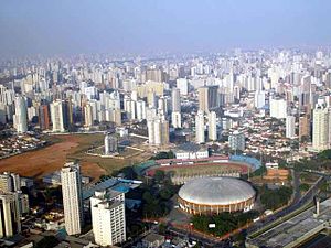
Ginásio do Ibirapuera (lit. 'Gymnasium of Ibirapuera'), officially named Ginásio Estadual Geraldo José de Almeida is an indoor sporting arena located in São Paulo, Brazil. The seating capacity of the arena is 11,000 people and it was opened on 25 January 1957. It is used mostly for volleyball matches.
Brasil Open
Tennis tournament
Distance: Approx. 1074 meters
Latitude and longitude: -23.578,-46.656
The Brasil Open was a men's tennis tournament held annually in São Paulo, Brazil. It was part of the ATP Tour 250 series, and was one of the main events in the Brazilian tennis calendar alongside ATP Tour 500 Rio Open. Since 2004, it was a part of the South American clay court circuit but was held on hard courts prior to 2004.

Colégio Bandeirantes de São Paulo
Private school in São Paulo
Distance: Approx. 226 meters
Latitude and longitude: -23.57783333,-46.6435
Colégio Bandeirantes, known as "Band", is an educational institution located in São Paulo, founded in 1934. It offers education from Early Childhood Education to High School. The school is known for its educational approach that seeks to develop academic and personal skills in its students.

Paraíso (São Paulo Metro)
São Paulo Metro station
Distance: Approx. 655 meters
Latitude and longitude: -23.574903,-46.640595
Paraíso is a station on Line 1 (Blue) and Line 2 (Green) of the São Paulo Metro.

Ana Rosa (São Paulo Metro)
São Paulo Metro station
Distance: Approx. 771 meters
Latitude and longitude: -23.58125,-46.63847
Ana Rosa is a station on Line 1 (Blue) and Line 2 (Green) of the São Paulo Metro.

Estádio Ícaro de Castro Melo
Distance: Approx. 917 meters
Latitude and longitude: -23.57816667,-46.65447222
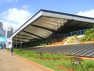
The Estádio Ícaro de Castro Melo is a stadium in São Paulo, Brazil, located near Ibirapuera Park, beside Ginásio do Ibirapuera, which is why it is also known as Estádio do Ibirapuera and Pista de Atletismo do Ibirapuera. It has a capacity of 13,000 people. In 2007, the Pan American Junior Athletics Championships were held in this venue.

Our Lady of Paradise Cathedral, São Paulo
Church in São Paulo, Brazil
Distance: Approx. 755 meters
Latitude and longitude: -23.5725,-46.6425
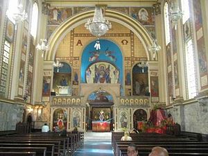
Catedral de Nossa Senhora do Paraíso is a church located in São Paulo, Brazil and is the seat of the Melkite Greek Catholic Eparchy of Nossa Senhora do Paraíso em São Paulo. The temple is located in the neighborhood of Paradise in the city of São Paulo and was constructed in 1952. This church became bishop's see on November 29, 1971, after being transferred from Saint Basil Church (Rio de Janeiro).

Catedral Metropolitana Ortodoxa
Antiochian Orthodox cathedral in São Paolo
Distance: Approx. 642 meters
Latitude and longitude: -23.57564,-46.64017
The Orthodox Metropolitan Cathedral of São Paulo (Portuguese: Catedral Metropolitana Ortodoxa de São Paulo), also known as the Orthodox Cathedral of São Paulo, is a cathedral of the Greek Orthodox Church of Antioch, located at 1515 Vergueiro in Paraíso, Vila Mariana, São Paulo, Brazil. Dedicated to Paul the Apostle, it is home to the Antiochian Orthodox Archdiocese of São Paulo and All Brazil. It was constructed to serve the many Lebanese Brazilians of the Orthodox Christian faith who had been immigrating to Brazil since the late 19th century.
Arab Evangelical Church of São Paulo
Distance: Approx. 569 meters
Latitude and longitude: -23.57837,-46.63993
The Arab Evangelical Church of São Paulo is a Baptist Evangelical in São Paulo. It is affiliated with the Brazilian Baptist Convention.

Casa das Rosas
Museum in São Paulo, Brazil
Distance: Approx. 847 meters
Latitude and longitude: -23.57108694,-46.64554889
Casa das Rosas — Espaço Haroldo de Campos de Poesia e Literatura, is a museum and cultural center in the Paraíso neighborhood of São Paulo, Brazil.

Santa Catarina Hospital
Private Hospital in São Paulo, Brazil
Distance: Approx. 1004 meters
Latitude and longitude: -23.5696834,-46.6452771
Santa Catarina Hospital is a private institution located on Paulista Avenue, in the city of São Paulo, Brazil. It was founded in 1906 and is maintained by the Santa Catarina Congregation Association, a philanthropic entity that also operates in the states of Rio de Janeiro, Espírito Santo, Mato Grosso, and Rio Grande do Sul.
São Paulo Cultural Center
Public institution in São Paulo, Brazil
Distance: Approx. 1025 meters
Latitude and longitude: -23.57083333,-46.64027778
The São Paulo Cultural Center (English: Centro Cultural São Paulo) is a public institution subordinated to the Municipal Department of Culture of São Paulo that includes the Pinacoteca Municipal, the Oneyda Alvarenga Record Collection, the collection of Mário de Andrade's Folklore Research Mission, a set of libraries, exhibition spaces, an area for various courses, theaters and a cinema. It is considered one of the city's main cultural spaces and one of the first institutions in São Paulo to be considered a "cultural center" in the strict sense of the term. It opened in 1982.
Weather in this IP's area
clear sky
21 Celsius
21 Celsius
20 Celsius
21 Celsius
1012 hPa
76 %
1012 hPa
923 hPa
10000 meters
0.45 m/s
0.89 m/s
108 degree
05:12:36
18:31:52
