Country:
Region:
City:
Latitude and Longitude:
Time Zone:
Postal Code:
IP information under different IP Channel
ip-api
Country
Region
City
ASN
Time Zone
ISP
Blacklist
Proxy
Latitude
Longitude
Postal
Route
Luminati
Country
Region
ma
City
vitoriadomearim
ASN
Time Zone
America/Fortaleza
ISP
Directnet Prestacao de Servicos Ltda.
Latitude
Longitude
Postal
IPinfo
Country
Region
City
ASN
Time Zone
ISP
Blacklist
Proxy
Latitude
Longitude
Postal
Route
db-ip
Country
Region
City
ASN
Time Zone
ISP
Blacklist
Proxy
Latitude
Longitude
Postal
Route
ipdata
Country
Region
City
ASN
Time Zone
ISP
Blacklist
Proxy
Latitude
Longitude
Postal
Route
Popular places and events near this IP address

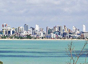
João Pessoa, Paraíba
Capital city of Paraíba, Brazil
Distance: Approx. 8876 meters
Latitude and longitude: -7.12,-34.88
João Pessoa (Portuguese pronunciation: [ʒuˈɐ̃w peˈsoɐ]) is a port city in northeastern Brazil. It is the largest city in, and capital of, the state of Paraíba with an estimated population of 833,932 (as of 2022). It is located on the right bank of the Paraíba do Norte river.

Almeidão
Distance: Approx. 4751 meters
Latitude and longitude: -7.1675,-34.87277778
Estádio José Américo de Almeida Filho, usually known as Almeidão is a multi-purpose stadium in João Pessoa, Brazil. It is currently used mostly for football matches. It hosts the games of Botafogo (PB), CSP, and Santos (PB).

Presidente Castro Pinto International Airport
Airport in Brazil
Distance: Approx. 7274 meters
Latitude and longitude: -7.14833333,-34.95027778
João Pessoa–Presidente Castro Pinto International Airport (IATA: JPA, ICAO: SBJP) is the airport serving João Pessoa, Brazil located in the adjoining municipality of Santa Rita. Since August 2, 1960 the airport is named after João Pereira de Castro Pinto (1863-1944), a lawyer, writer and President of the State of Paraíba (at the time State Governors had the title of President) from 1912 to 1915.
Roman Catholic Archdiocese of Paraíba
Catholic ecclesiastical territory
Distance: Approx. 9233 meters
Latitude and longitude: -7.1154,-34.8844
The Roman Catholic Archdiocese of Paraíba (Latin: Archidioecesis Parahybensis) is a Latin Metropolitan archdiocese, named after the city of João Pessoa, which used to be named Paraíba, in southeastern Brazil. Its cathedral archiepiscopal see is a minor basilica, the Cathedral Basilica of Our Lady of the Snows (Catedral Basílica Metropolitana Nossa Senhora das Neves), in the city of João Pessoa, the state capital.
Mumbaba River
River in Brazil
Distance: Approx. 1830 meters
Latitude and longitude: -7.21222222,-34.905
The Mamuaba River is a river of Paraíba state in western Brazil.

Bayeux, Paraíba
Municipality in Northeast, Brazil
Distance: Approx. 7623 meters
Latitude and longitude: -7.13333333,-34.93333333
Bayeux is a municipality in the state of Paraíba in the Northeast Region of Brazil. Presidente Castro Pinto International Airport which serves the state capital (João Pessoa) is located at Bayeux. The municipality was called Barreiros until 1944, when the name was changed to celebrate the first city of the Battle of Normandy to be liberated, Bayeux, France, during the Second World War.

Conde, Paraíba
Municipality in Northeast, Brazil
Distance: Approx. 7156 meters
Latitude and longitude: -7.26,-34.90777778
Conde, Paraíba is a municipality in the state of Paraíba in the Northeast Region of Brazil. It is the location of Carapibus, a popular beach.
Cathedral Basilica of Our Lady of the Snows, João Pessoa
Church in João Pessoa, Brazil
Distance: Approx. 9233 meters
Latitude and longitude: -7.1154,-34.8844
The Cathedral Basilica of Our Lady of the Snows (Portuguese: Catedral Basílica Metropolitana Nossa Senhora das Neves) also called João Pessoa Cathedral is a Catholic church located in the old town of João Pessoa, capital of the state of Paraiba in Brazil. It is the seat of the Archdiocese of Paraíba. A church dedicated to Our Lady of the Snows was built on a hill by the first settlers of Paraiba in 1586.

Church of Saint Peter Gonzalez
Catholic church in João Pessoa, Brazil
Distance: Approx. 9233 meters
Latitude and longitude: -7.1154,-34.8844
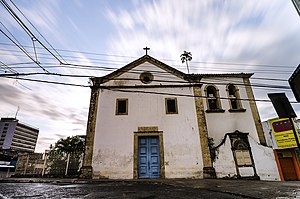
Saint Peter Gonzalez Church (Portuguese: Igreja de São Frei Pedro Gonçalves) is a Catholic church located at Largo de São Frei Pedro Gonçalves (which includes the church, houses and Hotel Globo). It is on top of the hill of the old Porto do Varadouro, in front of the Sanhauá River in the historic center of João Pessoa, capital of the Brazilian state of Paraíba. It stands out for its eclectic architecture with Neoclassical influences.

Church of Our Lady of Mercy (João Pessoa)
Church
Distance: Approx. 9233 meters
Latitude and longitude: -7.1154,-34.8844
Our Lady of Mercy Church is a Catholic church located in the Historic Center of João Pessoa, capital of the Brazilian state of Paraíba. The Church of the Holy House of Mercy, considered the first church of Paraíba. It was built under a primitive chapel built by Duarte Gomes da Silveira and represents a very important monument within the framework of the heritage historical-artistic Paraíba.

Church and Convent of Our Lady of the Rosary (João Pessoa)
Church
Distance: Approx. 7518 meters
Latitude and longitude: -7.13312408,-34.87959527
Church and Convent of Our Lady of the Rosary is a church and convent dedicated to Our Lady of the Rosary located in the neighborhood of Jaguaribe, in the Historic Center of João Pessoa, capital of the Brazilian state of Paraíba. It stands out for the quality of its neoclassical architecture.
Weather in this IP's area
broken clouds
30 Celsius
33 Celsius
30 Celsius
30 Celsius
1014 hPa
58 %
1014 hPa
1011 hPa
10000 meters
5.14 m/s
60 degree
75 %
04:51:32
17:19:30
