Country:
Region:
City:
Latitude and Longitude:
Time Zone:
Postal Code:
IP information under different IP Channel
ip-api
Country
Region
City
ASN
Time Zone
ISP
Blacklist
Proxy
Latitude
Longitude
Postal
Route
Luminati
Country
Region
ma
City
vitoriadomearim
ASN
Time Zone
America/Fortaleza
ISP
Directnet Prestacao de Servicos Ltda.
Latitude
Longitude
Postal
IPinfo
Country
Region
City
ASN
Time Zone
ISP
Blacklist
Proxy
Latitude
Longitude
Postal
Route
db-ip
Country
Region
City
ASN
Time Zone
ISP
Blacklist
Proxy
Latitude
Longitude
Postal
Route
ipdata
Country
Region
City
ASN
Time Zone
ISP
Blacklist
Proxy
Latitude
Longitude
Postal
Route
Popular places and events near this IP address

Pinheiros River
River in São Paulo state, Brazil
Distance: Approx. 4738 meters
Latitude and longitude: -23.52666667,-46.75
The Pinheiros River (Portuguese: Rio Pinheiros) is a tributary of the Tietê River that runs 25 kilometres (16 mi) through the city of São Paulo, Brazil. Until 1920, the river was known as Jurubatuba. After being channelized its name was changed to Pinheiros.
RedeTV!
Brazilian television network
Distance: Approx. 3917 meters
Latitude and longitude: -23.52146,-46.763165
RedeTV! (Portuguese: [ˈʁedʒi teˈve], also Rede TV! or RTV!

Serra da Cantareira
Distance: Approx. 3114 meters
Latitude and longitude: -23.45833333,-46.76527778
The Serra da Cantareira is a Brazilian mountain range to the north of the city of São Paulo in the São Paulo state. The area has many walking trails and is popular among locals. The Pico do Jaraguá, São Paulo's highest point, is located there.
Pico do Jaraguá
Mountain in São Paulo, Brazil
Distance: Approx. 3114 meters
Latitude and longitude: -23.45833333,-46.76527778
Pico do Jaraguá (Jaraguá Peak) is the highest mountain in the Brazilian city of São Paulo, at 1135 metres above sea level, located at the Serra da Cantareira. Jaraguá means Lord of the Valley in Tupi.
CDT da Anhanguera
Distance: Approx. 1772 meters
Latitude and longitude: -23.47555556,-46.7775
The Centro de Televisão da Anhanguera, popularly known as CDT da Anhanguera, is the second largest center of television production in Brazil and is the headquarters of the Brazilian TV company SBT. The complex is second only to the Estúdios Globo of TV Globo, located in Rio de Janeiro. The large complex was inaugurated in 1996 by Silvio Santos and it is located in the city of Osasco within the Greater São Paulo metro area. It concentrates all of the activity of SBT in a single facility.
Subprefecture of Pirituba-Jaraguá
Subprefecture in Southeast, Brazil
Distance: Approx. 4380 meters
Latitude and longitude: -23.475,-46.72361111
The Subprefecture of Pirituba-Jaraguá is one of 32 subprefectures of the city of São Paulo, Brazil. It comprises three districts: Pirituba, São Domingos, and Jaraguá. The highest point of the municipality of São Paulo, Pico do Jaraguá, is located in this place.

São Domingos (district of São Paulo)
District of São Paulo, Brazil
Distance: Approx. 2897 meters
Latitude and longitude: -23.5035,-46.7434
São Domingos is one of 96 districts in the city of São Paulo, Brazil.

2019 São Paulo helicopter crash
Distance: Approx. 4446 meters
Latitude and longitude: -23.451989,-46.786984
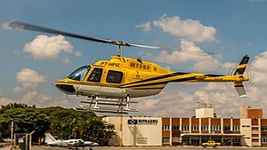
On 11 February 2019, a Bell 206B helicopter crashed while trying to land on the Rodoanel Mário Covas highway, following an unspecified malfunction. Among the victims was journalist Ricardo Boechat. The pilot, Ronaldo Quatrucci, was also killed and one person on the ground was injured.

Pirituba (CPTM)
Railway station in São Paulo, Brazil
Distance: Approx. 3958 meters
Latitude and longitude: -23.4885,-46.726007
Pirituba is a train station on CPTM Line 7-Ruby, located in the district of Pirituba in São Paulo.

Vila Clarice (CPTM)
Railway station in São Paulo, Brazil
Distance: Approx. 2772 meters
Latitude and longitude: -23.469781,-46.744385
Vila Clarice is a train station on CPTM Line 7-Ruby, located in the district of Pirituba in São Paulo.

General Miguel Costa (CPTM)
Railway station in São Paulo, Brazil
Distance: Approx. 5008 meters
Latitude and longitude: -23.523779,-46.737562
General Miguel Costa is a train station, belonging to ViaMobilidade Line 8-Diamond, located in the municipality of Osasco, Brazil.

Jaraguá State Park
Biological reserve in São Paulo, Brazil
Distance: Approx. 2993 meters
Latitude and longitude: -23.45952778,-46.76744444
Jaraguá State Park (Portuguese: Parque Estadual do Jaraguá) is a preservation area located in the state of São Paulo, Brazil. It was created in 1961 in the Serra da Cantareira, around the Jaraguá Peak, the highest point in the municipality of São Paulo with an altitude of 1,135 meters. The park includes Afonso Sardinha's house, listed as a historical heritage site, and the place where slaves washed the gold they found in the region.
Weather in this IP's area
clear sky
24 Celsius
24 Celsius
23 Celsius
25 Celsius
1013 hPa
68 %
1013 hPa
931 hPa
10000 meters
2.06 m/s
140 degree
05:13:02
18:32:53

