Country:
Region:
City:
Latitude and Longitude:
Time Zone:
Postal Code:
IP information under different IP Channel
ip-api
Country
Region
City
ASN
Time Zone
ISP
Blacklist
Proxy
Latitude
Longitude
Postal
Route
IPinfo
Country
Region
City
ASN
Time Zone
ISP
Blacklist
Proxy
Latitude
Longitude
Postal
Route
MaxMind
Country
Region
City
ASN
Time Zone
ISP
Blacklist
Proxy
Latitude
Longitude
Postal
Route
Luminati
Country
ASN
Time Zone
America/Sao_Paulo
ISP
Durand do Brasil Ltda
Latitude
Longitude
Postal
db-ip
Country
Region
City
ASN
Time Zone
ISP
Blacklist
Proxy
Latitude
Longitude
Postal
Route
ipdata
Country
Region
City
ASN
Time Zone
ISP
Blacklist
Proxy
Latitude
Longitude
Postal
Route
Popular places and events near this IP address

Guarapiranga
Reservoir in São Paulo
Distance: Approx. 7902 meters
Latitude and longitude: -23.7269,-46.7352
The Reservoir of Guarapiranga (Represa de Guarapiranga) is a reservoir in the southern area of the city of São Paulo, in the State of São Paulo, Brazil.

Parelheiros (district of São Paulo)
District of São Paulo, Brazil
Distance: Approx. 5993 meters
Latitude and longitude: -23.85,-46.73333333
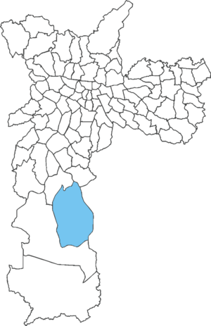
Parelheiros is one of 96 districts of the city of São Paulo. Located in the subprefecture of Parelheiros in the extreme south of the city, it is one of the largest and most rural districts. Very little of this area is inhabited, and is covered with reserves of the Atlantic Forest.

Embu-Guaçu River
River in Brazil
Distance: Approx. 7850 meters
Latitude and longitude: -23.8,-46.8
The Embu-Guaçu River is a river of São Paulo state in southeastern Brazil.
Embumirim River
River in Brazil
Distance: Approx. 9356 meters
Latitude and longitude: -23.71666667,-46.75
The Embu-Mirim River is a river of São Paulo state in southeastern Brazil.
Subprefecture of Parelheiros
Subprefecture in Southeast, Brazil
Distance: Approx. 5993 meters
Latitude and longitude: -23.85,-46.73333333
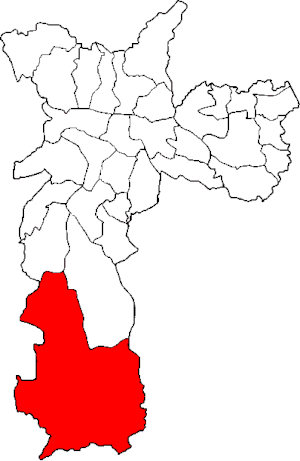
The Subprefecture of Parelheiros is one of 32 subprefectures of the city of São Paulo, Brazil. It comprises two districts: Parelheiros and Marsilac. It's the southernmost, least populated and poorest borough of São Paulo.

Colônia crater
Impact crater in São Paulo, Brazil
Distance: Approx. 8354 meters
Latitude and longitude: -23.87083333,-46.70833333
The Colônia crater is a recently confirmed impact crater located in the municipality of São Paulo, Brazil. It is a round bowl-shaped depression, without any obvious central bulge, with a diameter of about 3.6 kilometres (2.2 mi), bounded by a circular ring of hills about 125 metres (410 ft) high relative to the inner depression. Its approximate location is 23°52′15″ South and 46°42′30″ West, 770 metres (2,530 ft) above sea level.

Cidade Dutra
District of São Paulo, Brazil
Distance: Approx. 9673 meters
Latitude and longitude: -23.712,-46.7033
Cidade Dutra is one of 96 districts in the city of São Paulo, Brazil.

Grajaú (district of São Paulo)
District of São Paulo, Brazil
Distance: Approx. 6049 meters
Latitude and longitude: -23.7738,-46.6693
Grajaú is one of 96 districts in the city of São Paulo, Brazil. Grajaú is a district of the municipality of São Paulo, located in the South Zone. It is administered by the subprefecture of Capela do Socorro, within the administrative region of the South Zone of São Paulo.

Primavera-Interlagos (CPTM)
Railway station in São Paulo, Brazil
Distance: Approx. 8784 meters
Latitude and longitude: -23.723465,-46.691734
Primavera-Interlagos is a train station on ViaMobilidade Line 9-Emerald, in the district of Cidade Dutra in São Paulo. The station was built by CPTM to attend the regions of Jardim Primavera and Interlagos.

Grajaú (CPTM)
Railway station in São Paulo, Brazil
Distance: Approx. 7124 meters
Latitude and longitude: -23.737377,-46.697608
Grajaú is a train station on ViaMobilidade Line 9-Emerald, in the district of Grajaú in São Paulo.

Bruno Covas/Mendes-Vila Natal (CPTM)
Railway station in São Paulo, Brazil
Distance: Approx. 4772 meters
Latitude and longitude: -23.755808,-46.710021
Bruno Covas/Mendes–Vila Natal, formerly Mendes–Vila Natal, or simply just Mendes or Vila Natal, is a train station on ViaMobilidade Line 9-Emerald. It is part of the State Government plan to extend the line in 4.5 kilometres (2.8 mi) until the place where was located the old Varginha station of the Jurubatuba branch, of the extinct FEPASA. The branch was deactivated by CPTM in the end of 2001 "due to infrastructure precariousness" of the line at the time. After the station opening, Governor João Doria signed an executive order renaming the station after the late São Paulo mayor Bruno Covas, who died from cancer in May 2021.

Varginha (CPTM)
Railway station in São Paulo, Brazil
Distance: Approx. 3123 meters
Latitude and longitude: -23.770833,-46.711944
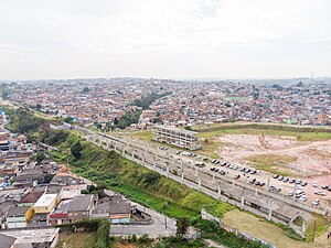
Varginha will be a train station on ViaMobilidade Line 9-Emerald, in the district of Grajaú in São Paulo. It is part of a plan of the State Government to extend the Line Emerald in 4.5 kilometres (2.8 mi) towards south of the city, from Grajaú station. It is being rebuilt in the place where was located the old Varginha station, which belonged to the Jurubatuba branch, of the extinct FEPASA. The branch was deactivated by CPTM in November 2001, "due to infrastructure precariousness" of the line at the time, which was not compatible with the rest of the railway, nor with the new administrative policies adopted by the company during that period, as it aimed a "pattern elevation" of the services provided by the company, transforming Line C-Celeste (current Line 9-Emerald), just like other railways transferred to it, from suburban services to metropolitan services.
Weather in this IP's area
broken clouds
16 Celsius
16 Celsius
15 Celsius
17 Celsius
1014 hPa
90 %
1014 hPa
924 hPa
10000 meters
2.62 m/s
4.13 m/s
162 degree
80 %
05:39:43
18:08:37

