Country:
 Brazil
Region:
City:
Latitude and Longitude:
Time Zone:
Postal Code:
IP information under different IP Channel
ip-api
Country
Region
City
ASN
Time Zone
ISP
Blacklist
Proxy
Latitude
Longitude
Postal
Route
IPinfo
Country
Region
City
ASN
Time Zone
ISP
Blacklist
Proxy
Latitude
Longitude
Postal
Route
MaxMind
Country
Region
City
ASN
Time Zone
ISP
Blacklist
Proxy
Latitude
Longitude
Postal
Route
Luminati
Country
BRASN
Time Zone
America/Sao_Paulo
ISP
Durand do Brasil Ltda
Latitude
Longitude
Postal
db-ip
Country
Region
City
ASN
Time Zone
ISP
Blacklist
Proxy
Latitude
Longitude
Postal
Route
ipdata
Country
Region
City
ASN
Time Zone
ISP
Blacklist
Proxy
Latitude
Longitude
Postal
Route
Popular places and events near this IP address
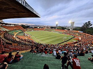
Estádio do Canindé
Football stadium in São Paulo, Brazil
Distance: Approx. 648 meters
Latitude and longitude: -23.52055556,-46.61833333
The Estádio do Canindé, also known as Estádio Oswaldo Teixeira Duarte, is a football stadium inaugurated on January 11, 1956 in Canindé neighborhood, São Paulo, São Paulo state, with a maximum capacity of 21,004 spectators. Although the stadium's maximum capacity is 28,500 people, due to a Paulista Football Federation decision, and following FIFA requirements, Canindé Stadium had its maximum capacity reduced to 25,470 spectators. As of 2011, it has a maximum capacity of 21,004.
Santana (district of São Paulo)
District of São Paulo, Brazil
Distance: Approx. 1448 meters
Latitude and longitude: -23.51666668,-46.62694445
Santana (Portuguese pronunciation: [sɐ̃ˈtɐnɐ]; from Portuguese Santa Ana, meaning Saint Anne) is a northern district in the subprefecture of Santana-Tucuruvi of the city of São Paulo, Brazil, and is located between 4–7 km (2.5–4.3 mi) from downtown São Paulo. Originating from the Sant’Ana Farm, property of the Society of Jesus that was first mentioned in 1560 by Father José de Anchieta, it functioned as the green belt of "São Paulo dos Campos de Piratininga". The farm's lands were divided into sesmarias at the beginning of the 19th century.

Carandiru Penitentiary
Prison in São Paulo, Brazil
Distance: Approx. 1518 meters
Latitude and longitude: -23.50833333,-46.62361111
Carandiru Penitentiary, officially São Paulo House of Detention (Portuguese: Casa de Detenção de São Paulo) was a prison located in São Paulo, Brazil. The prison was designed and built by Samuel das Neves in 1920, when it was considered a model-prison to meet the new demands of the 1890 criminal code. It was operational from 1956 to 2002 and, at its peak, was South America's largest penitentiary, housing over 8,000 inmates.

Ginásio da Portuguesa
Distance: Approx. 811 meters
Latitude and longitude: -23.520133,-46.620289
Ginásio da Portuguesa is an arena in São Paulo, Brazil. The Ultimate Fighting Championship held the UFC Brazil event here on October 16, 1998. The attendance was 8,500.
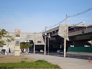
Carandiru (São Paulo Metro)
São Paulo Metro station
Distance: Approx. 1526 meters
Latitude and longitude: -23.509662,-46.624904
Carandiru is a metro station on São Paulo Metro Line 1-Blue, located in the district of Santana, in São Paulo. It was opened on 26 September 1975.

Portuguesa-Tietê (São Paulo Metro)
São Paulo Metro station
Distance: Approx. 1271 meters
Latitude and longitude: -23.5161449,-46.6251397
Portuguesa-Tietê is a metro station on São Paulo Metro Line 1-Blue, located in the district of Santana, in São Paulo. It was opened on September 26, 1975. Named as Tietê, it was renamed on June 10, 2006 as a tribute to Associação Portuguesa de Desportos, soccer club located in its surroundings.

Armênia (São Paulo Metro)
São Paulo Metro station
Distance: Approx. 1880 meters
Latitude and longitude: -23.52538889,-46.62919444
Armênia, originally known as Ponte Pequena, is a metro station on São Paulo Metro Line 1-Blue, located in the district of Bom Retiro, in São Paulo.

Brasil Game Show
Video gaming convention
Distance: Approx. 706 meters
Latitude and longitude: -23.511366,-46.612562
Brasil Game Show (known by the initials BGS and originally titled Rio Game Show (RGS)) is a yearly Brazilian video game convention organized by business executive Marcelo Tavares, that is currently held in São Paulo and is the largest gaming convention in Latin America and one of the largest in the world. The first edition of the event was held on June 21, 2009 in Rio de Janeiro, with an attendance of 4,000. Since moving from Rio de Janeiro to São Paulo, the event has been held at the Expo Center Norte, in the Vila Guilherme district of the city.
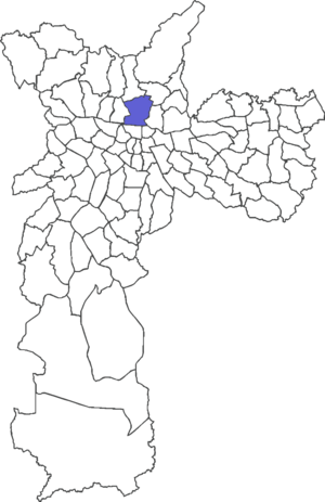
Subprefecture of Vila Mariana
Subprefecture in Southeast, Brazil
Distance: Approx. 1312 meters
Latitude and longitude: -23.51666667,-46.6
The Subprefecture of Vila Mariana is one of 32 subprefectures of the city of São Paulo, Brazil. It comprises three districts: Vila Mariana, Saúde, and Moema.

Tietê Bus Terminal
Distance: Approx. 1108 meters
Latitude and longitude: -23.516292,-46.623541
The Tietê Bus Terminal (Portuguese: Terminal Rodoviário Tietê) is the largest bus terminal in Latin America, and the second largest in the world, after the Port Authority Bus Terminal in New York City. The terminal is located in the Santana district in the city of São Paulo, Brazil. The official name in Portuguese is Terminal Rodoviário Governador Carvalho Pinto, named after Carlos Alberto Alves de Carvalho Pinto, a former Governor of the State of São Paulo.

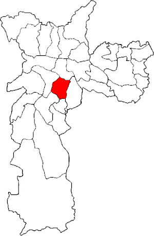
Pari (district of São Paulo)
District of São Paulo, Brazil
Distance: Approx. 1103 meters
Latitude and longitude: -23.5276,-46.6124
Pari is one of 96 districts in the city of São Paulo, Brazil. Administratively part of the Southeast Zone of São Paulo, Pari is located immediately to the east of the historic downtown in the Subprefecture of Mooca.

Chácara da Floresta
Association football stadium in São Paulo, Brazil
Distance: Approx. 1960 meters
Latitude and longitude: -23.52011389,-46.63182222
Chácara da Floresta (English: Forest Farmstead) was an association football stadium in São Paulo, Brazil. It was used by AA das Palmeiras, a three-time state champion club, from 1906 to 1929. From 1930 to 1935, it was used by São Paulo FC, champion of 1931 Campeonato Paulista, which after financial problems, negotiated the ground with CR Tietê (focused on water sports) It was also used by Independente EC, a dissident of CR Tietê who participates in the 1935 Campeonato Paulista.
Weather in this IP's area
broken clouds
17 Celsius
17 Celsius
16 Celsius
18 Celsius
1014 hPa
86 %
1014 hPa
931 hPa
10000 meters
3.6 m/s
150 degree
75 %
05:39:25
18:08:01