Country:
 Brazil
Region:
City:
Latitude and Longitude:
Time Zone:
Postal Code:
IP information under different IP Channel
ip-api
Country
Region
City
ASN
Time Zone
ISP
Blacklist
Proxy
Latitude
Longitude
Postal
Route
IPinfo
Country
Region
City
ASN
Time Zone
ISP
Blacklist
Proxy
Latitude
Longitude
Postal
Route
MaxMind
Country
Region
City
ASN
Time Zone
ISP
Blacklist
Proxy
Latitude
Longitude
Postal
Route
Luminati
Country
BRRegion
sp
City
barueri
ASN
Time Zone
America/Sao_Paulo
ISP
Durand do Brasil Ltda
Latitude
Longitude
Postal
db-ip
Country
Region
City
ASN
Time Zone
ISP
Blacklist
Proxy
Latitude
Longitude
Postal
Route
ipdata
Country
Region
City
ASN
Time Zone
ISP
Blacklist
Proxy
Latitude
Longitude
Postal
Route
Popular places and events near this IP address

Diadema, São Paulo
Municipality in Southeast, Brazil
Distance: Approx. 1248 meters
Latitude and longitude: -23.68611111,-46.61055556
Diadema (Portuguese pronunciation: [dʒi.ɐˈdemɐ], Diadem) is a municipality in São Paulo state, Brazil. Belonging to the ABCD Region of Greater São Paulo, it is 17 km (11 mi) distant from São Paulo's central point. Initially part of São Bernardo do Campo, Diadema became a city of its own in 1959.
Agência Paulista de Tecnologia dos Agronegócios
Distance: Approx. 4170 meters
Latitude and longitude: -23.64885556,-46.62715
The Agência Paulista de Tecnologia dos Agronegócios (APTA – São Paulo's Agency for Agribusiness Technology), linked to Secretaria de Agricultura e Abastecimento (Secretariat of Agriculture and Supplies), came about in 2001, in order to coordinate all agriculture and cattle raising research in the state of São Paulo, Brazil. Its main objective is to generate and transfer scientific and technological knowledge in agribusiness, thereby harmonizing the socio-economic development with environmental balance. The main innovation in this reorganization was the creation of 15 regional poles of development, spread throughout the state.

Instituto de Economia Agrícola
Distance: Approx. 4189 meters
Latitude and longitude: -23.64861111,-46.62633611
The Instituto de Economia Agrícola (IEA - Agricultural Economics Institute), linked to the Agência Paulista de Tecnologia dos Agronegócios (APTA) is a major public scientific research institute on economics and statistics applied to agricultural and farming questions, established in São Paulo, Brazil. The aim to provide technical information to support agribusiness decision makers and governmental policies. IEA was generated in the bosom of Dept.
Vila Facchini Biological Reserve
Distance: Approx. 3191 meters
Latitude and longitude: -23.658,-46.629
Vila Fachini Biological Reserve (Portuguese: Reserva Biológica Estadual Vila Fachini) is a biological reserve in the city of São Paulo, Brazil. The Vila Fachini Biological Reserve was created by decree nº. 45.803 in 1965.
Fontes do Ipiranga Biological Reserve
Biological reserve in Brazil
Distance: Approx. 3367 meters
Latitude and longitude: -23.656,-46.626
Fontes do Ipiranga Biological Reserve (Portuguese: Reserva Biológica do Parque Estadual das Fontes do Ipiranga) is a biological reserve in the Fontes do Ipiranga State Park in São Paulo State, Brazil.

Jabaquara (São Paulo Metro)
São Paulo Metro station
Distance: Approx. 4683 meters
Latitude and longitude: -23.647134,-46.640112
Jabaquara is a station on Line 1 (Blue) of the São Paulo Metro and is the current terminus. It will be integrated with the planned Line 17 (Gold). The station integrates with the Jabaquara Intermunicipal Terminal, allowing passengers to transfer to SPTrans and EMTU bus lines with their Bilhete Único card.
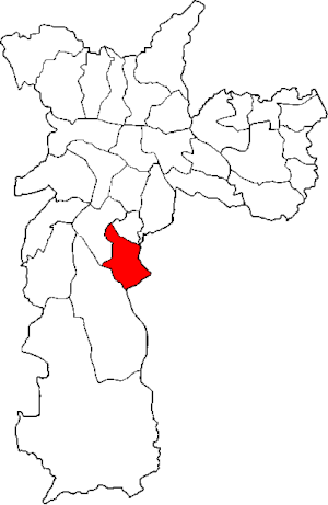
Subprefecture of Cidade Ademar
Subprefecture in Southeast, Brazil
Distance: Approx. 3587 meters
Latitude and longitude: -23.675,-46.65583333
The Subprefecture of Cidade Ademar is one of 32 subprefectures of the city of São Paulo, Brazil. It comprises two districts: Cidade Ademar and Pedreira.
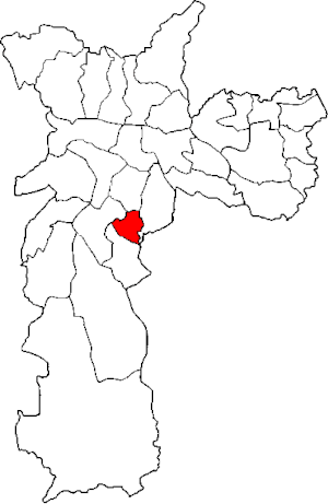
Subprefecture of Jabaquara
Subprefecture in Southeast, Brazil
Distance: Approx. 4473 meters
Latitude and longitude: -23.65222222,-46.64638889
The Subprefecture of Jabaquara is one of 32 subprefectures of the city of São Paulo, Brazil. It comprises one district: Jabaquara.

São Paulo Zoo
Zoo in São Paulo, Brazil
Distance: Approx. 4097 meters
Latitude and longitude: -23.649301,-46.622157
The São Paulo Zoo (Portuguese: Parque Zoológico de São Paulo) is the largest zoo in Brazil. With 824,529 m2 (82.45 hectares [203.7 acres]) of space in what was originally the Atlantic Forest, the zoo is south of the city of São Paulo. It displays more than 3,200 animals, 102 species of mammals, 216 species of birds, 95 species of reptiles, 15 species of amphibians and 16 species of invertebrates in enclosures that replicate the natural habitats of these animals.

Cidade Ademar (district of São Paulo)
District of São Paulo, Brazil
Distance: Approx. 3952 meters
Latitude and longitude: -23.6701,-46.6574
Cidade Ademar is one of 96 districts in the city of São Paulo, Brazil.

Pedreira (district of São Paulo)
District of São Paulo, Brazil
Distance: Approx. 1889 meters
Latitude and longitude: -23.6958,-46.638
Pedreira is one of 96 districts in the city of São Paulo, Brazil.

Arena Inamar
Distance: Approx. 4183 meters
Latitude and longitude: -23.7226108,-46.61308779
Estádio Municipal José Batista Pereira Fernandes, known as Distrital do Inamar or Arena Inamar, is a football stadium in Diadema, São Paulo, Brazil. It has a maximum capacity of 10,000 people, and hosts the home matches of Água Santa.
Weather in this IP's area
overcast clouds
15 Celsius
15 Celsius
13 Celsius
16 Celsius
1020 hPa
92 %
1020 hPa
930 hPa
10000 meters
5.81 m/s
6.71 m/s
182 degree
100 %
06:12:14
17:57:35