Country:
Region:
City:
Latitude and Longitude:
Time Zone:
Postal Code:
IP information under different IP Channel
ip-api
Country
Region
City
ASN
Time Zone
ISP
Blacklist
Proxy
Latitude
Longitude
Postal
Route
Luminati
Country
ASN
Time Zone
America/Sao_Paulo
ISP
Directnet Prestacao de Servicos Ltda.
Latitude
Longitude
Postal
IPinfo
Country
Region
City
ASN
Time Zone
ISP
Blacklist
Proxy
Latitude
Longitude
Postal
Route
db-ip
Country
Region
City
ASN
Time Zone
ISP
Blacklist
Proxy
Latitude
Longitude
Postal
Route
ipdata
Country
Region
City
ASN
Time Zone
ISP
Blacklist
Proxy
Latitude
Longitude
Postal
Route
Popular places and events near this IP address

Mandaqui
District of São Paulo, Brazil
Distance: Approx. 3302 meters
Latitude and longitude: -23.46833333,-46.64111111
Mandaqui is a district in the city of São Paulo, Brazil.

Alto de Santana
Place in Southeast, Brazil
Distance: Approx. 2051 meters
Latitude and longitude: -23.49194444,-46.62611111
Alto de Santana (Santana Heights) is a name commonly used, especially by business, to refer to an upper middle class area of Santana district in São Paulo city, Brazil. The term is used informally to refer to the bairro of Vila Santana (Santana Village) and the elevated region of the Santana bairro. Among the major routes that pass through the region are: Voluntários da Pátria street, Francisca Júlia street, Pedro Doll street, Doutor Guilherme Cristoffel street and Doutor Luis Lustosa da Silva street.

Baruel Mansion
Mansion built in the 19th century
Distance: Approx. 2452 meters
Latitude and longitude: -23.49666667,-46.62638889
Baruel Mansion (Portuguese: Palacete Baruel) is a mansion built in the 19th century, located in Alto de Santana, northern area of São Paulo city. The construction had been the headquarters of the Baruel estate, a farm where rice, beans, corn and sugarcane were grown with slave labour. The wealth of the owner is perceived in the buildings that make up the area.

Cemitério Municipal de Santana
Cemetery Santana, São Paulo, Brazil
Distance: Approx. 3406 meters
Latitude and longitude: -23.49666667,-46.63888889
The Cemitério Municipal de Santana (Municipal Cemetery of Santana), popularly known as Chora Menino (English: cry boy), is a cemetery located in the northeastern zone of São Paulo in the district of Santana, and is one of the oldest cemeteries in Brazil. It was officially recognized as a cemetery in 1897 and has an area of 38,485m². The local Jewish community used the location as a cemetery until 1970 known as Cemitério Israelita de Santana.

Tucuruvi (São Paulo Metro)
São Paulo Metro station
Distance: Approx. 816 meters
Latitude and longitude: -23.4800648,-46.6032261
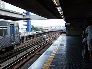
Tucuruvi is a metro station on São Paulo Metro Line 1-Blue, located in the district of Tucuruvi in São Paulo. It was opened on 29 April 1998, as part of the Line 1 north expansion plan.
Parada Inglesa (São Paulo Metro)
São Paulo Metro station
Distance: Approx. 869 meters
Latitude and longitude: -23.4870907,-46.6088104
Parada Inglesa is a metro station on São Paulo Metro Line 1-Blue, located in the district of Tucuruvi, in São Paulo. Belongs to the Line 1 north expansion plan, initiated in 1996. It would be named Paulicéia Station, according to the original project.
Jardim São Paulo-Ayrton Senna (São Paulo Metro)
São Paulo Metro station
Distance: Approx. 1555 meters
Latitude and longitude: -23.492473,-46.6171092
Jardim São Paulo–Ayrton Senna, originally known only as Jardim São Paulo, is a metro station on São Paulo Metro Line 1-Blue, located in the district of Santana, in São Paulo. It was opened by Governor Mário Covas on 29 April 1998, along with stations Tucuruvi and Parada Inglesa, in the Line 1 north expansion project, initiated in 1996.
Santana (São Paulo Metro)
São Paulo Metro station
Distance: Approx. 2898 meters
Latitude and longitude: -23.5024844,-46.6247267
Santana is a metro station on São Paulo Metro Line 1-Blue, located in the district of Santana, in São Paulo. It was opened on 26 September 1975. For more than 20 years, it was the terminus for the line in its north branch.

Northeast Zone of São Paulo
Place in São Paulo, Brazil
Distance: Approx. 1592 meters
Latitude and longitude: -23.48138889,-46.62666667
The Northeast Zone is an Administrative Zone of São Paulo, Brazil.
Capela de Santa Cruz (São Paulo)
Church in São Paulo, Brazil
Distance: Approx. 2417 meters
Latitude and longitude: -23.49666667,-46.62583333
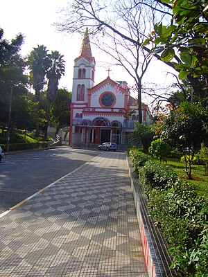
Capela de Santa Cruz is a church located in São Paulo, Brazil. It was completed in 1895.
Paróquia Santa Teresinha (São Paulo)
Church in São Paulo, Brazil
Distance: Approx. 2632 meters
Latitude and longitude: -23.49083333,-46.63388889
Paróquia Santa Teresinha is a church located in São Paulo, Brazil. It was built in 1945.

Albert Löfgren State Park
State park in São Paulo, Brazil
Distance: Approx. 3252 meters
Latitude and longitude: -23.462565,-46.637074
The Albert Löfgren State Park (Portuguese: Parque Estadual Alberto Löfgren), commonly known as the São Paulo Forest Gardens (Portuguese: Horto Florestal de São Paulo) is a state park in the state of São Paulo, Brazil.
Weather in this IP's area
overcast clouds
20 Celsius
20 Celsius
20 Celsius
21 Celsius
1008 hPa
95 %
1008 hPa
920 hPa
4000 meters
4.63 m/s
350 degree
100 %
05:16:26
18:24:05


