Country:
 Brazil
Region:
City:
Latitude and Longitude:
Time Zone:
Postal Code:
IP information under different IP Channel
ip-api
Country
Region
City
ASN
Time Zone
ISP
Blacklist
Proxy
Latitude
Longitude
Postal
Route
IPinfo
Country
Region
City
ASN
Time Zone
ISP
Blacklist
Proxy
Latitude
Longitude
Postal
Route
MaxMind
Country
Region
City
ASN
Time Zone
ISP
Blacklist
Proxy
Latitude
Longitude
Postal
Route
Luminati
Country
BRASN
Time Zone
America/Sao_Paulo
ISP
FUNDACAO DE AMPARO A PESQUISA DO ESTADO SAO PAULO
Latitude
Longitude
Postal
db-ip
Country
Region
City
ASN
Time Zone
ISP
Blacklist
Proxy
Latitude
Longitude
Postal
Route
ipdata
Country
Region
City
ASN
Time Zone
ISP
Blacklist
Proxy
Latitude
Longitude
Postal
Route
Popular places and events near this IP address

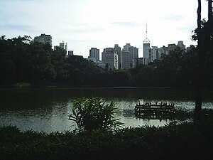
Vila Mariana (district of São Paulo)
District of São Paulo, Brazil
Distance: Approx. 402 meters
Latitude and longitude: -23.58333333,-46.63333333
Vila Mariana (Portuguese pronunciation: [ˈvilɐ maɾiˈɐnɐ]) is a borough of the city of São Paulo, Brazil. Located to the south of Bela Vista and Liberdade, east of Jardim Paulista and west of Ipiranga, it's a dynamic area of the city. Similar to its neighbor district, Moema, it's a wealthy area and it comprises some of the most famous symbols of São Paulo, like the Ibirapuera Park, the Obelisk and Mausoleum of the heroes from the Constitutionalist Revolution in 1932 and the "Monumento às Bandeiras", and the Fundadores de São Paulo monument.

Colégio Bandeirantes de São Paulo
Private school in São Paulo
Distance: Approx. 980 meters
Latitude and longitude: -23.57783333,-46.6435
Colégio Bandeirantes, known as "Band", is an educational institution located in São Paulo, founded in 1934. It offers education from Early Childhood Education to High School. The school is known for its educational approach that seeks to develop academic and personal skills in its students.

Paraíso (São Paulo Metro)
São Paulo Metro station
Distance: Approx. 1116 meters
Latitude and longitude: -23.574903,-46.640595
Paraíso is a station on Line 1 (Blue) and Line 2 (Green) of the São Paulo Metro.

Ana Rosa (São Paulo Metro)
São Paulo Metro station
Distance: Approx. 377 meters
Latitude and longitude: -23.58125,-46.63847
Ana Rosa is a station on Line 1 (Blue) and Line 2 (Green) of the São Paulo Metro.

Vila Mariana (São Paulo Metro)
São Paulo Metro station
Distance: Approx. 613 meters
Latitude and longitude: -23.589431,-46.634667
Vila Mariana is a station on Line 1 (Blue) of the São Paulo Metro.

Chácara Klabin (São Paulo Metro)
São Paulo Metro station
Distance: Approx. 1158 meters
Latitude and longitude: -23.592503,-46.629978
Chácara Klabin is an interchange station on Line 2 (Green) and Line 5 (Lilac) of the São Paulo Metro in the Vila Mariana district of São Paulo, Brazil.

Catedral Metropolitana Ortodoxa
Antiochian Orthodox cathedral in São Paolo
Distance: Approx. 1024 meters
Latitude and longitude: -23.57564,-46.64017
The Orthodox Metropolitan Cathedral of São Paulo (Portuguese: Catedral Metropolitana Ortodoxa de São Paulo), also known as the Orthodox Cathedral of São Paulo, is a cathedral of the Greek Orthodox Church of Antioch, located at 1515 Vergueiro in Paraíso, Vila Mariana, São Paulo, Brazil. Dedicated to Paul the Apostle, it is home to the Antiochian Orthodox Archdiocese of São Paulo and All Brazil. It was constructed to serve the many Lebanese Brazilians of the Orthodox Christian faith who had been immigrating to Brazil since the late 19th century.
Arab Evangelical Church of São Paulo
Distance: Approx. 731 meters
Latitude and longitude: -23.57837,-46.63993
The Arab Evangelical Church of São Paulo is a Baptist Evangelical in Sao Paulo. It is affiliated with the Brazilian Baptist Convention.
Lycée Pasteur de São Paulo
International school in Brazil
Distance: Approx. 1182 meters
Latitude and longitude: -23.5927407,-46.6299237
Lycée Pasteur de São Paulo (Portuguese: Liceu Pasteur) is a French international school located in Chácara Klabin, in Vila Mariana district of São Paulo. The school serves the levels maternelle (preschool) through lycée (senior high school).

Museu Lasar Segall
Museum in São Paulo, Brazil
Distance: Approx. 1157 meters
Latitude and longitude: -23.5947,-46.6356
Museu Lasar Segall (in English: Lasar Segall Museum) is an art museum in São Paulo, Brazil. Designed in 1932 by architect Gregori Warchavchik, the building which houses the museum was the residence and art studio of Lithuanian Brazilian artist Lasar Segall until his death in 1957. Segall's family opened the museum in 1967 to showcase the work of the artist.

Museum of Fine Arts of São Paulo
University museum located in São Paulo, Brasil
Distance: Approx. 626 meters
Latitude and longitude: -23.5893569,-46.6399944
The Museum of Fine Arts of São Paulo (MuBA) is a university museum located in the neighborhood of Vila Mariana, in the city of São Paulo, Brasil. It opened on September 23, 2007 and was officially registered on April 14, 2008. The museum is connected to the Fine Arts University Center of São Paulo (commonly known as "Fine Arts"), a private institution of higher learning, and is sustained through the School of Fine Arts Foundation of São Paulo (FEBASP).
Aclimação Park
Urban public park in São Paulo, Brazil
Distance: Approx. 1365 meters
Latitude and longitude: -23.57472222,-46.62888889
Aclimação Park (Portuguese: Parque da Aclimação) is a public leisure area located in the Aclimação district, in the central area of the Brazilian city of São Paulo. It opened on September 16, 1939, and covers an area of 112,000 square meters. It dates back to 1892, when Carlos Botelho decided to establish a garden on the site inspired by the Jardin d'Acclimatation in Paris.
Weather in this IP's area
clear sky
21 Celsius
22 Celsius
20 Celsius
22 Celsius
1019 hPa
80 %
1019 hPa
928 hPa
10000 meters
1.54 m/s
80 degree
06:10:14
17:58:18