Country:
Region:
City:
Latitude and Longitude:
Time Zone:
Postal Code:
IP information under different IP Channel
ip-api
Country
Region
City
ASN
Time Zone
ISP
Blacklist
Proxy
Latitude
Longitude
Postal
Route
Luminati
Country
Region
rm
City
santiago
ASN
Time Zone
America/Santiago
ISP
Telmex Chile Internet S.A.
Latitude
Longitude
Postal
IPinfo
Country
Region
City
ASN
Time Zone
ISP
Blacklist
Proxy
Latitude
Longitude
Postal
Route
db-ip
Country
Region
City
ASN
Time Zone
ISP
Blacklist
Proxy
Latitude
Longitude
Postal
Route
ipdata
Country
Region
City
ASN
Time Zone
ISP
Blacklist
Proxy
Latitude
Longitude
Postal
Route
Popular places and events near this IP address

Pedro Aguirre Cerda, Chile
City and Commune in Santiago Metro., Chile
Distance: Approx. 345 meters
Latitude and longitude: -33.49166667,-70.675
Pedro Aguirre Cerda (Spanish pronunciation: [ˈpeðɾo aˈɣire ˈseɾða]) is a commune of Chile located in Santiago Province, Santiago Metropolitan Region. It is named after President Pedro Aguirre Cerda.
San Miguel, Chile
City and commune in Chile
Distance: Approx. 2287 meters
Latitude and longitude: -33.48583333,-70.64944444
San Miguel (Spanish for "Saint Michael") is a commune of Chile located in Santiago Province, Santiago Metropolitan Region. It was founded on August 10, 1896.
Chile Tennis Federation
Distance: Approx. 1748 meters
Latitude and longitude: -33.48877,-70.654321
Chile Tennis Federation (Spanish: Federación de Tenis de Chile) is the national governing body of a tennis in Chile. The federation was formed on April 3, 1920 in Santiago, under the name of the Lawn Tennis Association of Chile (LTAC). In 1948 LTAC joined the International Tennis Federation.

Los Cerrillos Airport
Former airport that served Santiago de Chile
Distance: Approx. 2375 meters
Latitude and longitude: -33.49361111,-70.69777778
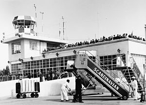
Los Cerrillos Airport (IATA: ULC, ICAO: SCTI) was the main aviation facility of Santiago, Chile until 1967, when Arturo Merino Benítez International Airport was opened in Pudahuel. The airport was closed in 2006.

El Llano metro station
Santiago metro station
Distance: Approx. 2418 meters
Latitude and longitude: -33.48269444,-70.64975
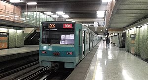
El Llano is an underground metro station on the Line 2 of the Santiago Metro, in Santiago, Chile. The station was opened on 21 December 1978 as part of the extension of the line from Franklin to Lo Ovalle.

San Miguel metro station
Santiago metro station
Distance: Approx. 2035 meters
Latitude and longitude: -33.48880278,-70.65108333
San Miguel is an underground metro station on the Line 2 of the Santiago Metro, in Santiago, Chile. The station was opened on 21 December 1978 as part of the extension of the line from Franklin to Lo Ovalle.

Lo Vial metro station
Santiago metro station
Distance: Approx. 1817 meters
Latitude and longitude: -33.49690278,-70.65300556
Lo Vial is an underground metro station on the Line 2 of the Santiago Metro, in Santiago, Chile. The station was opened on 21 December 1978 as part of the extension of the line from Franklin to Lo Ovalle.

Departamental metro station
Santiago metro station
Distance: Approx. 1900 meters
Latitude and longitude: -33.50240556,-70.6546
Departamental is an underground metro station on the Line 2 of the Santiago Metro, in Santiago, Chile. The station was opened on 21 December 1978 as part of the extension of the line from Franklin to Lo Ovalle.

Ciudad del Niño metro station
Santiago metro station
Distance: Approx. 2279 meters
Latitude and longitude: -33.50953333,-70.65663889
Ciudad del Niño is an underground metro station on the Line 2 of the Santiago Metro, in Santiago, Chile. It is named for the former Ciudad del Niño Presidente Juan Antonio Ríos. The station was opened on 21 December 1978 as part of the extension of the line from Franklin to Lo Ovalle.

Cerrillos metro station
Santiago metro station
Distance: Approx. 2388 meters
Latitude and longitude: -33.48333333,-70.69472222
Cerrillos is an underground metro station and the southern terminal station of Line 6 of the Santiago Metro network, in Santiago, Chile. It is underground, being the terminal station of Line 6, preceded by the Lo Valledor station. It is located at the intersection of Pedro Aguirre Cerda-Camino a Melipilla avenues with Departamental-Buzeta.

Lo Valledor metro station
Santiago metro station
Distance: Approx. 1885 meters
Latitude and longitude: -33.4784,-70.6809
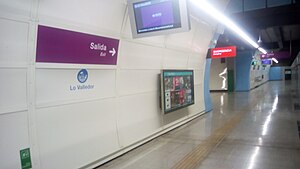
Lo Valledor is a station on the Santiago Metro in Santiago, Chile. It is underground, between the stations Cerrillos and Presidente Pedro Aguirre Cerda on the same line. It is located on the Carlos Valdovinos Avenue, in the commune of Pedro Aguirre Cerda.

Presidente Pedro Aguirre Cerda metro station
Santiago metro station
Distance: Approx. 1829 meters
Latitude and longitude: -33.47838889,-70.66505556
Presidente Pedro Aguirre Cerda is an underground metro station on the Line 6 of the Santiago Metro, in Santiago, Chile. This station is named for the name of the commune and the president of Chile of the same name who governed between 1938 and 1941. The station was opened on 2 November 2017 as part of the inaugural section of the line, between Cerrillos and Los Leones.
Weather in this IP's area
few clouds
14 Celsius
14 Celsius
12 Celsius
16 Celsius
1018 hPa
69 %
1018 hPa
956 hPa
10000 meters
4.12 m/s
180 degree
20 %
06:34:50
20:18:37